Visiting Arcosanti in 2020

Arcosanti is an “experimental city” in the desert about 70 miles north of Phoenix, Arizona. It is a spatial experiment and urban laboratory built by more than 8,000 participants, mostly volunteers and workshop members from all around the world over a 50 year period. The first buildings were erected in 1970.

Arcosanti is focused on innovative design, environmental accountability and experimental learning. It is home to a small but vibrant community of currently about 75 people, living and working in various mixed-use buildings and public spaces.

The project was started by the visionary architect Paolo Soleri (1919 – 2013) who was the leading force behind the project for most if his life, starting in the 1950s.

You can find out more about many of the details at arcosanti.org or, more factual, at the wikipedia page.

The first time I visited Arcosanti was in 1978, over 42 years ago. I went back a few times through 1984, but have not been back there since then. I have no pictures from those visits, only distant memories and impressions.

I remember thinking at the time that it was an interesting and admirable experiment in design and living, run but a group of hippies and idealists, but that it would never “get off the ground.” In the early years it didn’t change much.

So I was definitely interested in what I would find now in 2020.

We arrived at 9:00am on Friday morning, after a few miles off the I-17 freeway, driving down a dusty washboard dirt road through the desert. The parking lot was still empty. Our car was the only one there.

The path down to the visitor center was not too friendly, with decrepit benches and weeds that hadn’t been trimmed in years.

Here is the entrance to the visitor center.

Arcosanti makes a significant portion of its revenue from the sale of bells, both clay bells and copper bells. Prices range from $50 up to many hundreds of dollars for the larger and more elaborate ones. There are many to choose from in the gallery on the main entry floor.

We signed up for a guided tour of the entire facility, where  we saw the main buildings and learned about their use. Above is the “Apse” which is a half-dome that serves as the shop for where the clay bells are made.

Then there are the iconic arches, which is the feature that every visitor to Arcosanti will remember forever. These arches were there when I first visited, and they are still there now, and they look exactly the same, perhaps a bit more weathered and worn, but still carrying the “unfinished look” they had over 40 years ago.

Here is the amphitheater and some living quarters behind it.

Looking up, you can see the attachments for the canopy over the amphitheater that has never been completed.

More living quarters, and a greenhouse in the back.

Here is a view of the foundry, a domed building with offices and living quarters close by. The main central area is where the copper bells are poured in sand forms.

Our tour lasted about an hour and a half and ended in the cafeteria, a few levels below the gallery in the main visitor building.

Here

Here is a view out the cafeteria window to the south.


Another view. The cafeteria also serves as a display area for artists to show and sell their pottery, jewelry, garments and many other objects.

The community attracts about 40,000 visitors every year.

The existing structures at Arcosanti are meant to begin to provide for the complete needs of a community. They include: a five-story visitors’ center/cafe/gift shop; a bronze-casting apse; a ceramics apse; two large barrel vaults; a ring of apartment residences and quasi-public spaces around an outdoor amphitheater; a community swimming pool; an office complex, above which is an apartment that was originally Soleri’s suite. A two-bedroom “Sky Suite” occupies the highest point in the complex; it, as well as a set of rooms below the pool, is available for overnight guests. Most of the buildings have accessible roofs.

— Wikipedia

Of all the buildings there, the last one was completed in 1989. This means that for over 30 years, no new construction has been undertaken and the community has not grown.

Arcosanti looked unfinished and untenable in 1978, and it still looks exactly that way now. It’s an experiment that never quite got off the ground when the founder and visionary was driving it. Now that Soleri is no longer alive, I wonder if there is enough will and stamina to keep it growing.

When Arcosanti was home to a few dozen people in 1978, I thought it would be home to hundreds, or thousands, in the years to come, as their plans indicated. That has not happened as of now in 2020.

I wonder what will happen in the next 40 years? Of course, I will never know.

But I am sure there will be an Arcosanti, baking in the Arizona desert sun, for many decades to come, and visitors will take home the beautiful bells. Here is ours, gracing our patio at home:

If you have the chance to stop by, I recommend you do so.

Water on Earth

There are a number of images circulating online about what the earth would look like without water. Here is one of them:


Picture Credit: Graphic by Howard Perlman, USGS. Globe Illustration by Jack Cook, Woods Hole Oceanographic Institution. [click to enlarge]
There are three blue spheres in this image. The large one, with a diameter of just over 860 miles, represents a bubble containing all the water on earth. The smaller one to the right is a sphere of about 169.5 miles, and it represents all the freshwater on earth, most of which is underground. The smallest bubble, which you’d probably miss if I didn’t put the red arrow there to point to it, is a sphere of about 34.9 miles. That represents all the freshwater in lakes, rivers and streams. That’s what we have to water our crops, our lawns, our golf courses, wash our cars, cook our rice and — drink!

There is something wrong with this graphic. It looks like you can see the ridges along the continents. Those are actually grossly exaggerated.

If the earth were reduced to the size of a bowling ball, and you’d swipe your fingertips over Mt. Everest, you would not feel the mountain. It would not be noticeable as a feature on the bowling ball. Likewise, if you were to scratch your fingernails over the Grand Canyon, you would not get caught in it. You would not even feel it. The earth without water reduced to the size of a bowling ball would be smoother than a real bowling ball, which has an occasional scratch here and there from normal use. The scratches on that real bowling ball, using that scale, are deeper than the deepest ocean trenches are on earth.


An Airport is an Airport

…or is it?

Recently I had a layover at Washington, DC’s Ronald Reagan Airport (DCA). Remember, this is the airport of our nation’s capital city. When you land at DCA, try to sit in a window seat on the left side of the plane. Almost all the time, the landing approach is to the south, and you get a wonderful glimpse of the Mall, the Capitol building at the end, the Washington Monument in the front, and the White House to the left, all in plain view, seemingly close enough to reach out and touch. Capital glory at its best.

…until you get off the plane and enter the DCA airport terminal. Quite often, if you land in a small commuter plane, you don’t even get a jet bridge. You walk on rickety metal stairs and ramps, outside, then enter a bus, wait until the entire plane is empty and all the people are in the bus, all the while breathing fumes of jet engines and bus exhaust all around.

The terminals are dilapidated, musty and crowded. The facilities are in want. It feels like you are in a third world county airport. It does not seem like you are in our proud nation’s capital. It is embarrassing.

Take, for example, a modern Asian airport, like Singapore Changi Airport, which has received the title of “World’s Best Airport” for seven years in a row.

This is an example of an airport of a thriving country which does not spend trillions of dollars on overseas wars in all corners of the world. It’s a country that invests in its infrastructure.

Jimmy Carter recently took a call from Donald Trump to talk about China. Carter’s main point reportedly was that China hasn’t spent a single dollar on war in many years. It has built an infrastructure of roads, it has more than half of the entire world’s high-speed train tracks, it has some of the world’s greatest and most modern airports, and it loans the United States money.

We need to rebuild our country’s roads – all of them. We need to fix our crumbling bridges. We need to improve our airport infrastructure.

When I watched the video above about Changi, I could not help but think of the book King Rat by James Clavell. The prison camp the entire story plays in is located near the premises of the Changi airport. Read King Rat, a 4-star book (in my rating) and marvel about the difference 75 years can make, from the bed-bug infested prison camp to the Jewel at Changi airport.

Visiting Dana Point

Yesterday we visited Dana Point, a little city on the shores of the Pacific not an hour’s drive away from my home. In my more than thirty years of living in Southern California I have never been to Dana Point before.

After reading Two Years Before the Mast by Richard Henry Dana recently, I have had plans to go and see the location. Richard Henry Dana, with this book, gave Dana Point its name, basically on the grounds of the following passage from the book which I read out loud on the beach to celebrate the occasion:

Coasting along on the quiet shore of the Pacific, we came to anchor in twenty fathoms’ water, almost out at sea, as it were, and directly abreast of a steep hill which overhung the water, and was twice as high as our royal-mast-head. We had heard much of this place from the Lagoda’s crew, who said it was the worst place in California. The shore is rocky, and directly exposed to the southeast, so that vessels are obliged to slip and run for their lives on the first sign of a gale; and late as it was in the season, we got up our slip-rope and gear, though we meant to stay only twenty-four hours.

We pulled the agent ashore, and were ordered to wait for him, while he took a circuitous way round the hill to the Mission, which was hidden behind it. We were glad of the opportunity to examine this singular place, and hauling the boat up, and making her well fast, took different directions up and down the beach, to explore it.

San Juan is the only romantic spot on the coast. The country here for several miles is high table-land, running boldly to the shore, and breaking off in a steep cliff, at the foot of which the waters of the Pacific are constantly dashing. For several miles the water washes the very base of the hill, or breaks upon ledges and fragments of rocks which run out into the sea. Just where we landed was a small cove, or bight, which gave us, at high tide, a few square feet of sand-beach between the sea and the bottom of the hill. This was the only landing-place.

Directly before us rose the perpendicular height of four or five hundred feet. How we were to get hides down, or goods up, upon the table-land on which the Mission was situated, was more than we could tell. The agent had taken a long circuit, and yet had frequently to jump over breaks, and climb steep places, in the ascent. No animal but a man or a monkey could get up it. However, that was not our lookout; and, knowing that the agent would be gone an hour or more, we strolled about, picking up shells, and following the sea where it tumbled in, roaring and spouting, among the crevices of the great rocks. What a sight, thought I, must this be in a southeaster! The rocks were as large as those of Nahant or Newport, but, to my eye, more grand and broken.

Beside, there was a grandeur in everything around, which gave a solemnity to the scene, a silence and solitariness which affected every part! Not a human being but ourselves for miles, and no sound heard but the pulsations of the great Pacific! and the great steep hill rising like a wall, and cutting us off from all the world, but the “world of waters”! I separated myself from the rest, and sat down on a rock, just where the sea ran in and formed a fine spouting horn. Compared with the plain, dull sand-beach of the rest of the coast, this grandeur was as refreshing as a great rock in a weary land. It was almost the first time that I had been positively alone — free from the sense that human beings were at my elbow, if not talking with me — since I had left home. My better nature returned strong upon me. Everything was in accordance with my state of feeling, and I experienced a glow of pleasure at finding that what of poetry and romance I ever had in me had not been entirely deadened by the laborious life, with its paltry, vulgar associations, which I had been leading. Nearly an hour did I sit, almost lost in the luxury of this entire new scene of the play in which I had been so long acting, when I was aroused by the distant shouts of my companions, and saw that they were collecting together, as the agent had made his appearance, on his way back to our boat.

We pulled aboard, and found the long-boat hoisted out, and nearly laden with goods; and, after dinner, we all went on shore in the quarter-boat, with the long-boat in tow. As we drew in, we descried an ox-cart and a couple of men standing directly on the brow of the hill; and having landed, the captain took his way round the hill, ordering me and one other to follow him. We followed, picking our way out, and jumping and scrambling up, walking over briers and prickly pears, until we came to the top.

Here the country stretched out for miles, as far as the eye could reach, on a level, table surface, and the only habitation in sight was the small white mission of San Juan Capistrano, with a few Indian huts about it, standing in a small hollow, about a mile from where we were. Reaching the brow of the hill, where the cart stood, we found several piles of hides, and Indians sitting round them. One or two other carts were coming slowly on from the Mission, and the captain told us to begin and throw the hides down. This, then, was the way they were to be got down — thrown down, one at a time, a distance of four hundred feet! This was doing the business on a great scale.

Standing on the edge of the hill, and looking down the perpendicular height, the sailors “That walked upon the beach appeared like mice; and our tall anchoring bark diminished to her cock; her cock a buoy almost too small for sight.” Down this height we pitched the hides, throwing them as far out into the air as we could; and as they were all large, stiff, and doubled, like the cover of a book, the wind took them, and they swayed and eddied about, plunging and rising in the air, like a kite when it has broken its string. As it was now low tide, there was no danger of their falling into the water; and, as fast as they came to ground, the men below picked them up, and, taking them on their heads, walked off with them to the boat. It was really a picturesque sight: the great height, the scaling of the hides, and the continual walking to and fro of the men, who looked like mites, on the beach. This was the romance of hide dropping! Some of the hides lodged in cavities under the bank and out of our sight, being directly under us; but by pitching other hides in the same direction, we succeeded in dislodging them. Had they remained there, the captain said he should have sent on board for a couple of pairs of long halyards, and got some one to go down for them. It was said that one of the crew of an English brig went down in the same way, a few years before. We looked over, and thought it would not be a welcome task, especially for a few paltry hides; but no one knows what he will do until he is called upon; for, six months afterwards, I descended the same place by a pair of top-gallant studding-sail halyards, to save half a dozen hides which had lodged there. Having thrown them all over, we took our way back again, and found the boat loaded and ready to start. We pulled off, took the hides all aboard, hoisted in the boats, hove up our anchor, made sail, and before sundown were on our way to San Diego.

— Dana, Richard Henry. Two Years Before the Mast; A Personal Narrative (1911): WITH A SUPPLEMENT BY THE AUTHOR AND INTRODUCTION AND ADDITIONAL CHAPTER BY HIS SON (Kindle Locations 2302-2351). Houghton Mifflin. Kindle Edition.

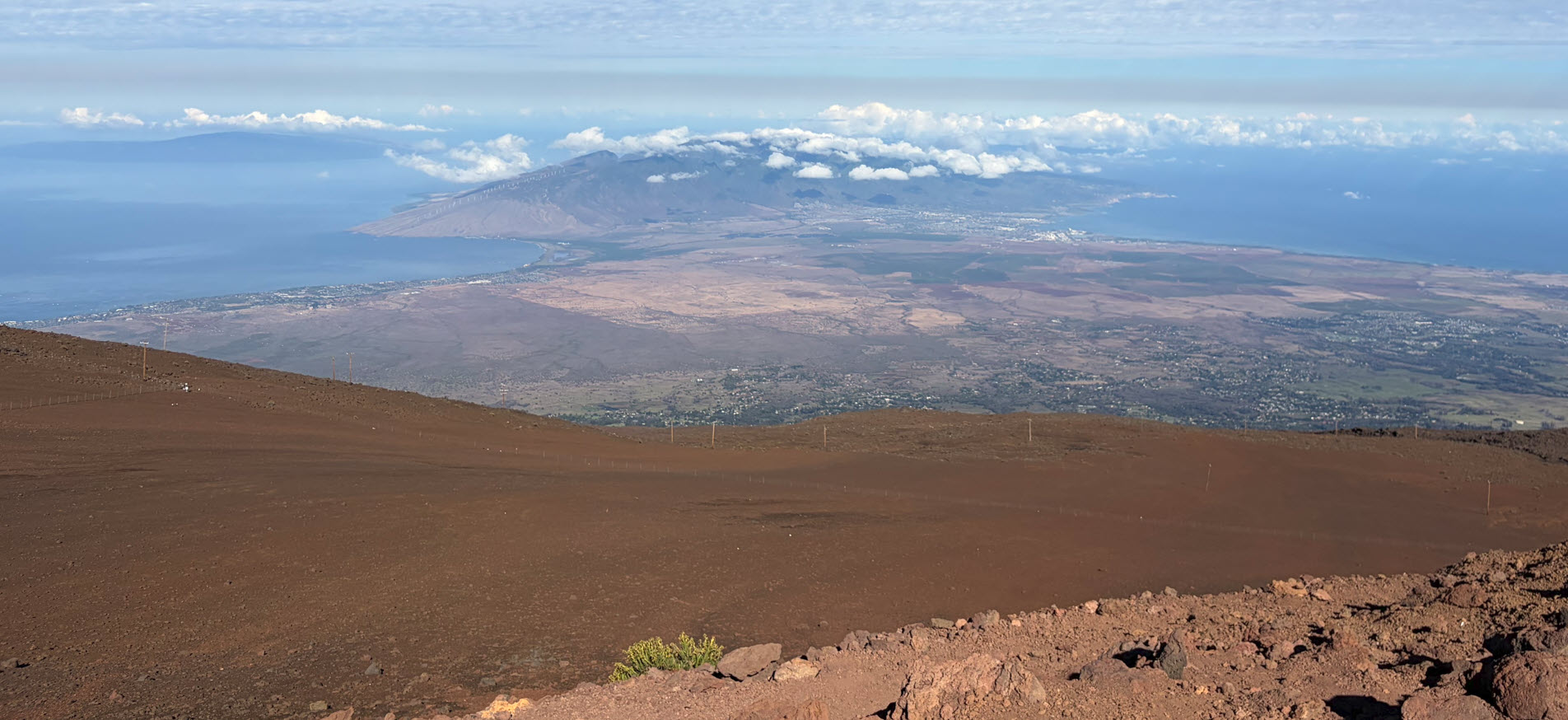
I took a picture of the cliffs Dana is describing. It was still morning, and the marine layer over the coast had not yet cleared, hence the grey sky.

Later, after spending some time walking along the board walk and getting some lunch in one of the seafood places, we drove up the hill, where there are now housing developments with ocean view as far as the eye can see. However, we found the spot where Dana was likely standing when he took the hides off the ox cart and threw them down the cliff like huge Frisbees.

Here is the view from the top:

Moored down in the harbor is the Pilgrim, a full-sized replica of the ship Dana sailed on from Boston in 1835 on the trip he described in Two Years Before the Mast.

This is that the Pilgrim looks like under full sail, which I found on the Ocean Institute’s website. Click on the image to jump to that site for more information.

[picture credit: Ocean Institute]
The Pilgrim moored at Dana Point is a replica of the original ship that was built in 1825 in Boston for $50,000 and designed for shipping back and forth between the American East Coast and California. To do this, they had to sail all the way around Cape Horn, the southern tip of South America. This replica was built in Denmark in 1945. 

I truly enjoyed our visit to Dana Point, tracing some California history, and I strongly recommend reading Two Years Before the Mast, a book for which I gave a four-star review.

Kilauea Volcano – And Pele’s Wrath

We have good friends who live in Hawai’i, on the Hilo side, just a few miles from the volcano. They are under alert watch, and depending on a change of direction of the flow, they might have to evacuate with only minutes’ notice. Some of the flows travel at 17 miles per hour. If the volcano is only 10 miles away, you have maybe 30 minutes to get away.

They sent us the photograph above, taken by one of their friends. This is not lava we’re looking at, but the reflected glow of the lava from the clouds above the volcano.

If you have never been near lava flow, you cannot imagine its power and its terrible force. Lava is nothing like the “red stuff” you had to jump over in the early video games of the 1980s. Lava is 2000 degrees hot, and you can feel the heat radiating off it from a hundred feet away. Standing within reach is burning hot. I have taken a stick of wood (the proverbial 10 foot pole) and poked it near the lava, and it instantly incinerates. Anything in its path is consumed by fire instantly and rapidly.

The Hawai’ians believe in the legend of Pele, the goddess of the volcano. It’s no wonder, after observing the unworldly power of the volcano, that the Hawai’ian people created legends around it.

Kīlauea is a currently active volcano that is located on the island of Hawaiʻi and is still being extensively studied. Many Hawaiians believe Kilauea to be inhabited by a “family of fire gods”, one of the sisters being Pele, who is believed to govern Kilauea and is responsible for controlling its lava flows.

— Wikipedia

[Apologies for the frequent commercials in this video]

The video above is about 13 minutes long and shows very graphic views of the lava, as well as what it does to whatever gets in its way. Roads are obliterated, covered by many feet of black lava rock. Houses in the way simply vanish. When Pele is done, there is literally nothing left.

The Hawai’ian islands have formed for millions of years, and they are still forming now. They are not stopping just because we are here now and building cities next to the volcano. Hawai’i is still growing. New land is created by the volcano spilling lava into the ocean. Decades from now, palm trees will grow on that brand new land and plant roots will start eroding the lava into black soil. And a thousand years from now, somebody will level the ground and build a resort hotel on it.

We can observe geological processes right in front of our eyes.

And we are an awe.

The Wonders of Egypt

[click to enlarge] Photo Credit: Credit James Cruz (jamesjcruz on Instagram)
I have never been to Egypt and have not seen this view with my own eyes. But it must be one of the most spectacular views in the world, truly awe-inspiring.

What gets me is what I see in the lower left corner of the picture. It looks like a shed, or a chicken coop in a slummy back yard. If I owned a property in that spot I’d have a palatial veranda overlooking the most awesome view in the world. I would not put a shed in that corner.

But then again, this pyramid was completed more than 4,500 years ago. When Cleopatra was born in 69 B.C., those pyramids were already 2,500 years old. In other words, Cleopatra is closer to us in the time line than she is to the time the pyramids were built.

The chicken coop will long be gone, and Cairo will likely be dust 2,000 years hence, and the pyramid will still be there, and the sun will still set behind it.

That thought gives me comfort.

Darkness over North Korea

It’s 5:53pm Pacific time here in San Diego.

http://www.flightradar24.com – click to enlarge

I just checked the flight radar site (amazing, check it out by clicking here) and saw not a single plane over North Korea. What a strange country!

Here is an image of North Korea from space:

click for image credit

Perhaps they are keeping the lights out so the Great Leader Kim Jong-un can get a good night’s rest.

Geographic Size of Vietnam

When reading Rolland Kidder’s book Backtracking in Brown Waters I came to the realization that Vietnam is much larger geographically than I always thought. I thought it was a fairly small country is Southeast Asia.

Here are two superimposed images of Vietnam compared to the coastline of  the Eastern United States.

Source: Backtracking in Brown Waters, but Rolland E. Kidder, page 99

The above image is from of Kidder’s book referenced above.

Here is a similar image:

Source: CIA

The above comparison comes from the online profile by the CIA on Vietnam.

Thoughts on Hawaii

Norbert at Sunset on Maui — Picture Credit: Trisha

One of the best things about Hawai’i is that it puts me in my place. I love the islands, and I love even more marveling about them.

The islands are one of the most remote places on earth. It takes six hours by plane from the nearest mainland, California, to get here. There is no land in between. And once here, there is no other land in any direction closer than that. We’re in the middle of the Pacific, as far away from any land as you can get.

As the islands formed, only one new species of animal was added every 10,000 years, since it was so difficult for life to get here. Driftwood carried insects and seeds, and occasional storms carried birds. Of course, that all changed when humans started coming here a thousand years ago.

Whenever I am here, I am struck by how young these islands are compared to geological ages. I can see the youngness in the land, and still, compared to human history, it is ancient.

The Hawaiian islands were formed by a single hot spot under the Pacific that has been spewing lava for tens of millions of years, while the Pacific plate is moving from east to west. The oldest of the islands are toward the east, the biggest one remaining is Kauai. There are older islands west of Kauai, or remainders of islands, all washed back to the sea. Kauai is 5.1 million years old. That’s all. Oahu is 3 million years old. Maui is 1.32 million years old. The Big Island is only 400,000 years old. Proto humans already walked the earth and came out into the savannahs in Africa when the Big Island was formed.

And now, Lo’ihi is an active submarine volcano located about 22 miles off the southeast coast of the Big Island. Its top is now about 3,000 feet below sea level. When it finally reaches the surface, it will be the next Hawaiian island as the other ones slide northeast.  

Maui is called the Valley Isle. There are really two major volcanoes on Maui,  the western side is 5,700 feet high, and Haleakala is 10,000 feet high. The valley between the two mountains is pronounced and very obvious when looking down from either mountain. Driving from ocean to ocean from the north end of the valley to the south end takes only about 20 minutes. Looking at the water lapping at the edge makes me think how the ocean is biting into the land, foot by foot. Every time I drive that stretch I am aware that this land will be under water in the not too distant future. It won’t take many feet of sea level rise before this valley ocean, and Maui becomes two islands. Our descendants will see two islands where I only see one. The only question is, will it be my grandchildren, or will it be another 50,000 years?

To think that all of Haleakala will be washed into the sea, completely gone, in another 10 million years boggles my mind. Ten million years is nothing in geological terms. To wash a 10,000 foot mountain completely into the sea in 10 million years, the rain and wind only has to erode it by 1 foot every 1,000 years. Quite possible.

In my entire lifetime I just got to catch a small glimpse of land being formed in Hawaii, and being washed away. A blink of an eye only. This puts my human lifespan into perspective and lets me understand how long a span of 10 million  years actually is.

Watching time shape Hawaii reminds me of a quote in a John Denver song:  I have to say it now, it’s been good life all in all, it’s really fine to have a chance to hang around.

Cooke Passage – Longest Straight Line Sail Around the World

You can sail from the west coast of Canada in a straight line around the world and arrive on the east coast of Canada.