Movie Review: Mile…Mile & a Half

Muir Project

A group of artists took the John Muir Trail (JMT) and filmed a documentary. In addition to carrying gear and food for 25 days, they brought camera equipment, batteries and all it takes to make a film. They documented their trip, from beginning to end, some of the lows, some of the highs, and all of it is inspiring. Now I have plans underway to hike the JMT with my son next summer. Seeing this documentary helped get me motivated. 25 days under the stars.

Rating - Three Stars


Throwing Away all the Ice Cream

There is soup. Not just soup but bison chili. And a huge roaring fireplace. And a couple of other hikers, tucked into a table next to the windows, drinking rootbeer. I’m sitting there stuffing my face when I hear the employees behind me-

“The ice-cream freezer is broken. We have to throw out all this ice-cream!”

“Um, excuse me,” I say, standing up. “But we are hikers and we will eat some of this ice-cream for you.”

The employee somehow agrees to this, and then we’re elbow deep in ice-cream twix bars. Unfortunately I can only eat one melted snickers bar, on top of all the other food I’ve already eaten, before I feel as though I’m going to hurl. This is disappointing, but maybe for the best. Dairy upsets my stomach, and I shouldn’t be eating it at all. But when you’re in the middle of a thru-hike and someone announces that the ice-cream freezer is broken and they have to throw away all the ice-cream…

— from Carrot Quinn’s Blog – one of the through-hikers I follow

Book Review: Thru-Hiking Will Break Your Heart – by Carrot Quinn

An Adventure on the Pacific Crest Trail

carrot-quinn-book-cover

Nobody knows for sure, but they say that some 700 to 800 people annually try to thru-hike the Pacific Crest Trail (PCT), a ribbon of trail that starts at the Mexican border outside of San Diego and winds its way for 2,660  miles all the way to Canada. Only about 300 to 400 complete the hike every year. Carrot Quinn has done it both in 2013 and 2014. She started in late April and reached Canada five months later in late September.

Thru-Hiking Will Break Your Heart is her memoir of her 2013 hike, her first serious hiking endeavor. She celebrated her 31st birthday in September on the trail, in what she describes one of the most miserable days and nights of her life.

Unlike Cheryl Strayed’s famous story in book and movie – Wild – Carrot’s account is not about overcoming any demons of her life. It’s all and only about the hike.

The book is written in the first person and in the present tense, which makes it read like a journal, and it really is a journal, pouring out the raw emotions of exhilaration, pain, terror, dread, joy, lust and accomplishment. You might wonder how she was able to fill this novel-length book with stories about the trail and the hike, without getting sidetracked into back-stories. But she does it. It’s a memoir I could not put down and worked through quickly.

Granted, I am interested in hiking, and the PCT has always been a lure. I am pretty sure that anyone not interested in and passionate about hiking would not find the book as readable as I did. To them it would be overkill and repetitious.

But for those of us that love hiking and want to know what it’s like to do an epic hike like the PCT, this is the story that will bring it all to life. I felt like I was right there with Carrot and her friends, and I caught a glimpse of what it must be like to be out there on that monstrous journey, that endless trail that is the PCT.

Rating - Three Stars

Hiking: On the Santa Rosa Plateau

Santa Rosa Plateau Yesterday I talked with a friend in Albany, NY who told me that it was 20 below zero with the wind chill factor. Today Trisha and I went for a walk on the Santa Rosa Plateau (in Riverside County just north of Murrieta) and it was 86. If I had gotten on an airplane and traveled there, it would have been 100 degrees difference from takeoff to landing. A great day for a picnic, and three and a half mile hike and a few pictures in Southern California. Here I am with the snow-covered peaks of San Gorgonio behind me, more than 70 miles away. I love those mountains. If you haven’t been there, the Santa Rosa Plateau is a great nature preserve in the rolling hills of Southern California, with wildflowers, lots of live oak, sporting a historic Adobe ranch and also vernal pools. The hikes are easy with no great elevation changes, and range from just a mile or two to larger circles of 10 to 12 miles. The best time to go is in winter and spring – right now.

Hiking: Cactus to Clouds (C2C)

The Cactus to Clouds (C2C) trail is a hiking trail from Palm Springs, California to the San Jacinto Peak. This trail has the greatest elevation gain of any trail in the United States, and it is listed as number 5 by Backpacker Magazine in the list of America’s Hardest Day Hikes. The trail starts in Palm Springs behind the Art Museum at an elevation of 460 feet. San Jacinto Peak is at 10,834 feet, so the trail rises a total of about 10,300 feet.

Compare this to hiking from Whitney Portal, which is at 8,360 feet to the peak of Whitney, at 14,505 feet, so the climb is “only” 6,200 feet. Even the climb to the top of Mt. Everest from base camp is only 800 feet more elevation difference than the Cactus to Clouds.

You get the idea: You cannot climb more altitude in a day in a single hike than on this trail pretty much anywhere in the world. It’s formidable.

So at 6:00am in the morning on Super Bowl Sunday I got in my car and drove to Palm Springs with the intent of doing an “exploratory hike” of C2C. This is not the kind of hike you attempt unless you are extremely well prepared and very fit for climbing. I strongly believe in making exploratory forays into difficult hikes before I commit. My plan was to ascend as far as I could, given water, daylight and sheer stamina, and then turn around.

Here is the chart [click to enlarge] showing my trek – as far as I got. Map

The green arrow shows where the trailhead is. It is located right behind the parking lot of the Palm Springs Art Museum, and the trail at that point is called the Museum Trail. It is extremely steep as soon as you set foot on the trail, and it never lets up for a full hour and 1,000 feet elevation gain.

There is an alternative trail that starts at the red arrow a few blocks south, which probably is a bit milder. It is part of the Skyline Trail which meets the C2C after about a mile or so. I may try that one next time.

Trailhead

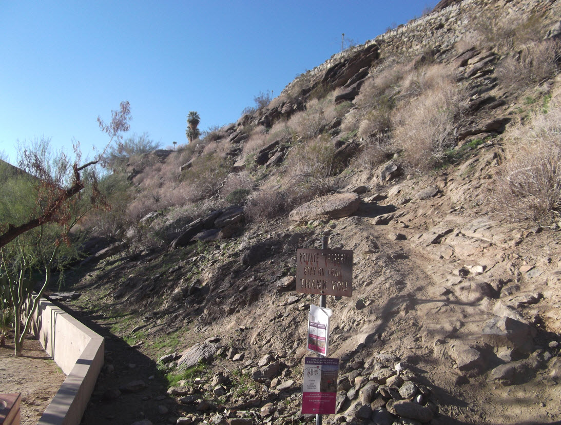
The picture above shows the trailhead behind the museum parking lot. The trail is extremely rough, rocky, and actually hard to find in the first mile. I was certainly off trail a number of times, scrambling through boulders, trying to find my way. They have small white blazes on rocks, but they are not steady and consistent enough to maintain a good trail. When in doubt, head straight up, and eventually you come across the trail again.

Cactus

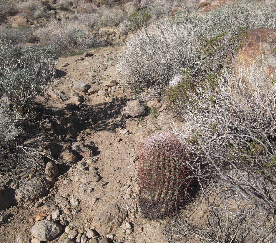
This is why it’s called “Cactus” to Clouds.

Looking Down

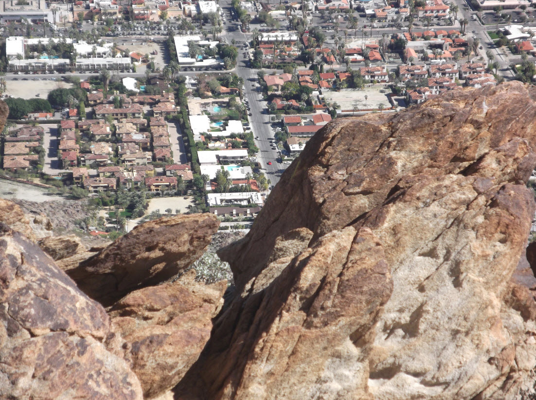
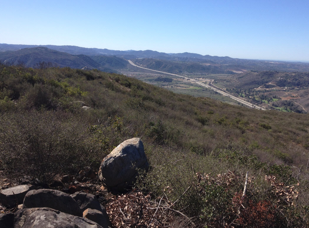
Looking down from about 800 feet up it seems almost precarious right over the city.

More looking down

Here are more views. I would not want to live in one of those houses below when an earthquake rattles this mountain and shakes some of these boulders loose.

Palm Springs Below

Looking north from about 1,500 feet up into the desert with Palm Springs below.

Rescue 1

After about an hour and a half, I got to the first “rescue box.” The sign says to not break the seal unless it’s an emergency, so I stayed away.

The rescue boxes are a grim reminder of those who have died or come near death on this harsh trail.  Inside supposedly are a telephone, water, and other essentials. I have heard that some people have raided these boxes even though there was not an emergency. Can you imagine getting here in a life-threatening situation and finding the box empty?

San Gorgonio

One I got a bit over 3,000 feet high, I was able to see the snow-covered peaks of San Gorgonio in the distance, the highest peak in Southern California.

Mountain Station

A bit further, and I was finally able to glimpse the mountain station in the distance. This is where the Palm Springs Aerial Tramway ends – which means it’s the first place where there is water (and beer – it’s a full mountain lodge with bar and restaurant) and a way down and out.

From where I am standing, that is still more than 5,000 feet up and about 7 miles away.

This is where I decided I had to turn around. I was at 3,500 feet elevation, I was 3.5 miles in from the trailhead, and I had hiked for 3.5 hours. You get the idea, one mile and 1,000 feet elevation per hour. It was close to noon, I had used up half my water, and close to half my daylight, and all my strength.

The C2C is a nasty trail where you quickly get to a point of no return. The only way out is continuing up the steep trail – and nature does not care if you have any more water. People have turned around too late, tried to hike back down, only to be overcome by the furnace of the desert heat. Heatstroke is the most common form of death on the C2C, followed, of course, by falls. In the winter the trail gets icy.

The day I was there it was iced up above 6,500 feet. I had no crampons, so if I had continued on, I would have run out of water at about 6,000 feet, with 2,600 more to climb before the mountain station, on an icy trail along steep cliffs. A very lethal combination.

I once got caught in ice in the Grand Canyon without crampons – never again.

But that’s why it’s called an exploratory hike. Time to turn around. I rested a bit, ate, drank some water, took in the panorama, and headed back down. It took me three more hours to get back down to the city. Very steep trails take as long to go down as they take to climb up – at least for me.

I was here

I looked back up from the trail to the highpoint that I had reached.

High Point

Later, from the car, I glanced back to the ridge and found the very spot that I had reached before I turned around.

Now I know how to conquer the C2C. It will take two more trips, at least:

Next time I need to leave at 3:00am with a headlamp, so I can ascend to about 3,500 feet before daylight. I have to carry at least 6 liters of water, perhaps 7. That should get me to the mountain station by about 1:00pm. That’s enough for that try. 8,000 feet up, in about 10 hours.

The following time, depending on how I did, I should be able to go the extra 5.5 miles from the mountain station to the San Jacinto Peak for the full 10,000 feet. I should be able to get there by 2:00pm, provided I leave at 2:00am from the valley. The problem is, there is no water on the peak, so I’ll have to carry enough to get up and back down to the mountain station, making for a 20 mile hike before I can take the tram down.

Summary:

The C2C is a badass day hike. Only experienced hikers should attempt this. I recommend an exploratory hike first, to get the lay of the land. This mountain commands respect.

Movie Review: Wild

Wild2

I went to see Wild because it was the top-rated movie this Christmas season, with 92% on the Tomatometer.

Wild is a movie about hiking the Pacific Crest Trail, or PCT, as it is commonly called. That’s how it’s presented.

But that’s not really what it is. Wild is a movie about a young woman growing up in middle America with disadvantages, lots and lots of disadvantages.

The movie is based on the book of the same name by Cheryl Strayed that came out a few years ago.

Wild1

I never read the book. Checking the cover, and trusting the reputation of Oprah’s Book Club, I decided that this was a chick book and it wasn’t for me.

I entered the theater to watch the movie only because of all the choices it was the highest rated. You might say I entered with prejudices.

Cheryl (Reese Witherspoon) and her little brother grew up mostly with their single mom Bobbi (Laura Dern), who left her abusive husband when the children were little. They were poor, mom working waitressing jobs just to keep things together. Bobbi got cancer at the age of 45 and died rapidly. The children tried to cope, each in their own way. Cheryl ruined her own marriage through her adulterous ways.  After her divorce she skided into self-destruction, seeking abusive male relationships, descending into the fog of the drug culture all the way to shooting up heroin. Somehow she decided to pull herself up by her bootstraps and hike a portion of the PCT. The hike of over 100 days was supposed to clear her foggy mind and extract the demons that haunted her life.

The movie starts out with hiking scenes, but is constantly interspersed with flashbacks to Cheryl’s childhood, youth and young adult life of self-abuse. The flashbacks are sometimes only seconds long. While lots of flashbacks in a movie sometimes make it disjointed, it actually works quite well here, since the scenery of the two lives are so vastly different.

The scenes on the trail are nature, tents, backpacks, mountains, meadows, snow. Unmistakably the present. The scenes in the flashbacks are mom, children, naked bodies, drugs, wife beater guys and life in run down houses. So I always knew what part of the story we were in without getting confused.

Being a hiker, I looked forward to the hiking parts, but hiking is basically boring, hours and hours of setting one foot in front of the other, surrounded by breathtaking scenery that you don’t even see, because you are hungry, thirsty, tired, and can’t wait for the next four miles to be over so you finally reach your destination and camp. Hiking does not an exciting movie make.

But the parts about flashback life are more interesting. Sex, drugs, illness, drama, all makes for a story to tell. So it is not surprising that’s what the movie makers focused on to move the story along. And it worked. Getting some frontal nudity of Reese Witherspoon probably also attracted a viewer or two.

Cheryl “only” hiked a part of the PCT, about 1,000 miles, from the Mojave desert to the Bridge of the Gods, the cross-over from Oregon to Washington. The actual Pacific Crest Trail is a 2,650-mile ribbon of dirt and rock that runs from Mexico to Canada through California, Oregon and Washington. If you want to learn about what it’s really like to hike the PCT, you can check out the following blogs, all by people who hiked it just this past 2014 season.

  • Carrot Quinn – hiked the PCT in 2014, then the lowest to highest (L2H) from Death Valley to the peak of Mt. Whitney in 6 days, and is now on the Florida trail, hiking 800 miles from the southern tip of Florida through the swampland north.
  • Not a Chance – hiked the PCT in 2014, then with Carrot the L2H, and is now hiking the Te Araroa, 1800 miles from the northern to the southern tip of New Zealand.
  • Twinkle – hiked the PCT south to north in 2014, ended in September, flew to Maine, and hiked a large part of the Appalachian Trail (AT) north to south, ending late in November. He hiked 4,400 miles between March and November 2014.

These people didn’t hike 1,000 miles in 100 days, they hiked the full PCT 2,650 miles in 110 days, give or take a few. These are the badasses of ultra-light long-distance hikers, and their blogs are enlightening. This is where you learn about hiking.

But this is not a review of long distance hiking, it’s a review of the movie Wild. Cheryl Strayed, with her book and this movie, has put some spunk into PCT hiking, I am sure, and there probably are a number of people who went on the trail due to it. Not a Chance, somewhere, says that people keep asking her if she knew Cheryl Strayed, and she keeps answering “Cheryl hiked the PCT in 1992 when I was a toddler!”

The hikers I listed here didn’t affect the image of the PCT anywhere near how Cheryl did with her book and now movie. But then, Cheryl didn’t start out her hike wanting to affect hiking, the PCT, or the hiking world. Her story was about overcoming the demons of life. We are not all lucky enough to be born into affluent and functional families, with clean college educations, parents that can afford to send us to Harvard or Stanford. Many, many of us are born into much less fortunate environments. So it was for Cheryl. She chose hiking to expel the demons, and it seems she was successful.

And, in the process, she greatly popularized the PCT.

Wild is a wild ride, with stunning scenery, some suspense, good entertainment value, and no doubt a learning experience for viewers – particularly those that know nothing about hiking.

Rating - Two and a Half Stars

Ode to Portland – by Carrot Quinn

Portland you’ve been so beautiful, but I know that that’s the way the summer goes. Summer is when everyone forgets about the winter. The damp grey skies, the salad mister rain. The mornings so dark you have to turn all the lights on when you wake up. The way everyone struggles. Being here now makes me almost want to live in Portland again, but I know too that this is not the frumpy, disheveled city that I came of age in. This new city is full of beautiful, monied yuppies, who work tech jobs and spend their evenings “trying new restaurants”. Maybe, one day, when I’ve made my fortune, I’ll come back, and buy expensive products for my hair. Until then I’ll live in exile in the hinterlands, with all the other people who look like they got dressed in the dark.

by Carrot Quinn

Hiking Wright Peak in the Adirondacks

July 23, 2014, was not a perfect choice for a hike in the Adirondacks, but it was the only one open in my calendar. Thunderstorms were in the forecast, with a 40% chance of rain.

I had big plans, bagging a 4-peak-victory, first summiting Algonquin Peak, the second highest mountain in New York, then hopping over to Boundary and Iroquois Peaks on a minimum maintenance trail (this means no trail and no markings, only visuals of the peaks ahead), and then on the way back making a 0.4 mile each way excursion to Wright Peak, she “shortest one” of the four, at 4,580 feet altitude the 16th highest peak in New York.

But that was all just wishful thinking of my boundless energetic mind long before I had to put step in front of step.

I arrived at the trail head at Heart Lake at 5:40am and was walking by 5:50. It was dark and gloomy and the cloud cover was low. The first mile meandered through thick woods and marshland. Eventually it started climbing steadily.

The trail got rocky very quickly.

[note: click on any picture to enlarge]

Starting on Trail

If the above does not look too bad,  check  this out below:

More Trail 2

No, this is not a dry brook, it’s the trail. Somewhere around this point I passed another hiker that said this trail was much easier in the winter, because there were no rocks, just snow. Good point. I had never thought of that. I could carry up skis and come back down in no time. Hmmm.

Subject to Change

After about an hour and a half I came to this sign. I decided that my proper gear was hiking boots, trekking poles, and an extra long-sleeve shirt, windbreaker, down jacket and rain poncho in my pack, just in case. I was ready to go on.

Decision Time

Then it became decision time at 3.4 miles into the trail. The extremely rocky trail had already worn out my feet and knees and I had to be careful not to twist ankles or stub toes too much to save energy for the long return.

By this time, the sky around me was all socked in and while it didn’t rain yet and I didn’t hear any thunder, it seemed like it could start any time. Dreams of Algonquin and peaks beyond faded, and I decided to conquer Wright Peak first by taking this left turn and going up another 0.4 miles to the peak from this point. I could decide later if I wanted to move on to Algonquin or turn around when I got back to this junction.

Up the Rock

But what a 0.4 miles it was. This was the view east right from the sign above, showing the first section of the trail. Yes, the “wall” in the back was a slab of solid granite to climb up on, and the only way to do it was to let the tread on my boots do its gripping and trusting the boots. This is a nice exercise if you ever want to build your calves. It kept going like this on steep slabs of rock.

Heart Lake

About halfway up the last 0.4 miles I had a good view back to Heart Lake, where I had parked my car at the trailhead. The clouds below were so thick, the lake was only visible seconds at a time and then it disappeared again. I found a good moment to shoot this picture.

Seeing the Peak

Finally, the peak was within reach. Just a few more minutes.

Standing on the very Top

And here I was standing on the very top at 4,580 feet (which seems not much of an altitude for a Californian) but I was spreading my arms to keep my balance and prevent being blown over by the fierce wind whipping me around. The camera was sitting on a little rock ledge what was sheltered from the wind.

View from the Peak

When things cleared up for a moment I took another picture looking south from the peak.

Algonquin

This is a view toward the southwest and Algonquin, which is not really visible. I decided right there that I would not be attempting that mountain that day.

Debris

A hundred yards to the north of the peak is an airplane crash site, marked by a plaque. Four airmen lost their lives in a crash of a B-47 here on January 16, 1962. There is also still some debris from the plane collected there and strewn about the general area.

The Plaque

To give you a sense of the whipping wind at the top, here is a quick panoramic  video. I narrated over it but realize now that I didn’t speak anywhere near loud enough. I would have had to scream:

After I got to my cozy hotel that night I watched a PBS special about orangutans as I passed out after a long day on the trail and then in the car.

As I recollected my “rough” eight miles on the road, I remembered a blogger I follow, named Carrot Quinn, who is currently hiking the Pacific Crest Trail (from California to Mexico). She and her friends have been hiking 30 miles a day, every day, on their quest. I always thought that at age 57 I was a badass hiker, but Carrot and her buddies would leave me in the dust in minutes. When I checked  her blog today, titled Day 90: Hypothermia in Oregon in July, I found with amazement that Carrot and her friends had been watching the same documentary about orangutans on the same day after a very hard section on the Pacific Crest Trail.

They have me in awe.


Reminiscing about Hiking Half Dome

Prompted by a post from a friend about hiking Half Dome, I remembered our own experience in 2012 that I documented here at the time. Then I found this excellent introduction about Know before You Go – showing the challenges of hiking Half Dome. It feels good to have done this!

If you are interested in doing this, you must prepare and submit an application for a permit February of the year when you want to do it. Then there is a lottery where slots are allocated. If you are lucky, you get a slot on the days you choose.

Hiking San Jacinto – Again

Yesterday Trisha and I took friends who recently transplanted to Los Angeles (Laura and Brian) from Chicago on the San Jacinto Peak hike – in my opinion one of the most spectacular hikes in Southern California. The mountain’s north exposure, seen in the picture below, with 10,000 vertical feet, is one of the largest gains in elevation over such a small horizontal distance in the contiguous United States.

1024px-San_Jacinto_Peak_0675
San Jacinto Peak [click for picture credit]
It starts with a ride up on the world-famous Palm Springs Aerial Tram which whisked us from 100 degree F on the desert floor to a comfortable 60 degrees at the mountain station at 8,500 feet. It is a thrilling ride that I recommend highly if you have never done it. It also provides a way in the winter to lie by the pool in Palm Springs in the morning and go cross-country skiing in alpine conditions in the afternoon, all within a few miles of each other.

We took the classic shortest route to the peak. Getting a late start just before noon at the mountain station, I was concerned whether we could make the round trip which takes around four hours each way for old guys like me. But we did it with 20 minutes of daylight to spare, arriving back at the station around 7:15pm. It was a long 10.8 mile hike with thrilling highlights along the way.

[You can click on all the pictures to enlarge]

On the way up
Brian, Laura and Trisha in Round Valley, about two miles up.

Here is the map of the hike, showing our trek one way, going up. We came back the same and shortest way, but in the afternoon light everything looks different, so it seems like a new hike altogether.

Hike Map
Map of San Jacinto Hike

The altitude profile is here:

Hike Graph
Profile

As you can see, it’s a steady climb with a grade of about 10% on average, all the way up. Down is the same way the other way around. Interestingly, it takes me the same amount of time going down as it does going up. I have to save my knees and feet, and watch every step carefully. This makes for good scheduling of a trip and the turn-around time.

Very close to the peak, there is a stone hut that was built in 1935 by the Civilian Conservation Corps under the direction of Serbo-Croatian immigrant Alfred Zarubicka, a stonemason known in Idyllwild as “Zubi.”

Hut on the peak
Stone Hut on San Jacinto

From the hut to the peak, the trail fizzles out, and scrambling with both feet and legs over and around boulders is required. This can get nasty, because by then most hikers are dizzy from exhaustion and the high altitude. It’s hard to keep your balance, and every step, every pull, every jump across huge gaps in boulders carries some risk.

Fortunately, this section is not long, and at 3:30pm, we arrived at the top.

We made it
We Made It! Brian and Laura Celebrating Victory.

Now for the fun at the peak.

Oh yeah
Oh Yeah! Brian’s Obligatory Selfie sitting on the highest rock.

Climbing up to that highest point was easier than climbing down from it after the picture!

cant go any higher
Laura and myself at the Peak of San Jacinto – 10,834 feet

And that was our day’s work yesterday.

I left out the picture of the four of us at the bar in the mountain station – the “after” picture. Yes, there is a full restaurant and bar at the mountain station, and for those “hikers” that just want to pretend, there is plenty to do there all day long.

Movie Review: Walking the Camino

CaminoMapOSB
[click to enlarge]

Walking the Camino is a documentary about walking the Camino de Santiago, the millennium-old pilgrimage starting in the French Pyrenees and ending up in Santiago or, optionally, at the Atlantic Ocean. The hike is 780 km (about 500 miles) long. This makes it a bit more than two times the length the John Muir Trail in California. It was popularized a few years ago in America by the film The Way with Martin Sheen in 2011. This documentary follows six groups of hikers along the way and tells their stories, their background, and lets us share their joys and their aches.

Unlike backpacking trips in the United States, like the famous Appalachian Trail, the Pacific Crest Trail or the John Muir Trail, this hike has people walking from village to village. While a backpacking trip requires packing and carrying every raisin to be consumed, and bringing a tent and a sleeping bag, on the Camino de Santiago hikers check into hostels, or, if they want to be upscale, into bed-and-breakfasts, at the end of every day. Dormitory-style sleeping with dozens of other people snoring along is the norm. Communal dinners and breakfasts are part of the ritual. Visits to churches along the way are common. Hiking the Camino is as much a social experience as it is a hike.

Travelers of all kinds have walked the Camino de Santiago for more than 2,000 years. It was first paved by the Romans to mine the area’s gold and silver. Some of the Roman pavement still remains.  James Michener has hiked it three times and calls it “the finest journey in Spain, and one of two or three in the world.”

Christians have traveled it for nearly 1,300 years as a pilgrimage, and they now claim it to be their Camino. The Christians tell the legend that Santiago de Compostela is the burial-place of the apostle James the Greater, which makes it, along with Rome and Jerusalem as one of the great pilgrim destinations of Christendom.

Anyone even tempted to hike the Camino de Santiago must watch this movie. It tells of blisters and aching knees, total exhaustion, loneliness, soul-searching, despair, of hot sun and driving rain, days on end. But it also tells the story of the human spirit, of accomplishment and pure joy of being one with nature, surrounded by breathtaking scenery and beauty, hiking through villages and cities that seem as old as the earth itself.

Rating: ***

Hiking Monserate Mountain

This morning I hiked Monserate Mountain.

Monserate From Distance

[Click on any picture to enlarge.]

Here is a view of the mountain in the distance, right after I exited at the Hwy 76 exit off I-15 North and turned onto Old Hwy 395 North. The arrow shows where I am going.

Monserate Hike B

As you drive north on Old Hwy 395, turn right onto Stewart Canyon Road, go under I-15 and the trailhead is right there at the T of  Stewart Canyon Road and Pankey Road.

I started hiking at 9:00am, and it was already getting hot.

Monserate Trail Head

This is the view from the trailhead up the trail. To be safe, I brought two quarts of water, but I only needed about half of one.

Monserate Parking

 Here is the view back to the parking area about 20 seconds past the trailhead.

Monserate Hike A

The profile of the trail shows it is fairly steep and steady. The parking lot starts at an elevation of about 400 feet. The peak is at about 1542 feet, so it’s an elevation change of 950 feet over 1.6 miles of trail. I got into a good pace and arrived at the peak 44 minutes after leaving the car.

Monserate On Peak

Here is the peak. There is a little registration box.

Monserate Looking North

It was a spectacularly clear day, and I was able to see further than I would normally from here. The view to the north shows two of my favorite mountains. On the left is San Gorgonio, with 11,503 feet the highest peak in Southern California. It is covered with snow after the rains we had a couple of weeks ago. To the right is San Jacinto with an elevation of 10,834 feet. Of course, I have climbed both many times. You can search this blog for trip summaries.

San Gorgonio is about 70 miles away as the crow flies from where I am standing. San Jacinto about 60 miles.

Monserate Looking West

Looking west we overlook Fallbrook and Bonsall. In the distance is the blue band of the Pacific Ocean. In the middle of the view, marked by the green arrow, is the famous “Sleeping Indian,” a range of hills that resembles a man lying down on his back, sleeping. The arrow points to his head. The body stretches to the left (or south). People living in Fallbrook are known to give the location to their house as: “Our house is on the neck of the Sleeping Indian” or some other body part.

Monserate Looking South

Finally, looking south, I see I-15 from where I came, snaking over the hill at Lilac Road.

After taking these pictures and drinking some water, I went back the same way I came, carefully stepping on the steep parts of the trail so I didn’t slip. I got back to the car about 90 minutes after I left, and that included a five-minute break on the top.

It was very hot on the way down. I would recommend making this hike early in the morning, since the sun beats down on the trail which is always on the southern exposure. I turned the A/C on in the car when I got back at only 10:30. It was hot.

This is a good trail to get quick cardiovascular exercise, since it is quite steep. The round trip is 3.2 miles long. The trail is rough, quite eroded, with sharp, loose rocks everywhere. Most people I saw wore running shoes, but I was glad I had my full hiking boots. My ankles are not as sturdy as they used to be anymore.

Attempt to Hike Indianhead – Take Four

This year, on January 1, during my regular hike to the Palm Canyon Oasis, I did some more exploratory work about hiking Indianhead. It has to be done between now and early March, when it quickly gets too hot to do it.

Here are previous posts with maps and discussions. None of these excursions got me even close to the peak.

First Post

Second Post

Third Post

This time, I drove out to Borrego Springs and took a picture from the front of the mountain.

Indian Head 2014 A
Indianhead from Borrego Springs [click to enlarge]
I am not even sure if the peak visible from Borrego is the actual peak, or if it is a false peak. If it’s a false peak, the actual peak should be an easy ridge hike behind it. The picture below has my annotations on an approach that sounds feasible.

Indian Head 2014 B

The starting point is just a five-minute hike from the parking lot to the beginning of the prominent ridge visible from the Palm Canyon trailhead.

The first half hour up the ridge should not be too bad. The grade is about 30 to 40 degrees. There is no trail, so it’s careful walking through the brush, avoiding snakes, cactus, ocotillo, sharp stones and uneven footing. You can’t afford to twist an ankle here.

One of the crux areas is where the green arrow points. This is much steeper, perhaps approaching 45 degrees at that section, and covered with pretty rough, jagged, large slabs of rock. 45 degrees is as steep as the cables on Half Dome, so I expect it could get pretty sketchy there. But there is no way to know short of just going and checking it out.

After making it up that section, which could take some time given the pucker-factor, making it up to the ridge should be a little easier. The grade goes back a bit, but the slabs of rock there are huge, and it could be that there will be spots where there will be some scary traverses. The other side is almost vertical, so there is no way to go on that side.

Then it’s easy picking along the ridge, always careful not to get too far to the cliffs toward the back. It’s straight down from there on that side. The views must be spectacular, though.

Then comes the crux at the blue arrow. This looks again 45 degrees from all angles I have seen it, and there is no good way around. There could be a lot of scree there, too, with loose rocks and dirt.

I am not sure if the peak along the ridge at the red arrow is the true peak, or if Indianhead is not behind it. However, even that false peak would be a great achievement for me.

Equipment needed:

  • Good hiking boots. Sneakers don’t cut it here.
  • Hiking poles and a way to stash them on the pack during bouldering sections, when hands need to be free.
  • At least a gallon of water per person.
  • Snacks for an all day adventure.
  • Head lamps with good batteries, in case something goes wrong and we run out of daylight.
  • GPS so we can ascertain terrain and trace our steps back. There is no trail, and coming down such a mountain four hours after going up, when the light will be completely different, can be dangerous. It’s easy to pick the wrong ridge and get hopelessly lost.
  • Hardcopy topo map.
  • Sunscreen, hat, long-sleeved outfits, windbreaker, sunglasses.
  • Camera.
  • Cell phone. Reception should be good all the way on this route, due to the clear line of sight to Borrego Springs all the way up.
  • First aid kit.

Starting at the parking lot at 7:00am should leave enough time for a daylight hike all the way through. I can’t even guess how long it will take, but since it’s a 3,000 foot elevation change, it’s a tough workout and I will need plenty of rest stops.

Sure looks like I am ready. Now all I need is a partner. Two people are ok, three would be better. I am taking names.

New Palm Grove 2010 – 2014 with Bighorn Sheep

I have been hiking Palm Canyon in the Anza Borrego Desert every year right after New Year. This year I went today, January 1, 2014.

Starting out, on January 3, 2010, I noticed a brand new stand of palm trees developing. I took a picture and marked the spot (click to enlarge):

New Palm Grove 2010

When I came back two years later on January 7, 2012, here is the identical view:

New Palm Grove 2012

Then I came back on March 10, 2013. This is what it looked like:

Final 03-10-2013
New Palm Grove 2013

Today I went out again to Palm Canyon. When I got to the trailhead, there was a sign warning that there had been a severe flood during the summer in 2013, and that the trail had been obliterated in a number of places. Indeed, as I hiked in, I noticed that I found myself hiking off-trail quite a few times, but since the canyon narrows toward the oasis, there is no way to miss it.

When I got to my little experimental palm grove, I hardly recognized it. Here is what it looked like today:

Final 01-01-2014 with annotations
New Palm Grove 2014

The trees that were formerly where I placed the blue and green arrows are completely gone. The water pulled them out completely and washed them away. There is not a trace of them left. The center grove is still there, but it has hardly grown since last year, and it is severely bent at the root, obviously from the rush of the creek downstream.

When I got to the main oasis, I also didn’t recognize some of the terrain. Huge boulders and giant trunks of dead palm trees had been moved around.

If you have never seen a “real” oasis, the oasis at Palm Canyon is perfect. It’s 1.5 miles from the trailhead. After about a mile of desert hiking through extremely hot and dry terrain up the canyon, a small trickle develops in the stream bed, and within a few minutes it turns into a real creek. Then the oasis becomes visible from the distance.

Oasis1
The Oasis at Palm Canyon

These palm trees have been there for a long time. Their trunks are gigantic, and the boulders around them massive. It takes some real scrambling to get in there.

Here is a view from “inside.” The oasis is so large, there is no good way to take a picture once inside.

oasis2
Inside the Oasis

Then, on the way back out, I was treated to an exceptional surprise. I looked up and suddenly I saw a bighorn sheep right in front of me on the cliff. I got a few pictures to share here:

bighorn2
Bighorn on the Cliff
bighorn1
Bighorn Climbing Down

Seeing the sheep so close to me, and being able to watch it climb down the cliff and then prance away was a magnificent way to end my annual visit to Palm Canyon at Borrego Springs.