
July 23, 2014, was not a perfect choice for a hike in the Adirondacks, but it was the only one open in my calendar. Thunderstorms were in the forecast, with a 40% chance of rain.
I had big plans, bagging a 4-peak-victory, first summiting Algonquin Peak, the second highest mountain in New York, then hopping over to Boundary and Iroquois Peaks on a minimum maintenance trail (this means no trail and no markings, only visuals of the peaks ahead), and then on the way back making a 0.4 mile each way excursion to Wright Peak, she “shortest one” of the four, at 4,580 feet altitude the 16th highest peak in New York.
But that was all just wishful thinking of my boundless energetic mind long before I had to put step in front of step.
I arrived at the trail head at Heart Lake at 5:40am and was walking by 5:50. It was dark and gloomy and the cloud cover was low. The first mile meandered through thick woods and marshland. Eventually it started climbing steadily.
The trail got rocky very quickly.
[note: click on any picture to enlarge]

If the above does not look too bad, check this out below:

No, this is not a dry brook, it’s the trail. Somewhere around this point I passed another hiker that said this trail was much easier in the winter, because there were no rocks, just snow. Good point. I had never thought of that. I could carry up skis and come back down in no time. Hmmm.

After about an hour and a half I came to this sign. I decided that my proper gear was hiking boots, trekking poles, and an extra long-sleeve shirt, windbreaker, down jacket and rain poncho in my pack, just in case. I was ready to go on.

Then it became decision time at 3.4 miles into the trail. The extremely rocky trail had already worn out my feet and knees and I had to be careful not to twist ankles or stub toes too much to save energy for the long return.
By this time, the sky around me was all socked in and while it didn’t rain yet and I didn’t hear any thunder, it seemed like it could start any time. Dreams of Algonquin and peaks beyond faded, and I decided to conquer Wright Peak first by taking this left turn and going up another 0.4 miles to the peak from this point. I could decide later if I wanted to move on to Algonquin or turn around when I got back to this junction.

But what a 0.4 miles it was. This was the view east right from the sign above, showing the first section of the trail. Yes, the “wall” in the back was a slab of solid granite to climb up on, and the only way to do it was to let the tread on my boots do its gripping and trusting the boots. This is a nice exercise if you ever want to build your calves. It kept going like this on steep slabs of rock.

About halfway up the last 0.4 miles I had a good view back to Heart Lake, where I had parked my car at the trailhead. The clouds below were so thick, the lake was only visible seconds at a time and then it disappeared again. I found a good moment to shoot this picture.

Finally, the peak was within reach. Just a few more minutes.

And here I was standing on the very top at 4,580 feet (which seems not much of an altitude for a Californian) but I was spreading my arms to keep my balance and prevent being blown over by the fierce wind whipping me around. The camera was sitting on a little rock ledge what was sheltered from the wind.
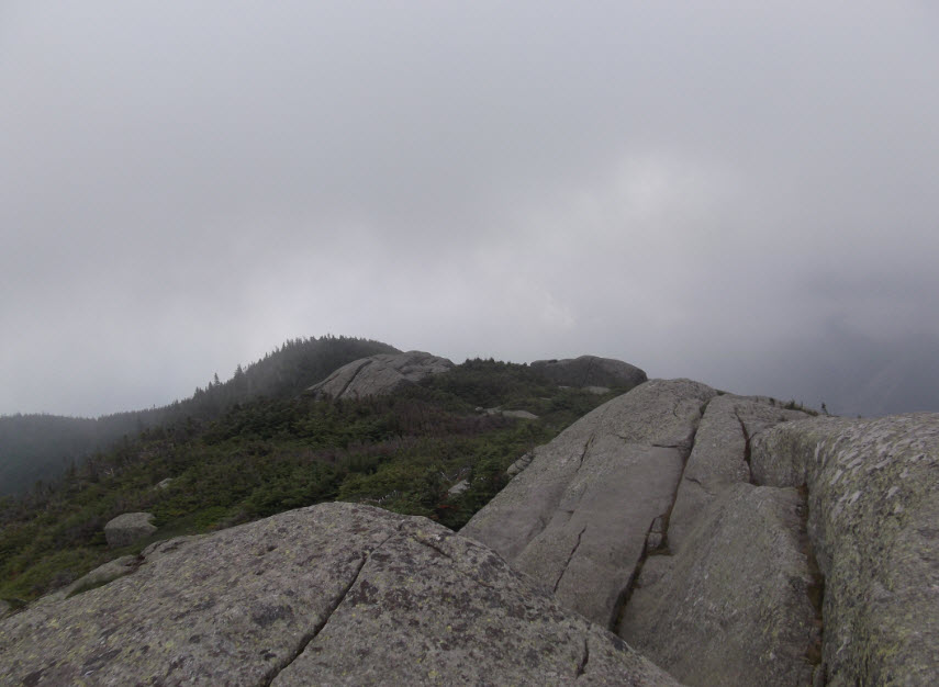
When things cleared up for a moment I took another picture looking south from the peak.

This is a view toward the southwest and Algonquin, which is not really visible. I decided right there that I would not be attempting that mountain that day.
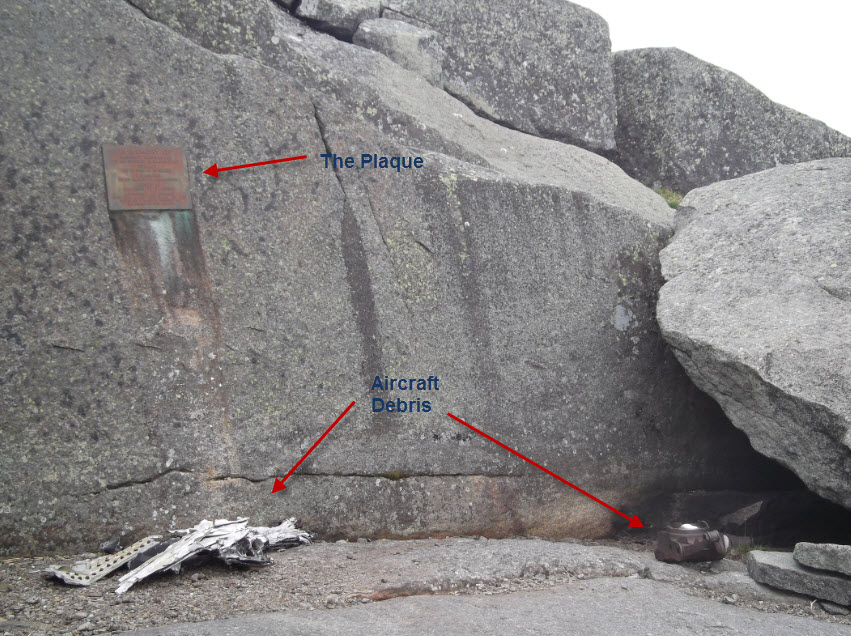
A hundred yards to the north of the peak is an airplane crash site, marked by a plaque. Four airmen lost their lives in a crash of a B-47 here on January 16, 1962. There is also still some debris from the plane collected there and strewn about the general area.

To give you a sense of the whipping wind at the top, here is a quick panoramic video. I narrated over it but realize now that I didn’t speak anywhere near loud enough. I would have had to scream:
After I got to my cozy hotel that night I watched a PBS special about orangutans as I passed out after a long day on the trail and then in the car.
As I recollected my “rough” eight miles on the road, I remembered a blogger I follow, named Carrot Quinn, who is currently hiking the Pacific Crest Trail (from California to Mexico). She and her friends have been hiking 30 miles a day, every day, on their quest. I always thought that at age 57 I was a badass hiker, but Carrot and her buddies would leave me in the dust in minutes. When I checked her blog today, titled Day 90: Hypothermia in Oregon in July, I found with amazement that Carrot and her friends had been watching the same documentary about orangutans on the same day after a very hard section on the Pacific Crest Trail.
They have me in awe.