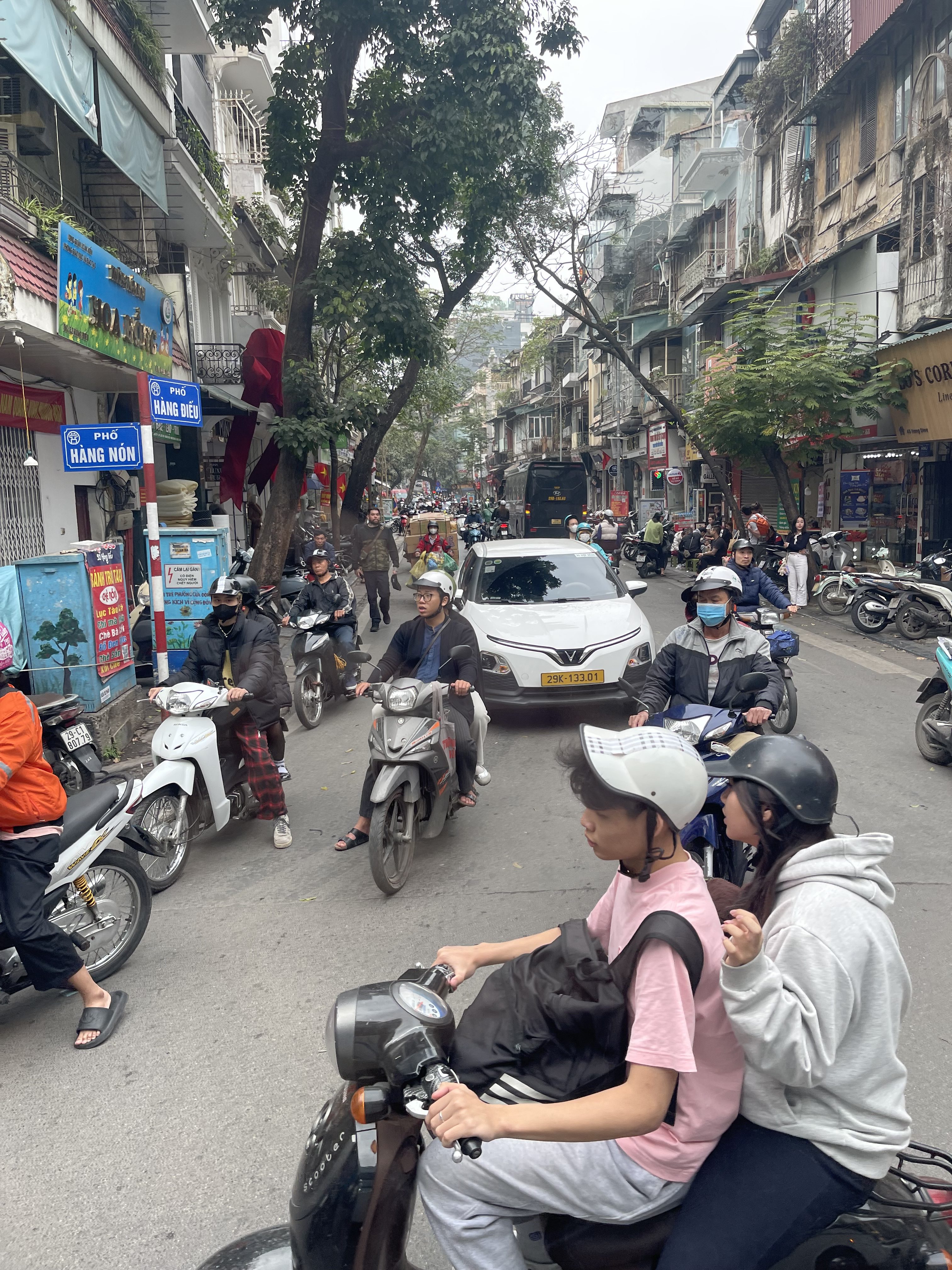
One of the most powerful impressions of Vietnam is undoubtedly its traffic. Per our guide, the metropolitan area of Hanoi has 8.5 million people and over 6 million motorcycles. They all seem to be on the road at all times. The ratio of motorcycles to cars is at least 30 to 1. They overpower all streets and alleys.
All vehicles, be it buses, trucks, cars, motorcycles and bikes do not stop for pedestrians, even at crosswalks. The only way to cross any road is to just step into traffic, hold up your hand (that helps a little) and walk. I have learned that you can’t look at the traffic or make eye contact. My human reflex makes me stop when I see a bus heading straight for me. But that’s a mistake. The bus expects me to move at my current speed and the driver therefore adjusts his speed and direction to avoid me. If I suddenly stop in panic, all hell breaks loose up-traffic and bad things happen. You just go, go, go. It’s better to go in a group of people, since there is power in the masses.
Most intersections, even with multiple lanes in all directions, do not have traffic lights. So the cross traffic of all types just enters the intersection and eventually makes it across. The cross traffic swims around it like a school of fish in the ocean.
It takes some getting used to. I am amazed that there are not more accidents. I only saw one motorcycle fallen in two weeks.
The following are two videos I took at random spots in Hanoi. Just put them into full screen mode on your browser and watch. Check out the people crossing the streets. Watch the cross traffic make its way. And be amazed.
Here is another one:
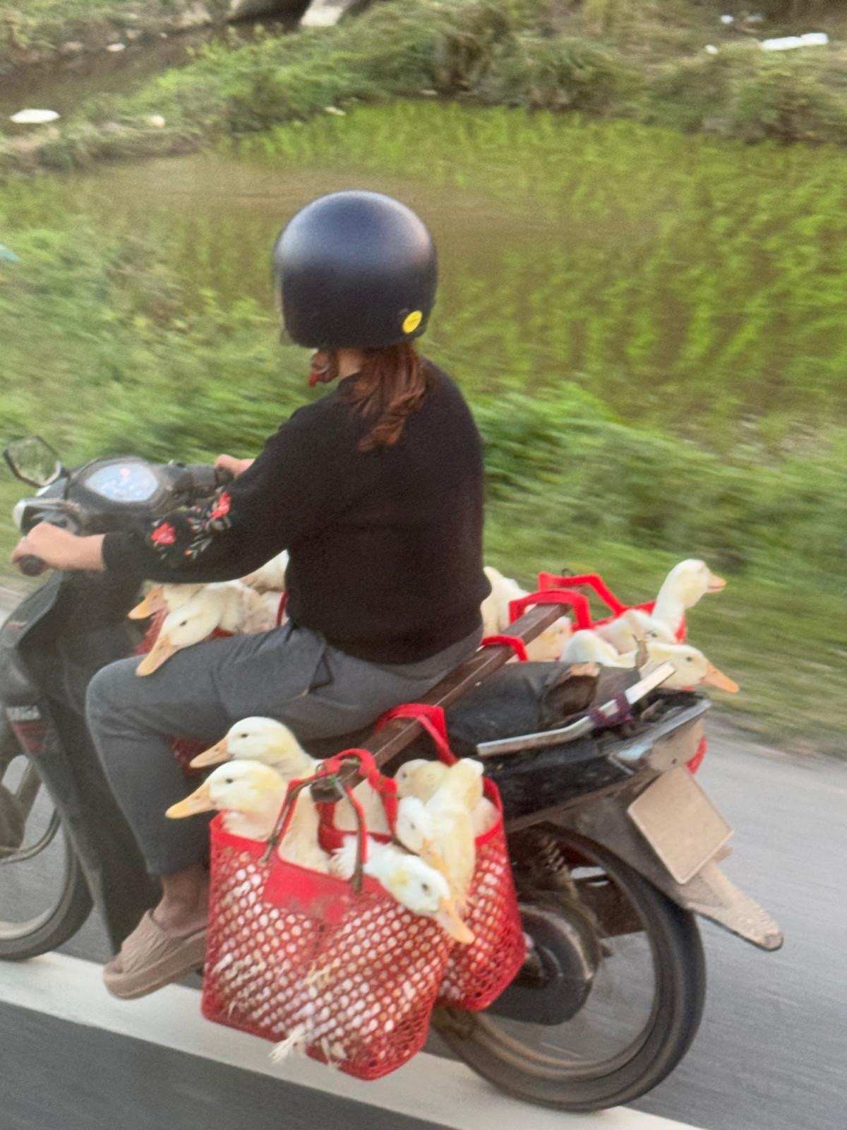
You can see all kinds of things on those motorcycles. Here is a woman with a load of ducks that rode next to our bus for quite a while.
I didn’t get a video, but we saw one with two pigs (dead pigs) on the back. We also saw entire pieces of furniture on the backs of motorcycles, usually too late to get the camera out to catch them.
There are many people who commute with their families. Click on the image below, zoom in and check how many kids you can find on the bikes.
Often we saw four people on a motorcycle, with both parents being on their phones, either navigating or watching videos.
Here is a father with a baby between his legs and a kid behind him.
Here is another typical street scene in Hanoi. Every street, every alley, looks like this.
Traffic in Vietnam is unique, chaotic, terrifying and fascinating all at once. I might note that we didn’t see any rental car counters at the various airports we flew in and out of, including Hanoi, Saigon and Da Nang. What tourist would be able to drive there anyway?
During our recent trip to Vietnam, we visited the Hỏa Lò Prison in Hanoi. Of all the wonderful things and experiences during this trip I could, and eventually will, report about, why am I picking the visit to a prison as the first topic?
Hỏa Lò was a prison in Hanoi originally used by the French colonists for political prisoners, and later by North Vietnam for U.S. prisoners of war during the Vietnam War. In America we know it as the Hanoi Hilton. The prison is a museum today, run by the Vietnamese government. Here is my entry ticket:
The exhibits spend much time and effort on the period of the French colonial suppression of the Vietnamese people and the brutality of the colonists against dissidents. The French behaved like dictators do: they built prison camps and sent those that didn’t think like them to those camps and subjected them to terrible atrocities, including starvation, torture and eventual death. The prison also has a section about the American POWs during the Vietnam war, but it is somewhat smaller and less focused. This is not surprising. The prison was used by French against the Vietnamese, but later by the Vietnamese against the Americans. You want to focus on what they did to you, not what you did to them.
One of our first guides was a young woman in her thirties who took us past the prison on a city tour and mentioned that the prison was used to detain American pilots. She actually said that “Vietnam took good care of those prisoners during the war.” This happened early during our trip, before it had sunk in that I was in a communist country where the people could definitely not speak freely, and in particular tour guides were likely briefed on what they should say about controversial topics. I quickly realized that I needed to remember that our guides were young people, born decades after the war, in a controlled society. It was not their fault that the opinions they needed parrot didn’t always align with the reality as I knew it. Arguing or debating points of view would not make sense in that context, so I learned how to listen carefully and digest the information later.
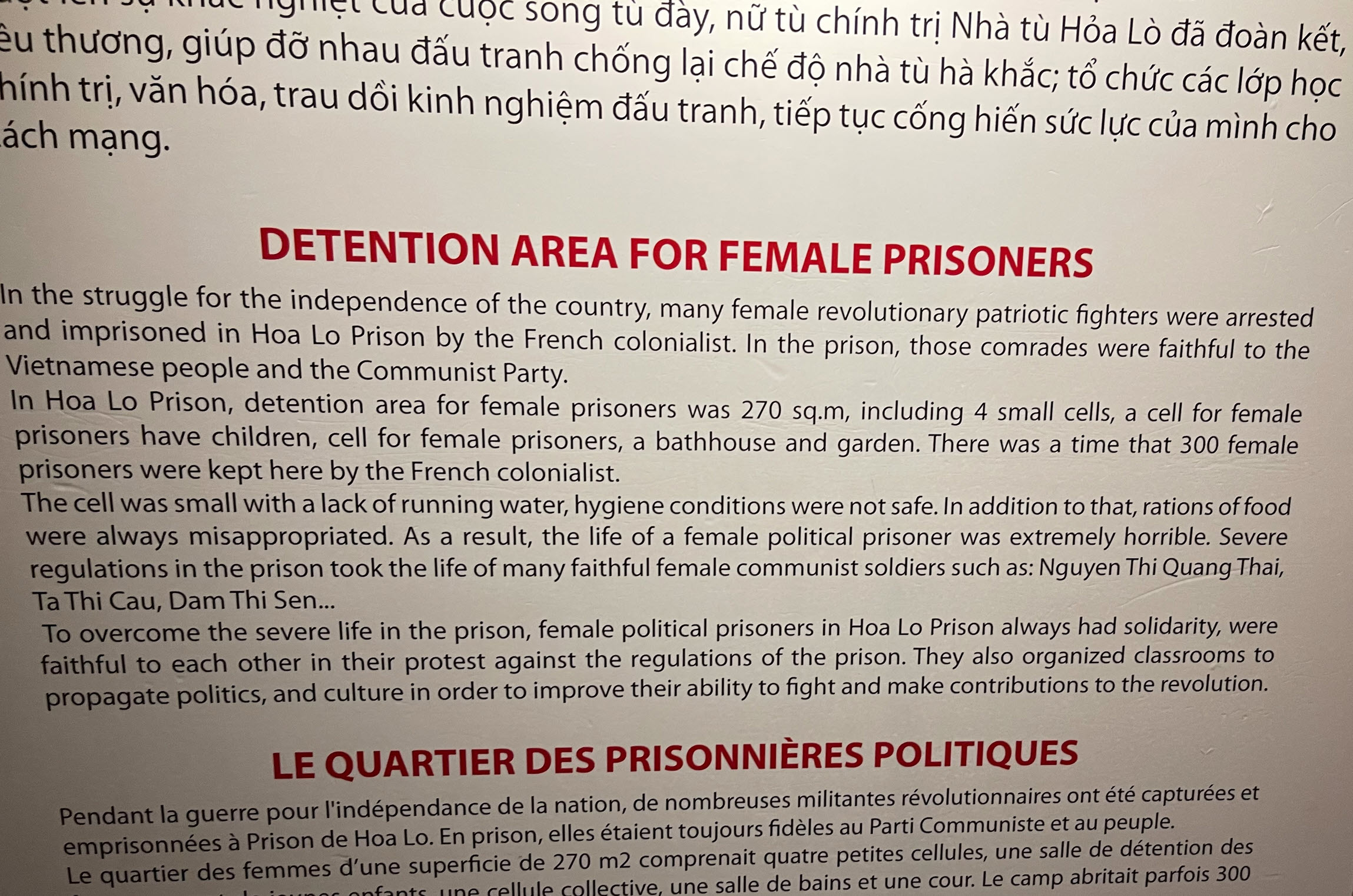
To illustrate my point, here is a sign in the exhibit about female prisoners. Pay attention to the tone of the message:
A visit to the prison was not part of the agenda of our trip. When we learned how close we were, we asked our guide to make room on the schedule, and we squeezed in a 90-minute visit to the museum. For me it was one of the highlights of a two-week visit in Vietnam, albeit a depressing one.
This is because I was always very interested in the lore of the Hanoi Hilton. Many books have been written about it, and one that stands out for me is John McCain’s autobiography Faith of my Fathers, which he wrote in 1999 when he first ran for president. I read it in 2008 when McCain ran for president (again) against Obama. Here is my review. I gave it four stars.
There is a lake in the heart of Hanoi, known as Hoan Kiem Lake. It’s also known as Sword Lake, Lake of the Returned Sword, or Tả Vọng Lake. In the book, McCain describes how he got shot down over Hanoi and as his bad luck would have it, that’s where he crashed. He almost drowned before some fishermen rescued him.
When we arrived in Hanoi, we stayed at the Pan Pacific Hotel, which you can see in the photo below, and it happens to be right on the shores of that lake.
It was eerie for me to walk along this lake in the morning after breakfast, remembering the story of McCain’s capture.
Here is an excerpt of my book review:
With two broken arms and one broken leg, he was beaten and tortured during the first few months, without any adequate medical care and only minimal and eventually botched operations on his leg. His arms were never set properly. Several times his arms and legs were refractured when he was beaten. He spent most of his years in captivity on crutches, due to his bad right leg. Medical care was withheld as a torture method. The prisoners were tortured initially to obtain military information about the initiatives of the war, from the newly captured prisoners that would have such information. Later they were tortured to extract video taped footage to be used for propaganda. The Vietnamese wanted to show the world how injust the war was by turning public opinion globally and in the US against the war. This could be done by having American officers make anti-war and unpatriotic statements, supposedly by their own volition. This hardly ever happened. The code of honor required that the prisoners endured terrible torture without ever breaking.
Prisoners were not allowed to communicate. They were kept in solitary confinement for months and sometimes years on end. When caught communicating, they were beaten for days and punished by being thown into squalid cells of 6 foot by 3 foot and no ventilation or sanitary measures for months. Health care and nutrition was completely inadequate, and some prisoners died from disease. At one time McCain describes being punished by standing, facing a corner, for more than two days. When he finally collapsed, he was beaten again for not following the rules.
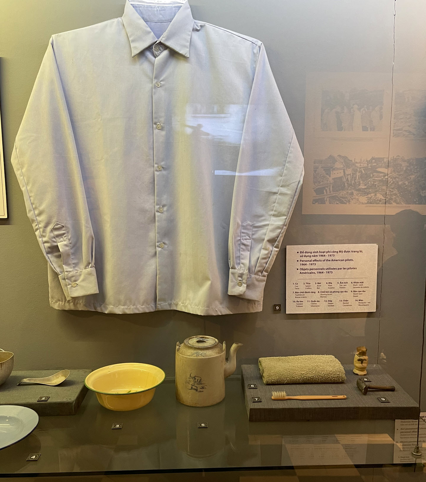
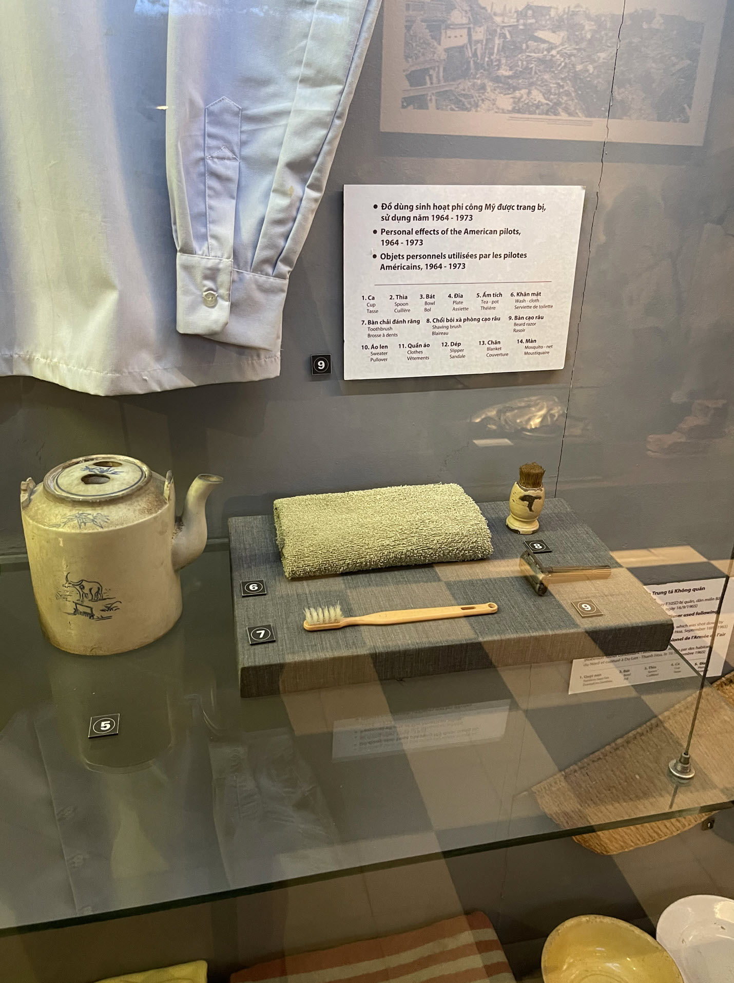
I highly recommend reading Faith of my Fathers to anyone wanting to understand the man John McCain and the experiences of a prisoner of war. If you only read one chapter, read the one about “John McCain’s Towel.” I will do that myself, now that I have been in the Hanoi Hilton, where the ghosts of the American prisoners from over 50 years ago still haunt the walls, and where I saw the infamous towel, as part of the gear issued to the prisoners, in this exhibit:
Above you see some of the gear given to the prisoners. On the right side you can see the towel. Since I knew its significance when I was there, I took a close up of that exhibit:
Here are some additional exhibits about individual prisoners. The one about McCain is a larger one, of course, due to his notoriety as a presidential candidate later in his life.
Here is a picture of McCain when we visited Vietnam in 2000 and toured the prison where he was captive and tortured for almost seven years.
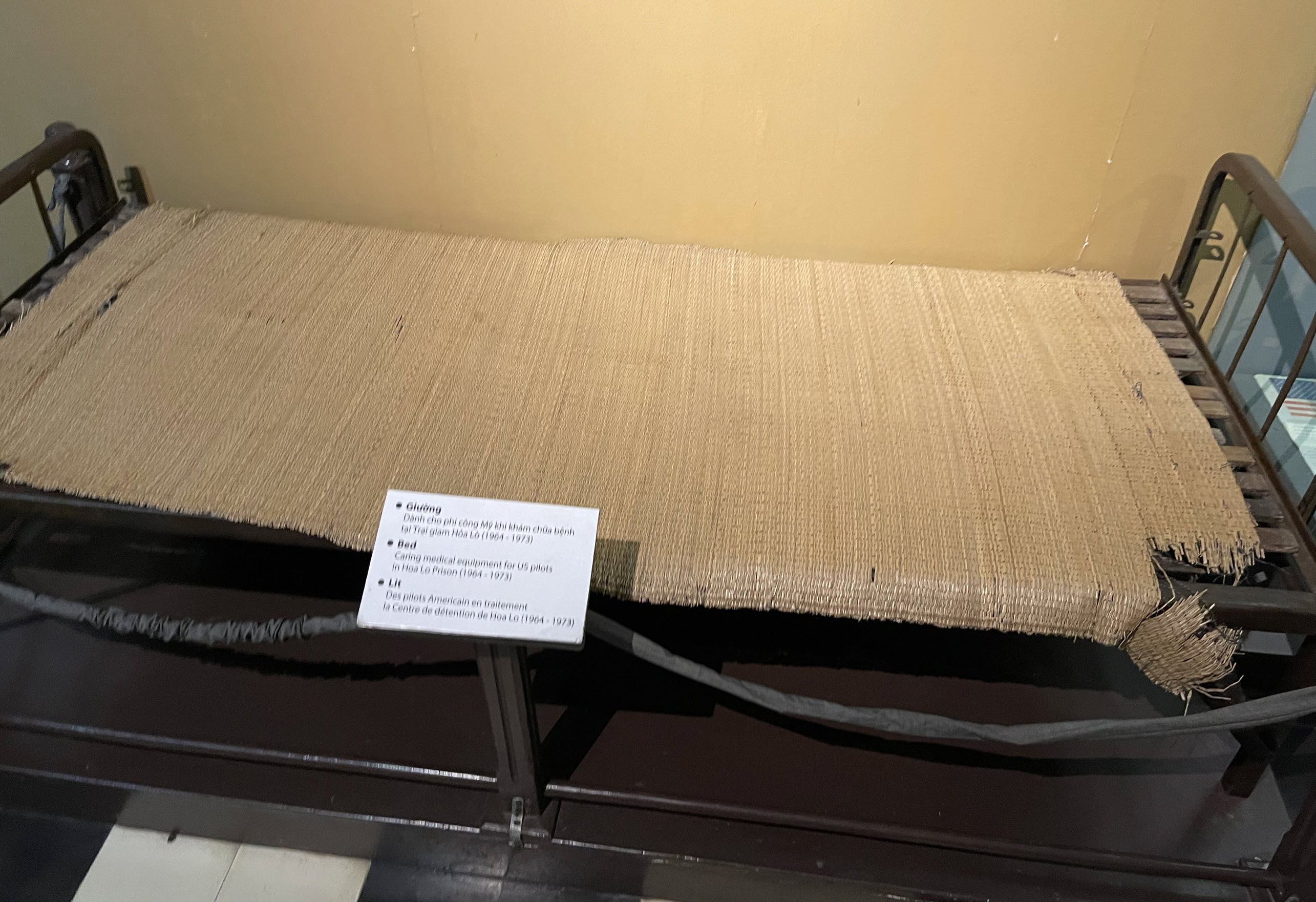
Here is a picture of the beds of the American prisoners.
In contrast, the image below shows how Vietnamese prisoners were shackled in endless rows during the colonial period. Remember, the crime of these men was that they didn’t think the Vietnamese people should be ruled by the French.
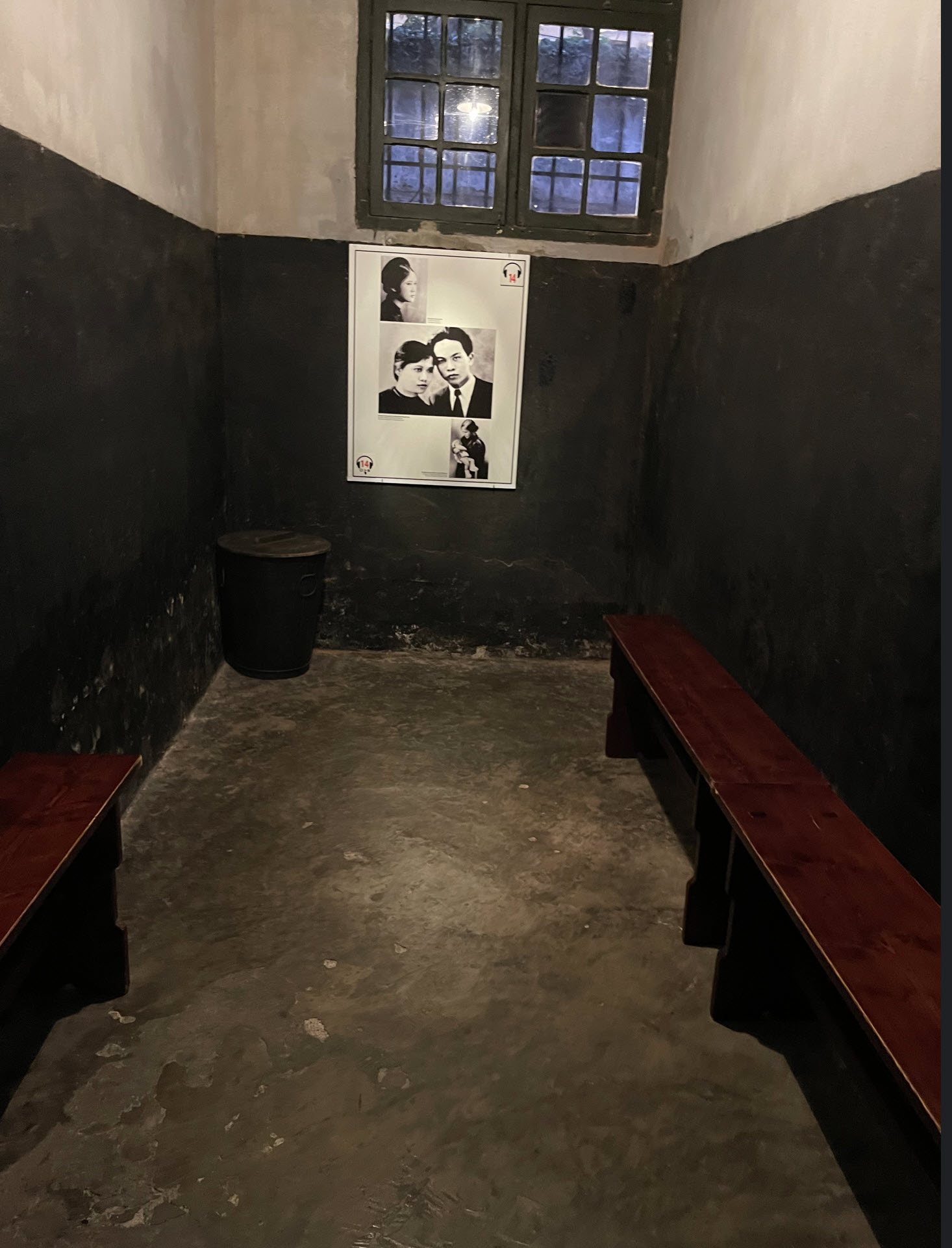
Here is a typical cell in the Hanoi Hilton.
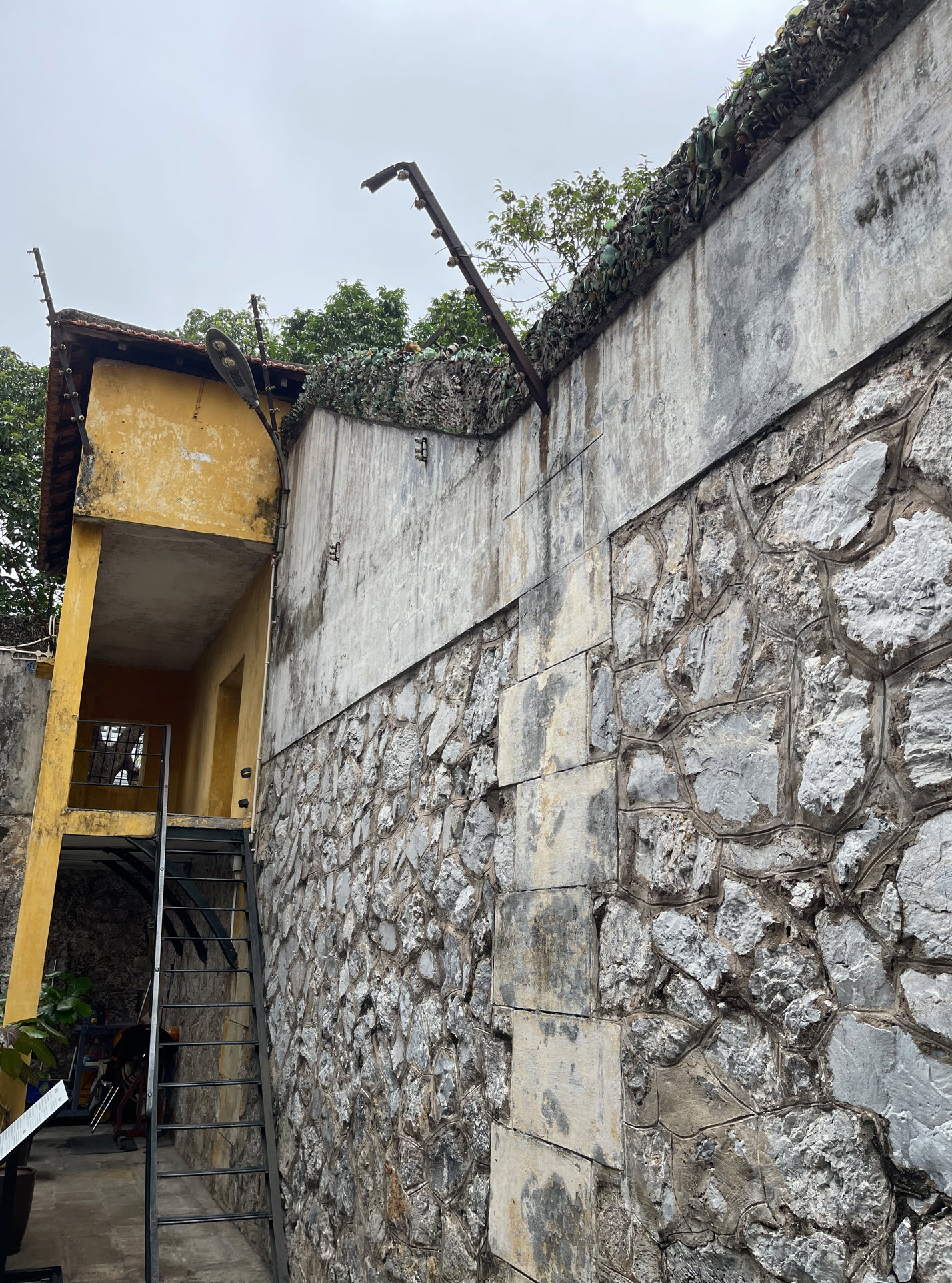
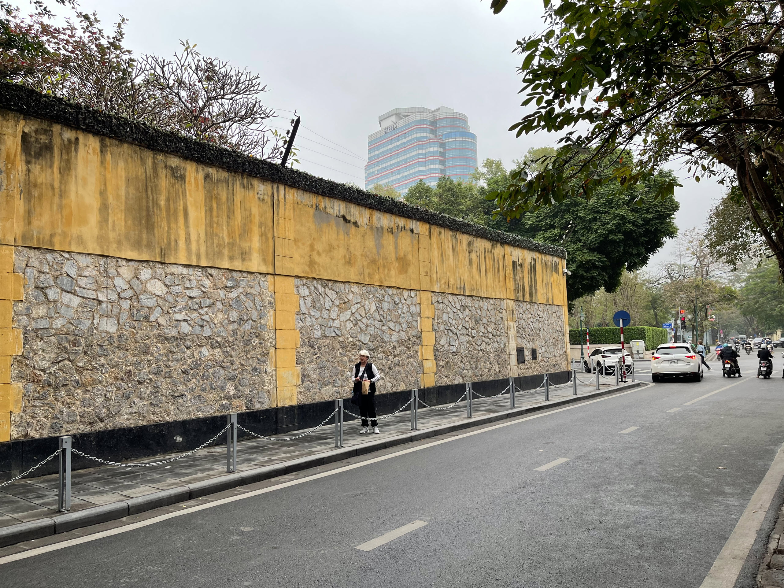
Below is a section of the prison wall from the inside. On top there is barbed wire, sometimes electric wire, but the wall is also covered with shards of glass cemented along the top.
This is the same wall from the outside.
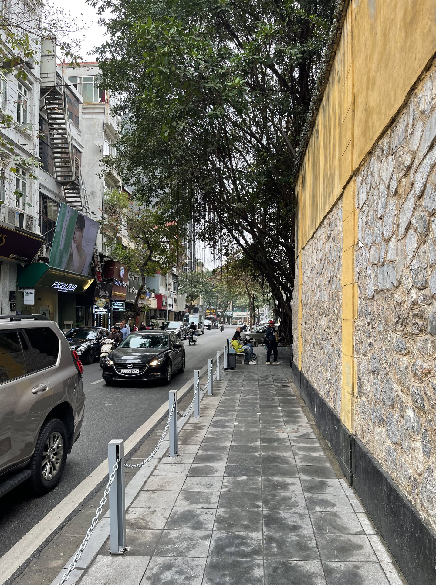
The prison is in the middle of the city, surrounded by the hustle and bustle of Hanoi. If you didn’t know what you are looking at, you would walk right past.
On the other side of the wall you find hotels, little shops, cafes and restaurants.
I wonder what it must have been like to be imprisoned for years behind these walls hearing and feeling the pulsating heart of the city all around you?
Last week I visited New York City. In the last few years, there has been a lot of new construction and some very iconic buildings have sprung up. Here is a shot from the front of the Midtown Hilton, where I stayed, at 53rd Street and 6th Avenue.
As always, you can click on the image and zoom in.
Located on 111 West 57th Street, in a section of town known as “billionaire’s row,” this is the world’s skinniest skyscraper. With a height of 1428 feet, is is also the second tallest residential building in the western hemisphere. You can read all about it here.
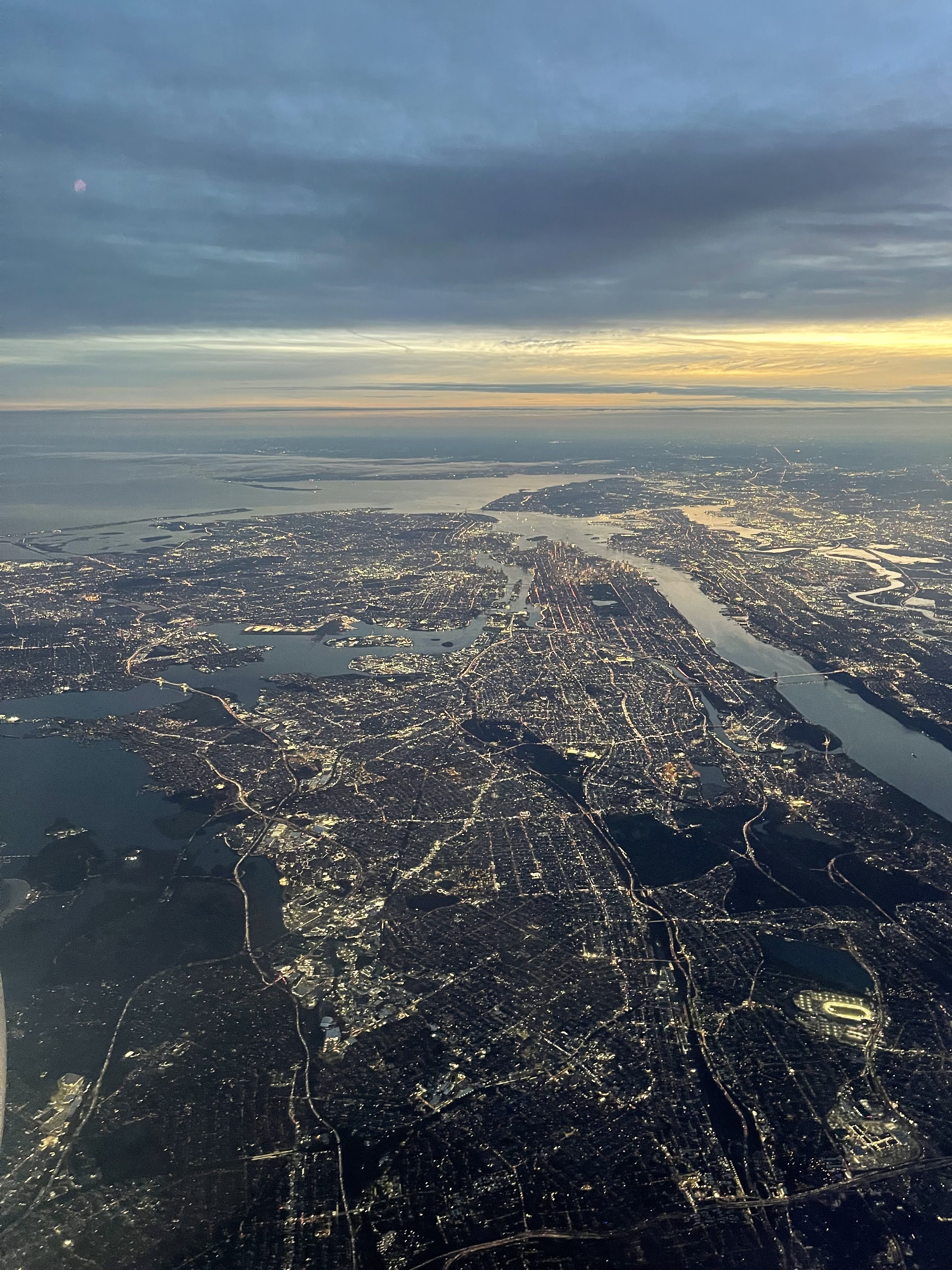
Then, a few hours later, my plane left as the sun was just setting, and I had a great arial view of New York City from 12,000 feet, with all of Manhattan in the left center of the image. You can clearly see the dark green rectangle of Central Park (with its lake).
I always like to visit New York and enjoy some of the iconic and unique attractions it offers.
In August and September, my wife and I spent three weeks in Europe, including five days in Paris toward the end of the trip. Early during the journey, my wife developed a cough, which kept getting progressively worse. I observed how her health slowly deteriorated over two weeks. Finally, as we were walking out of Versailles, she could hardly function anymore as her breathing became very labored.
I called an Uber and took her to l’Hôpital Paris Saint-Joseph. I randomly picked it as it was close to our hotel. We arrived at the emergency room around 3:00pm. My limited, 50-year-old rusty French was not up to the task of complex medical terminology, and the English of the French hospital’s staff and doctors was also limited.
As we checked in, they charged € 800 on our credit card as an advance.
My wife then spent six full hours in the emergency room while I waited. She was seen by several doctors, and had a full EKG and a CT scan done. They put her on an IV drip to re-hydrate. After eliminating many frightening scenarios, they diagnosed her with bilateral pneumonia, advised that she stop traveling and just get rest. The prescription included a strong antibiotic and a pain killer. While she was there, they provided the first dose of the antibiotic. The language barrier was severe, particularly communicating complex medical terms. The doctors ran their summary report through Google Translate and we received the report printed in two languages so we could take it home to her personal physician. The service was prompt, very courteous and thorough, and my wife, always positive, was impressed with one of the doctors, who she said looked “like a chiseled Greek god from the Louvre.”
I was not looking forward to the bill that would eventually come. Given limited experiences in American emergency rooms, I expected a bill for thousands of Euros.
Last week it came: € 541.
Amazing.
PS: We took it very easy traveling home and she is now finally and slowly recovering.
I just flew back from Portland, Oregon to San Diego. I sat in the front of the plane, on the right side, with perfect weather. Here are some views of the natural glory of California. As always in my blog, you can click on an image and zoom in. For these pictures, it might be worth it.
First, I caught a good shot of the town of South Lake Tahoe. This is where my son lives. I waved, but I don’t think he saw me.
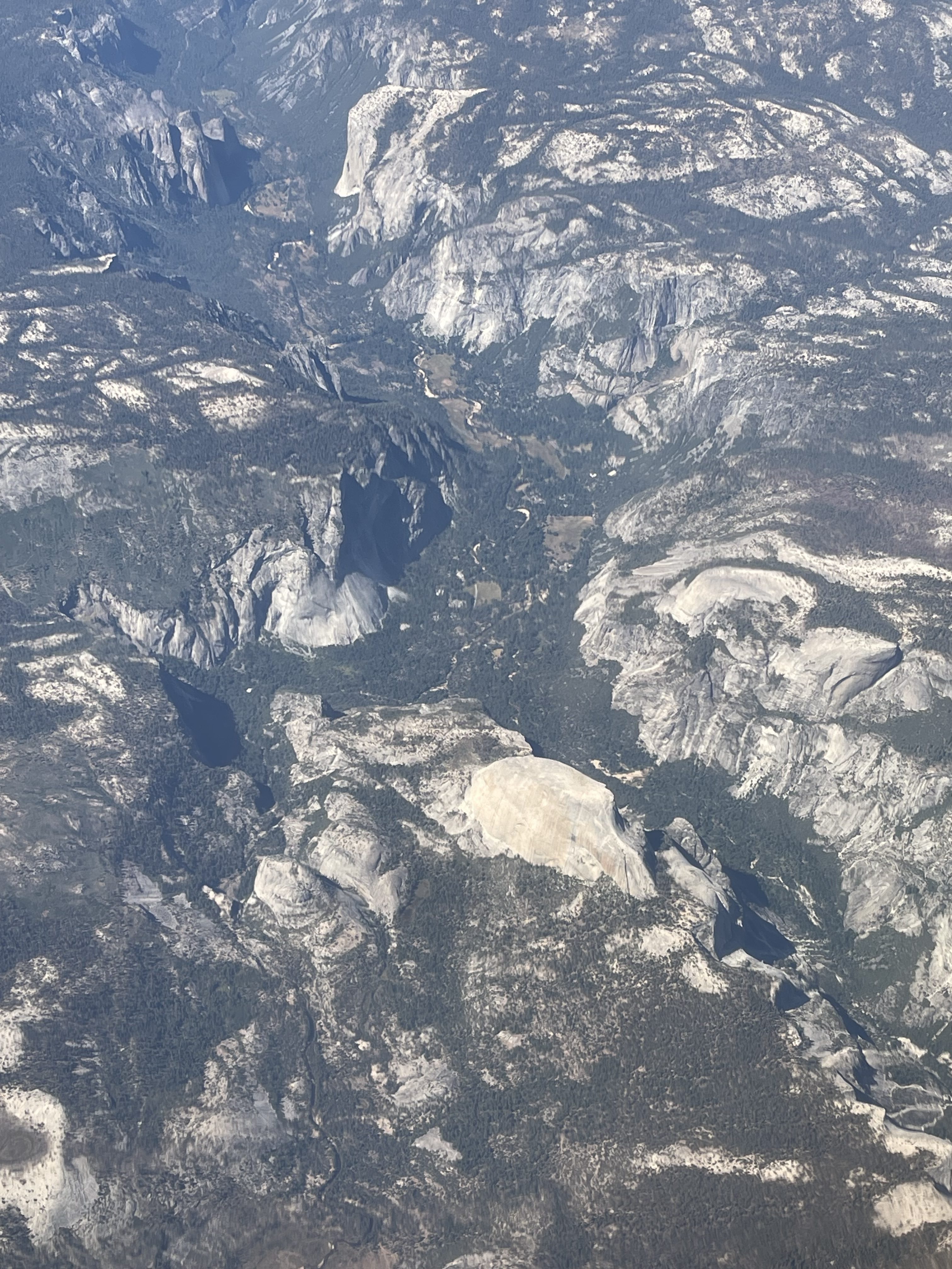
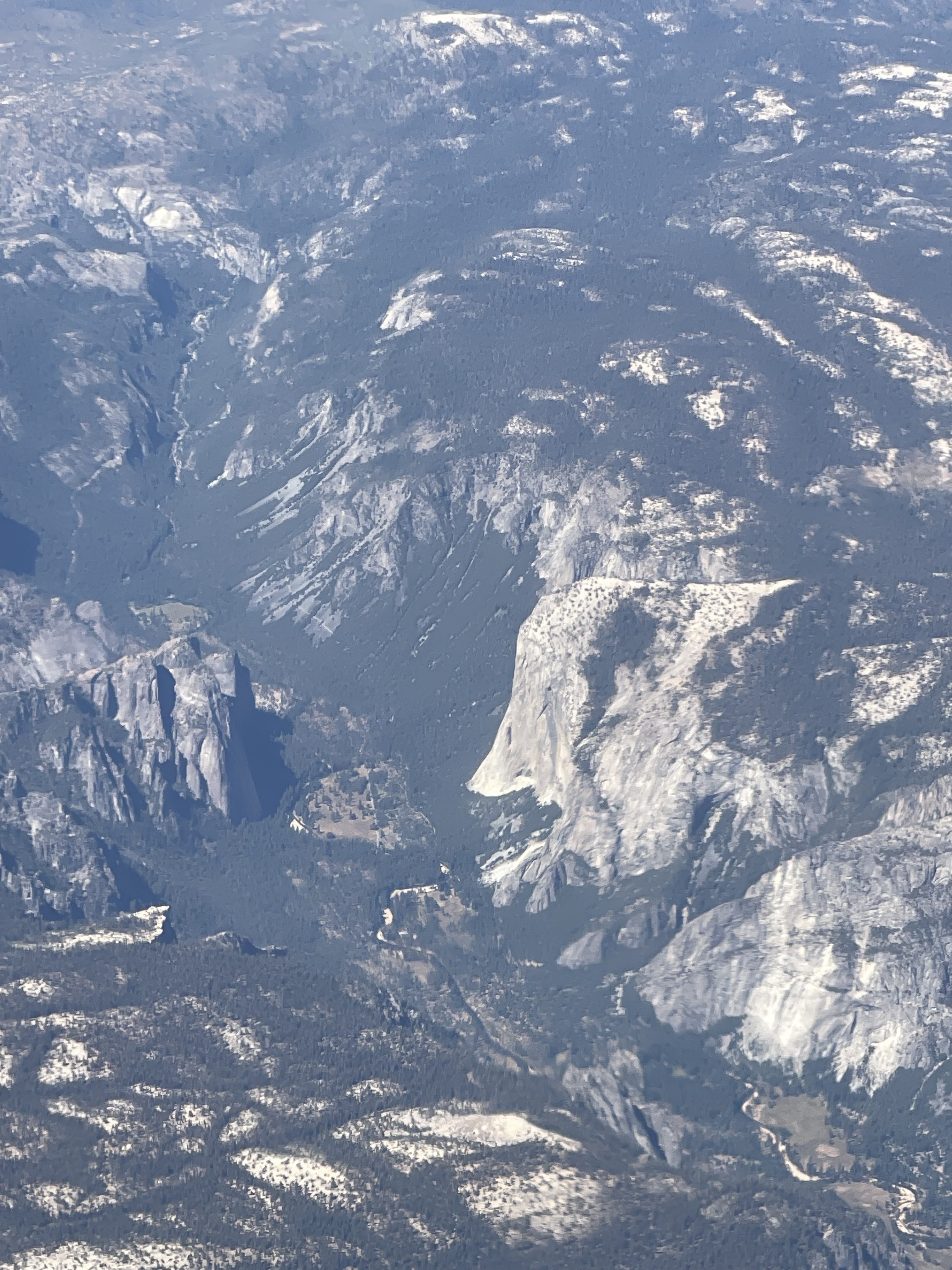
Then we flew over Yosemite Valley. I was able to see El Capitan, one of the most famous big walls for climbers in the world, and of course, Half Dome. I had fond memories of my climb of Half Dome almost to the day 12 years ago, which I chronicled here.
For those of you that don’t know what you’re looking at, here are some pointers. The red arrow points to El Capitan, and the blue one to the top of Half Dome.
I also took a zoomed shot of El Capitan, one of the most iconic rock formations in the world with more than 3,000 vertical feet of sheer granite.
I have lain on my back in the meadow below and looked up with binoculars. You can always find a few climbing parties on the rock, tinier than ants, on an impossibly tall and vertical wall. It is also made famous by recent rock climbing movies, such as “Dawn Wall” and “Free Solo.”
On August 19, 1974 I left my home village for a year abroad in the United States. Before then I had hardly left a 150 mile radius around my little village of Illkofen in Bavaria, which at the time had about 250 inhabitants. It may have a couple hundred more now.
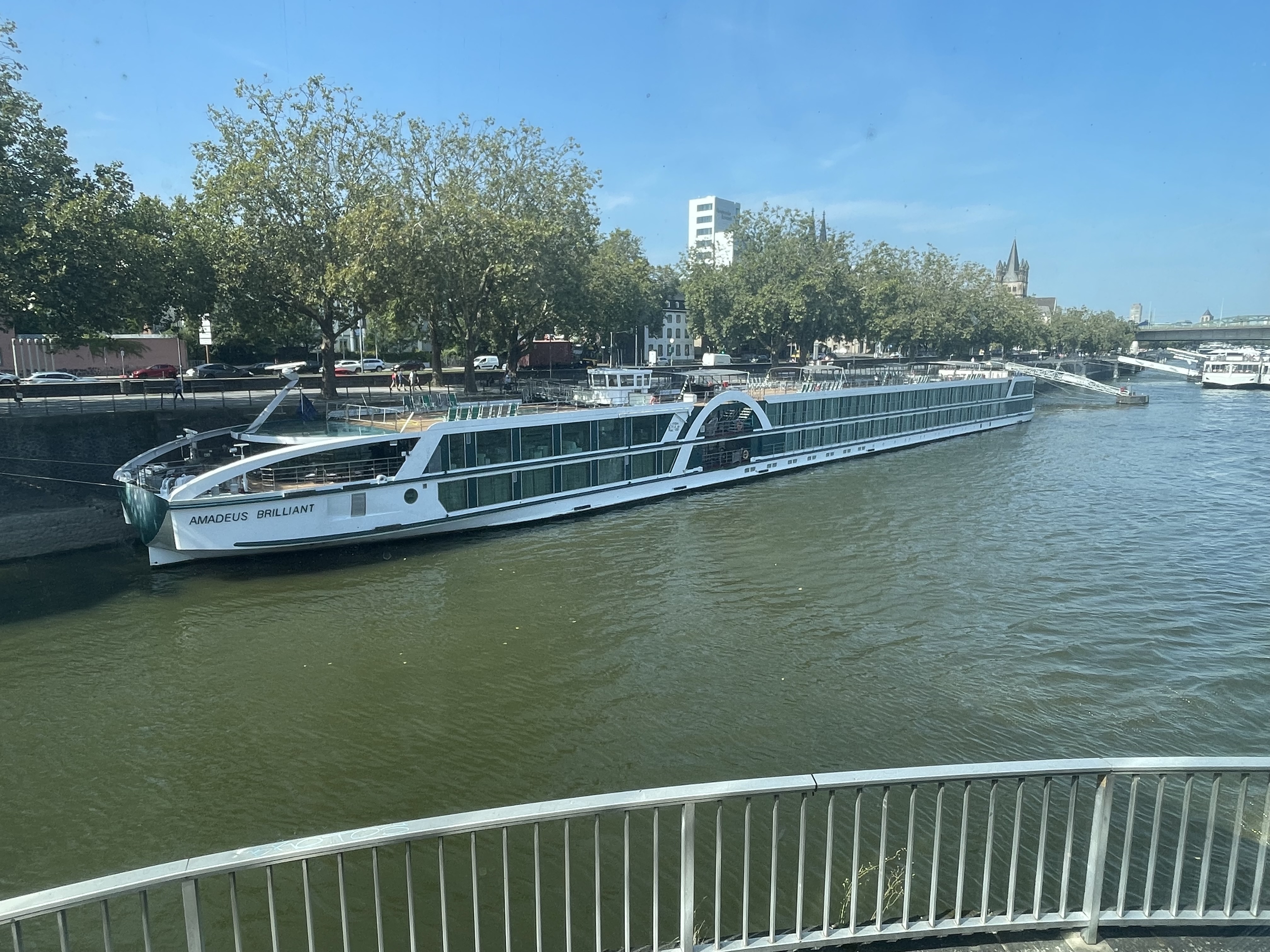
Exactly 50 years and three days later I boarded this river boat, the Amadeus Brilliant, in Passau with a group of international friends from all over the world for a reunion. We were going to cruise to from Passau in the south of Germany to Cologne over a seven-day period. I was one of the few Germans in the group, and it was a complete coincidence that the route would take us right by Illkofen, my home town.
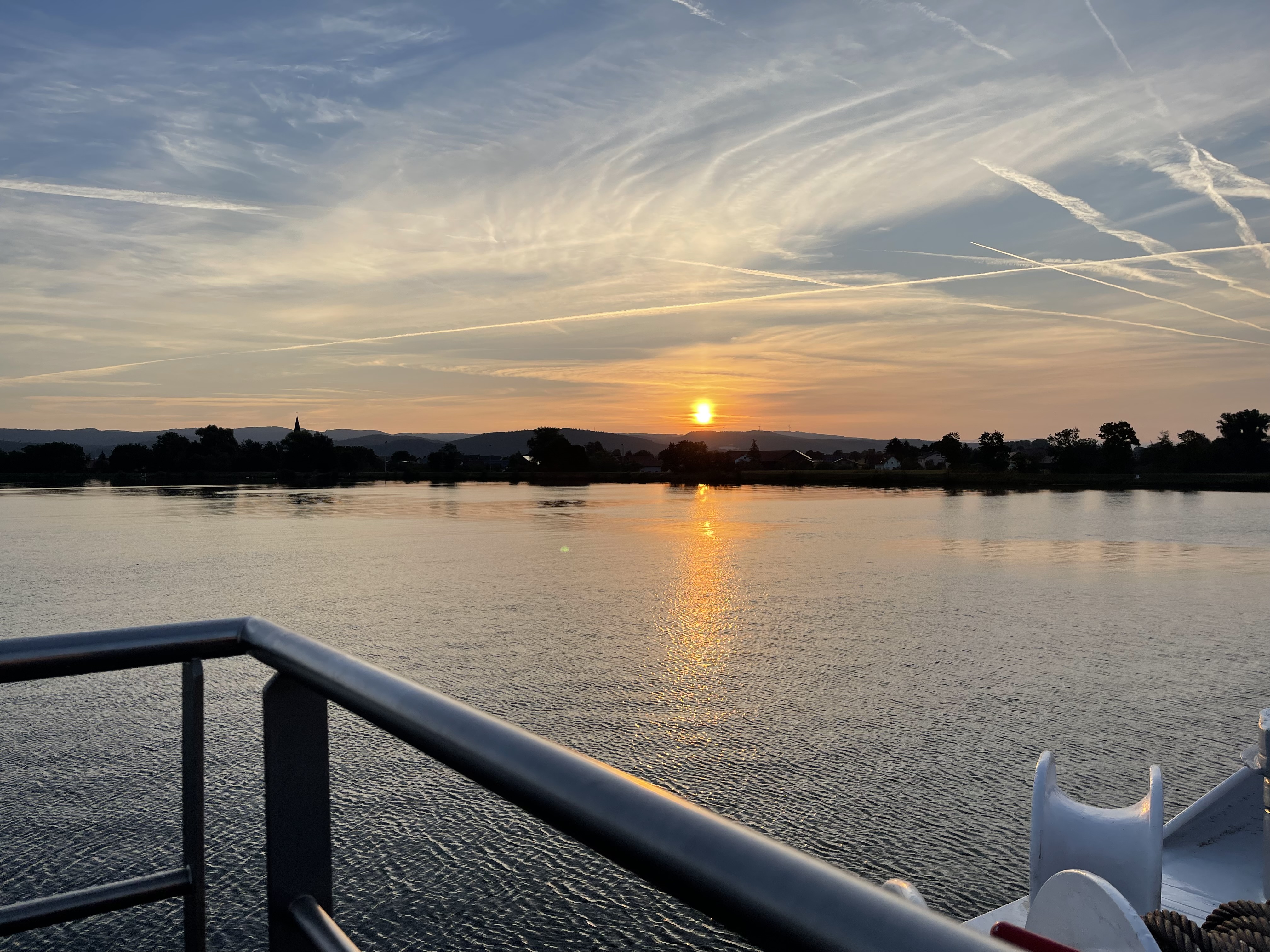
The river boat traveled mostly at night, and anchored during the day to give us a chance to have shore excursions in exotic places. I woke up around 5:00 am and went outside on the bow of the boat. Nobody else was up. The boat was gently gliding up the Danube and getting close to the old home. I was able to get this sunrise picture about half an hour before we got there.
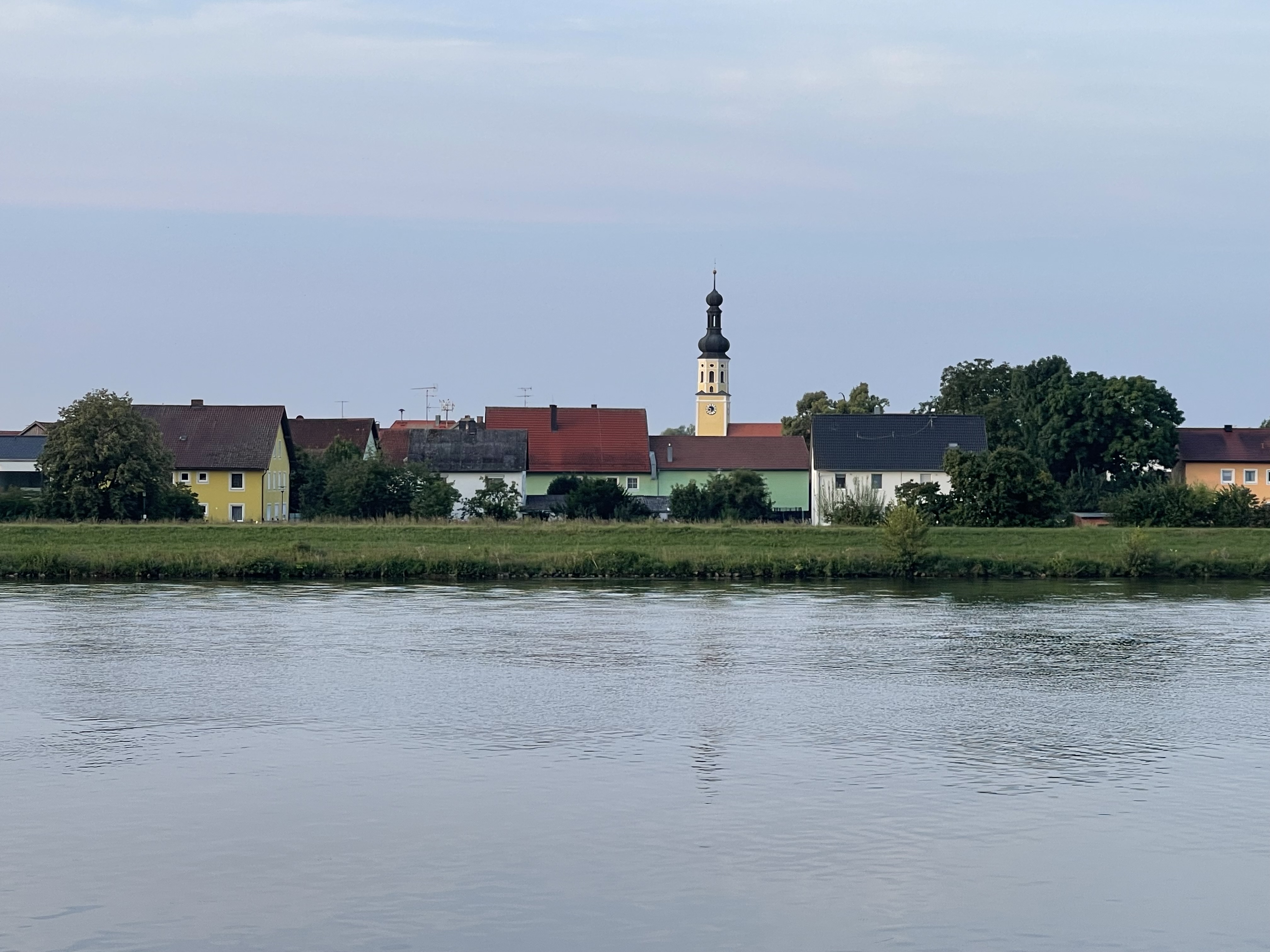
And then suddenly there was a great view of the old village, seemingly within reach. It was just before 6:00 am and the village was sleeping. Our boat eased its way past and I had memories rush through my head as I sat there in the cool air, gliding past the places of my childhood. I have played in every one of these houses and barns.
It went by very fast, and I quickly reminded myself to take a parting shot before we rounded the next bend and the village disappeared behind us.
It’s that kind of nostalgia that happens rarely in life, and it is always very private and hard to share in a public post.
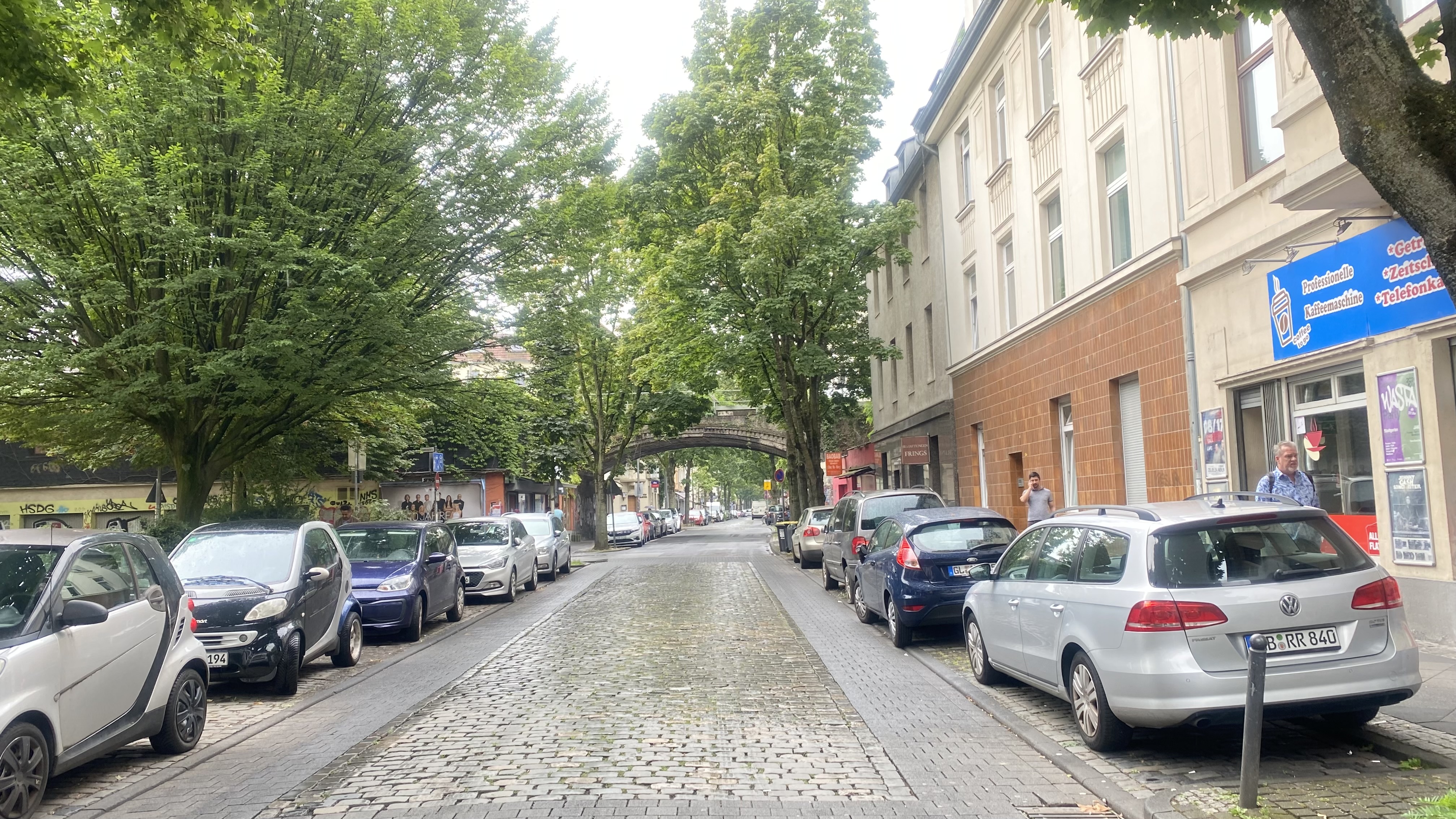
For most of the year 1977 I lived in Cologne. I was just 20 years old, and it was the very first place of my own. I was in the military, stationed at the Cologne/Bonn airport. I didn’t want to live in the barracks, so I found an apartment of my own at Taunusstraße 15. I moved out of there in November of 1977 and I have not been back to Cologne in the past 47 years, until today. For nostalgia’s sake, I just had to go back and check out the old neighborhood. Photocredit to Trisha who took all the pictures for me.
Here is a view from the Taunusplatz up the street a bit, a one-minute walk away.
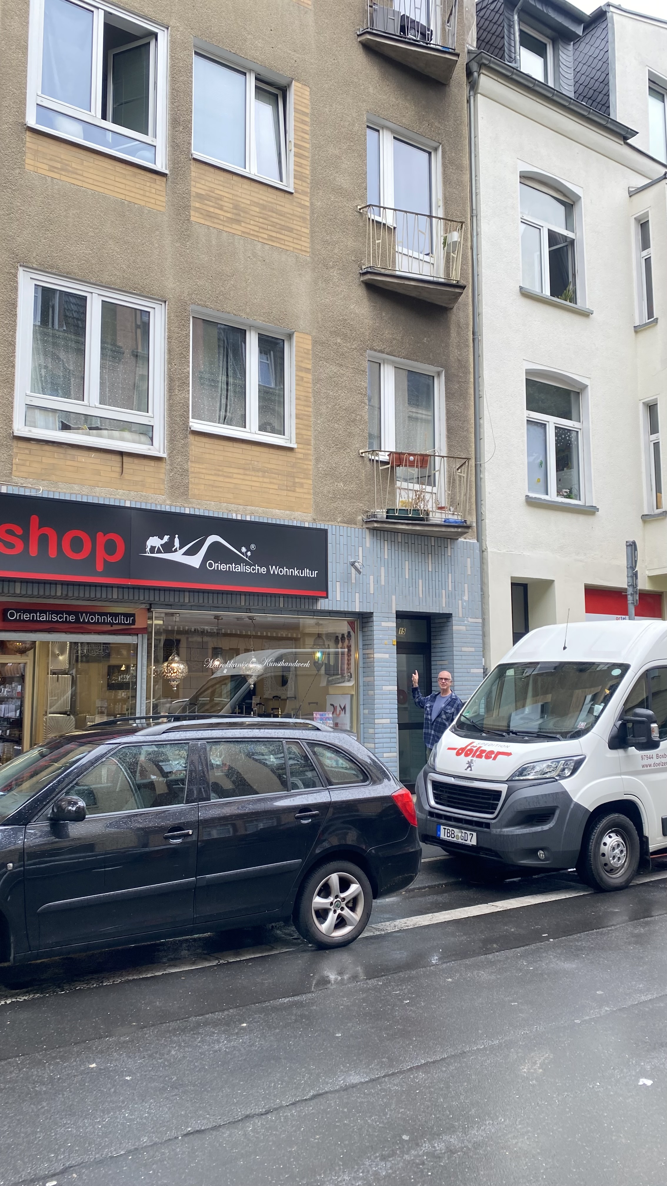
Here I am in front of the place. Unfortunately, there was a big van so we could not get any closer for a good photo of me at the door. I lived several stories up and in the back, overlooking the alley. But this was my entrance.
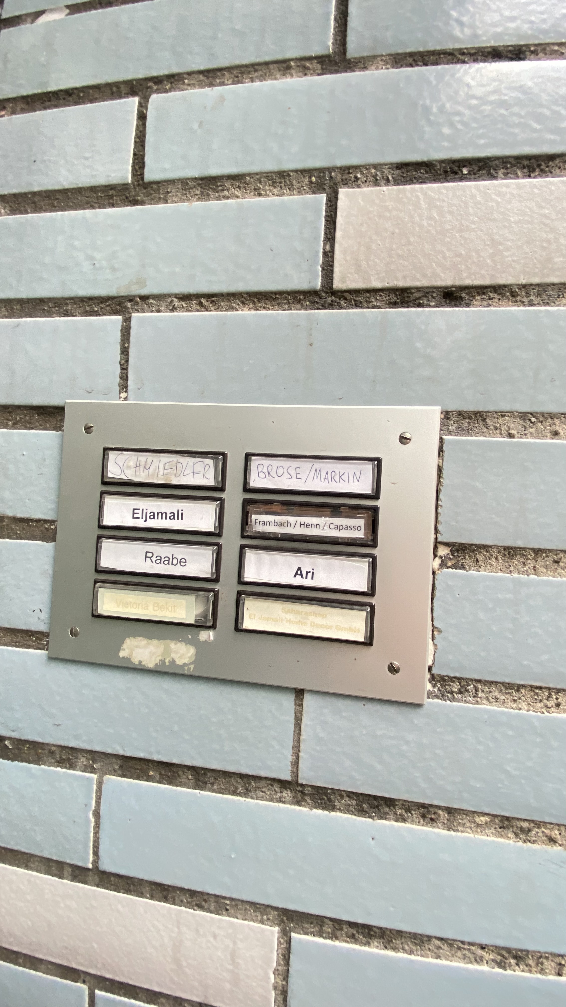
Here is the doorbell. My name was where Eljamali is now.
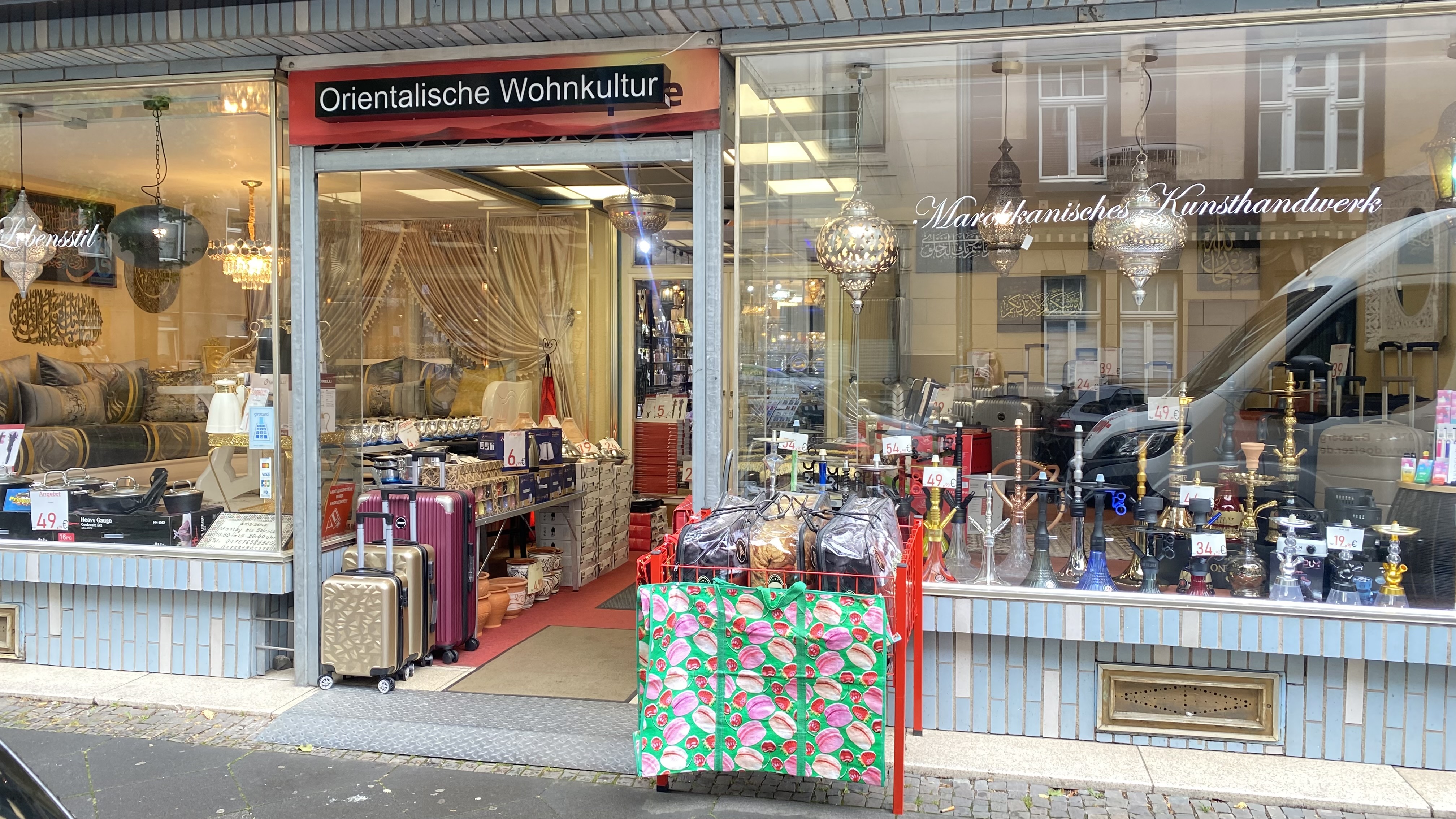
My landlord, Herr Wolf, lived on the second story, below me. He always let me borrow his vacuum cleaner. He was in his late 60ies, about my age now, and he owned and operated the store below, which was a haberdashery at the time, selling upscale conservative male clothing, nothing a young soldier could afford.
The neighborhood has changed. Now the store is a Turkish shop with all kinds of baubles and, of course, hookah pipes.
The neighborhood is very different now. All the stores and businesses are distinct middle eastern, with Turkey being the major presence. It used to be a German white middle class area. Now nobody even speaks native German. We went to a little cafe in the neighborhood, had a nice breakfast, bought some fresh fruit and then took an Uber back to the city.
I am sure I’ll never come this way again, but I had a nostalgic fix walking along the old street corners and awakening long forgotten memories.
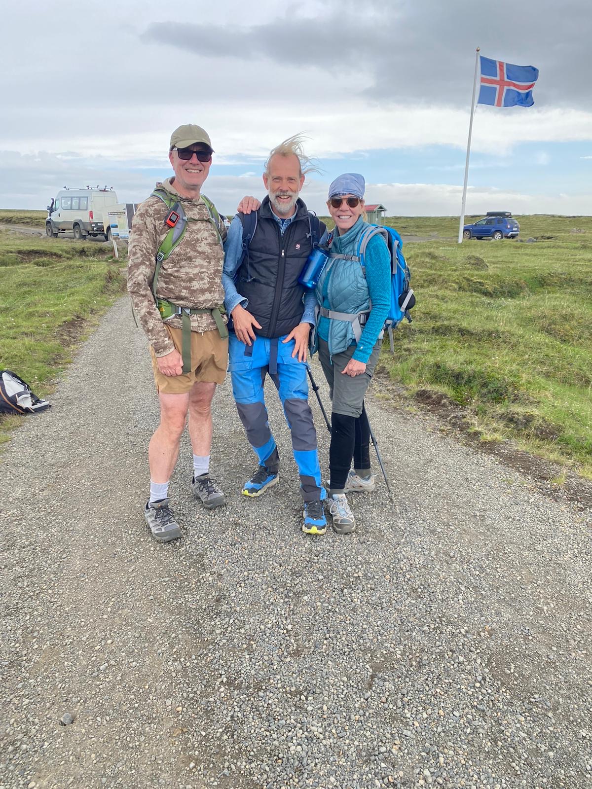
Iceland is a majestic place, with extremes, and a stark, striking beauty. After spending a week hiking the ancient trails on the highlands, I thought I’d show some pictures of fire and ice. Here are Trisha and I with our guide Jonas at the end of the last long hike, with the parking lot behind us.
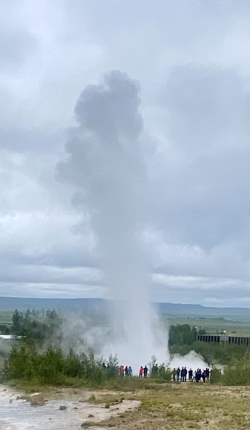
Here is a picture of the main geyser at the Geysir Hot Spring Area along the Biskupstungnabraut (well, highway 35) on the way to the highlands.
Here is a video of the same geyser, photo credit to Lou in our group:
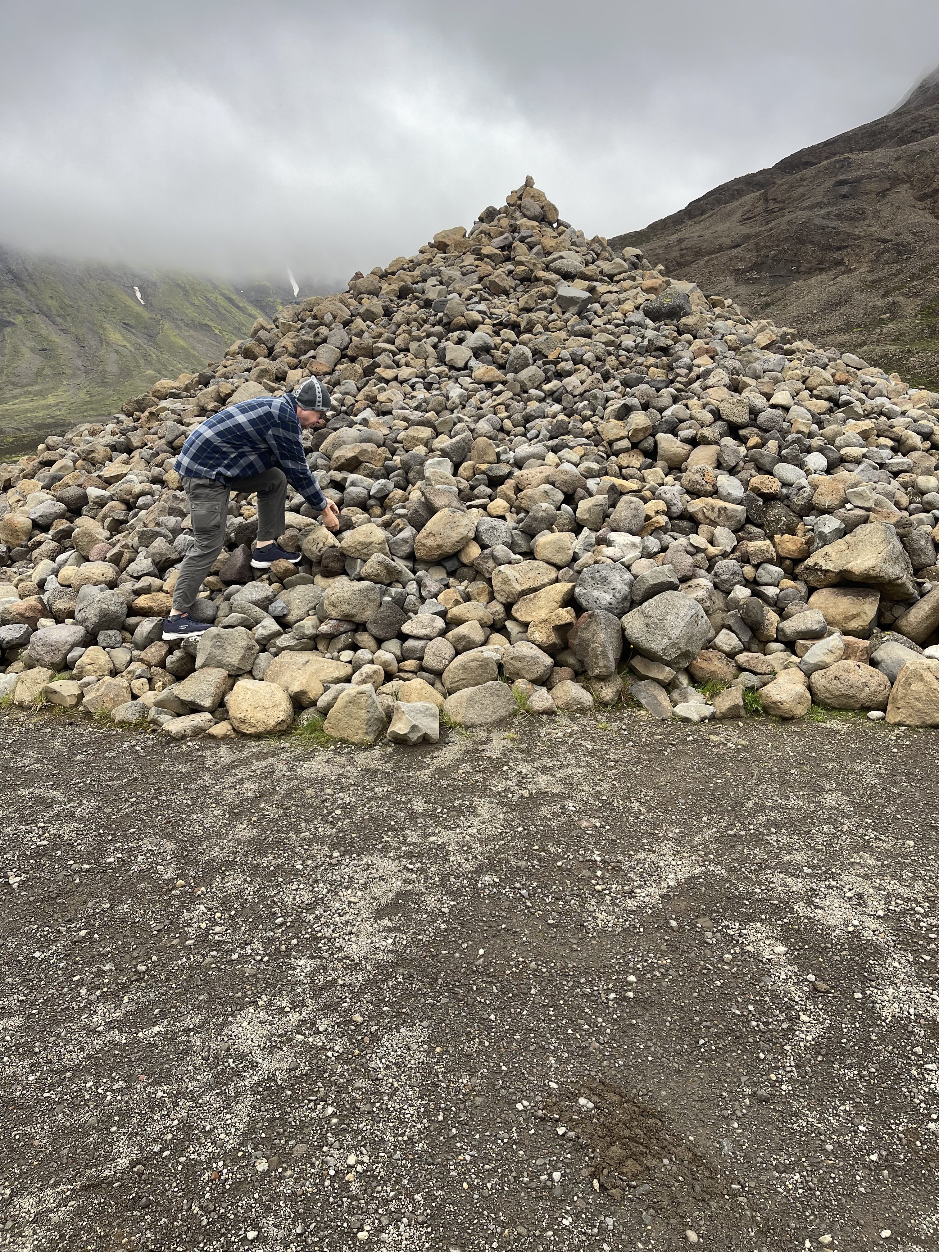
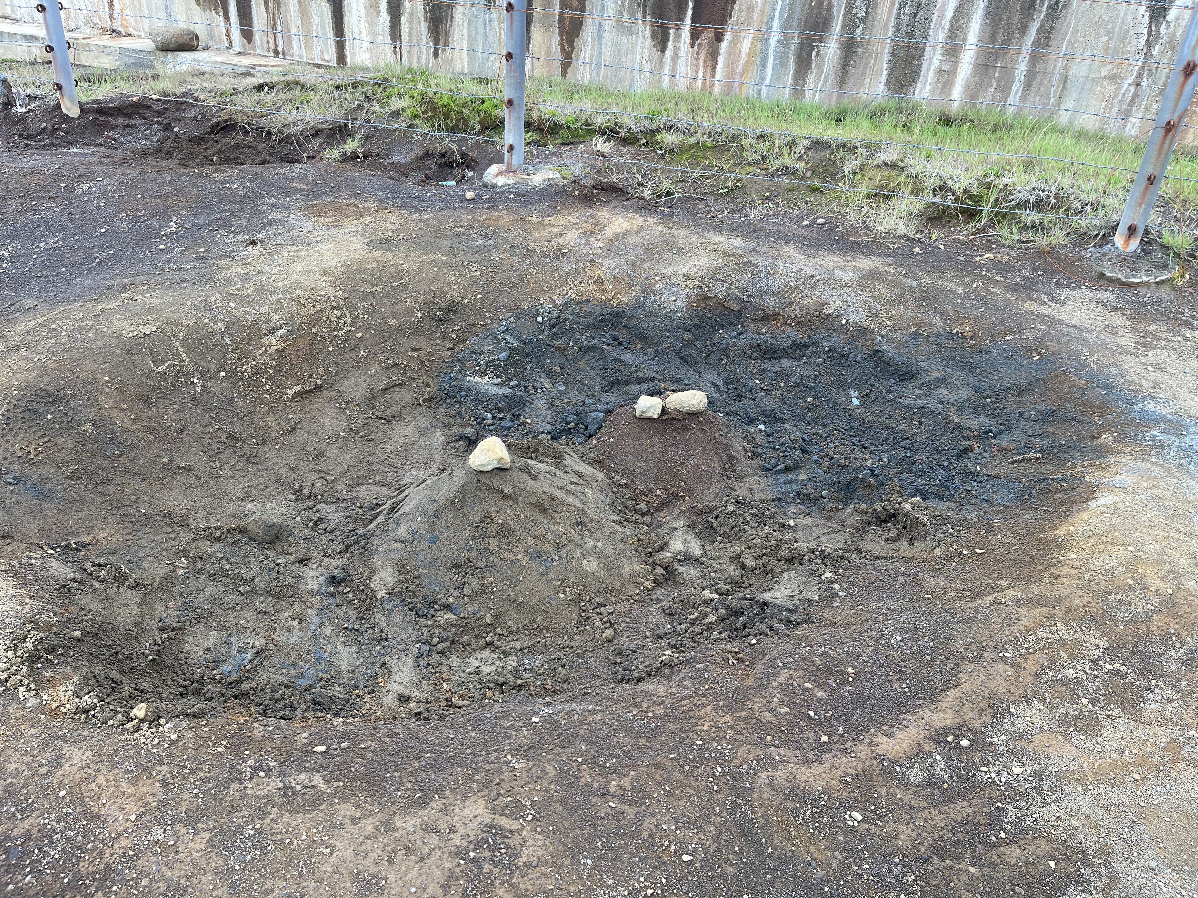
On our way out Jonas told us the story of his father, Valdimar, who in 1961 build a summer ski school way out in the mountains. He was one of the pioneers of developing sports in Iceland at the time. He had an old pair of rubber boots that apparently he didn’t need anymore. On his way out to the site where they were building a hut, he placed the boots on an open lot beside the road (a rough and rutted dirt road to this day) and put a rock into the boot for good luck while he was out there in the wilderness working. His sons, including Jonas, and friends started to take up the practice. They would stop by the boots on their way out and leave a rock for good luck and to fend off accidents and mishaps. This was kept up by the locals and recently the guides. Here you can see me, over 63 years after the practice started, laying down my rock for good luck. There is a pair of rubber boots somewhere under this pile. I came home unscathed from the land of fire and ice, which means that my rock worked.
Up in the Hveradalir Geothermal Area some of us hiked down a muddy ravine to a steaming hot spring. Sulfur was heavy in the air. My glasses immediately fogged up from the heavy steam and I had to take them off to see. And seeing was critical, since one little misstep and you can find yourself in a cauldron of boiling mud:
Speaking of boiling. There is an area where the locals bake their bread in boiling dirt. See the picture below with the little mounds with rocks on top of them? When I touched the dirt, it was hot. When I pushed my fingers into the dirt, is was very hot, boiling hot.
The locals bring shovels and special baking pots with their rye bread dough. They dig a hole in the hot dirt, put in the pot, cover the pot with a special cloth to keep the dirt out, and then cover the whole thing with dirt again making a mound. To mark it as an oven, they put a rock on top. You have to remember which one is your own rock and of course not disturb somebody else’s cooking mound. There are dozens of these mounds in this area. When you come back the next day, you dig up the pot, and your bread is done. I tasted their bread and loved it.
The cooking dirt is right next to a large lake which you can see in the video below. The lake water is normal cold temperature. I touched it to make sure. Just like any lake. But within just a few feet of the lake’s shore there are little hot spots with boiling water. You could boil an egg in this little spring.
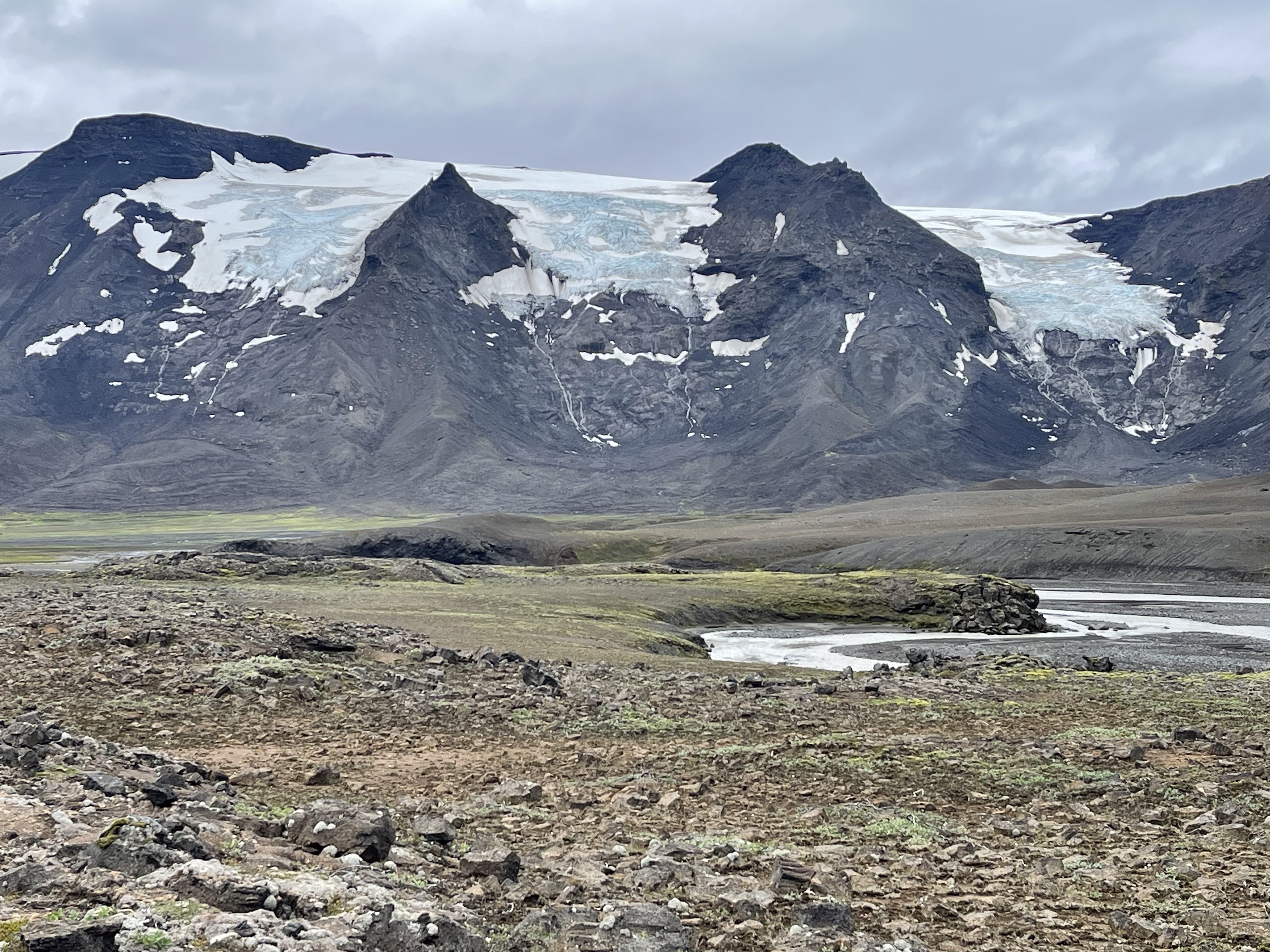
After fire, there is always ice. Here is a good view of the Langjökull glacier from our trail.
The Fagradalsfjall volcano, which had been dormant for 800 years, began erupting in March 2021. It had just just erupted again a few months ago, and we were warned that it was supposed to go off again within days of our visit. Fagradalsfjall is only about 10 miles from the Keflavik International Airport and close to the capital city Reykjavik. We did not have time to visit the volcano during our trip, but we did stop at the Lava Show in Reykjavik. In a theater-like setting, they are actually showing a live lava flow, and you can experience the intense heat of fresh hot lava and watch it cool off while a narrator describes what is going on. I highly recommend that show.
Iceland is a majestic, dramatic and extreme country with a hardy people and a glorious and very difficult language. I want to go back.
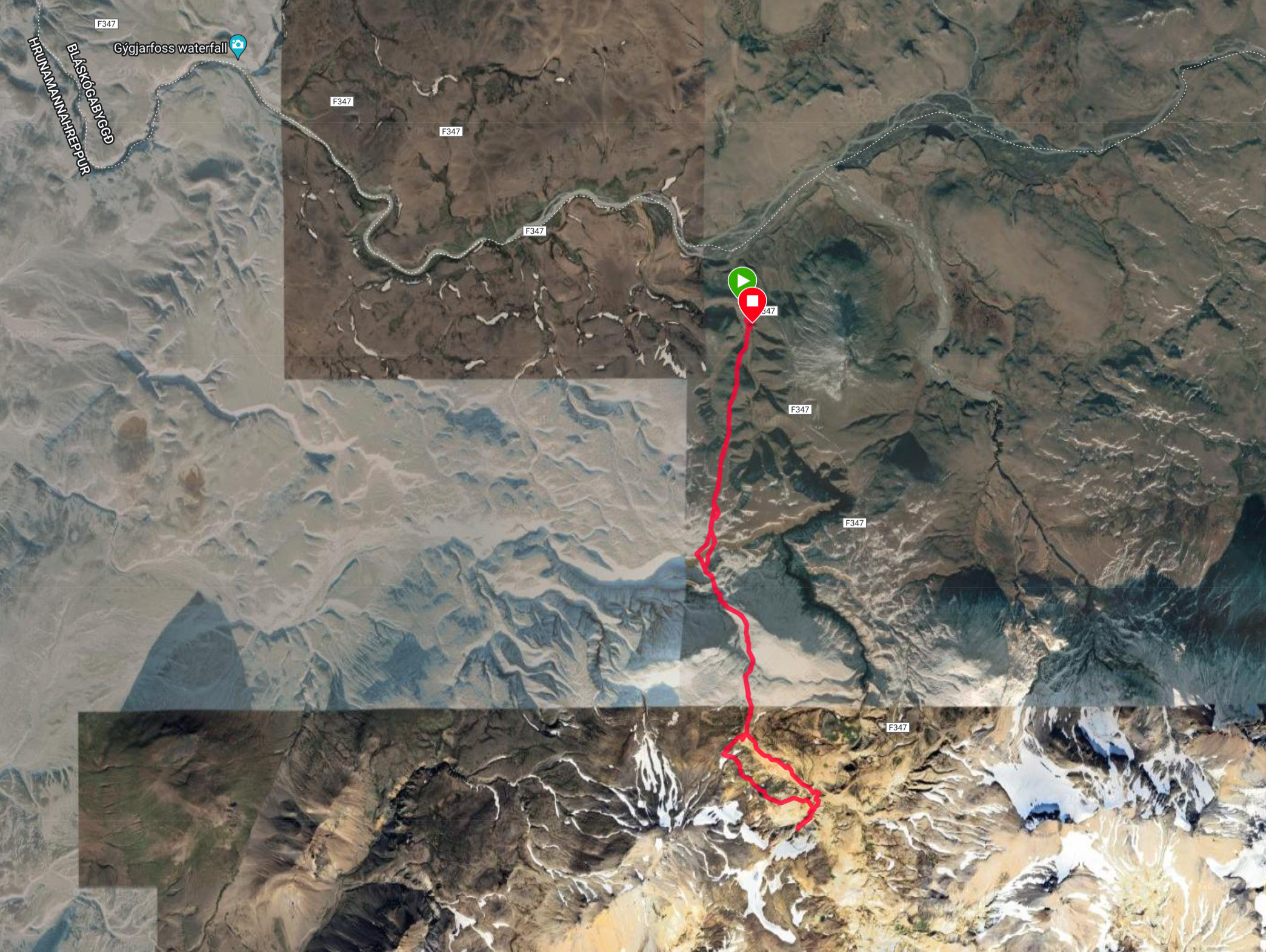
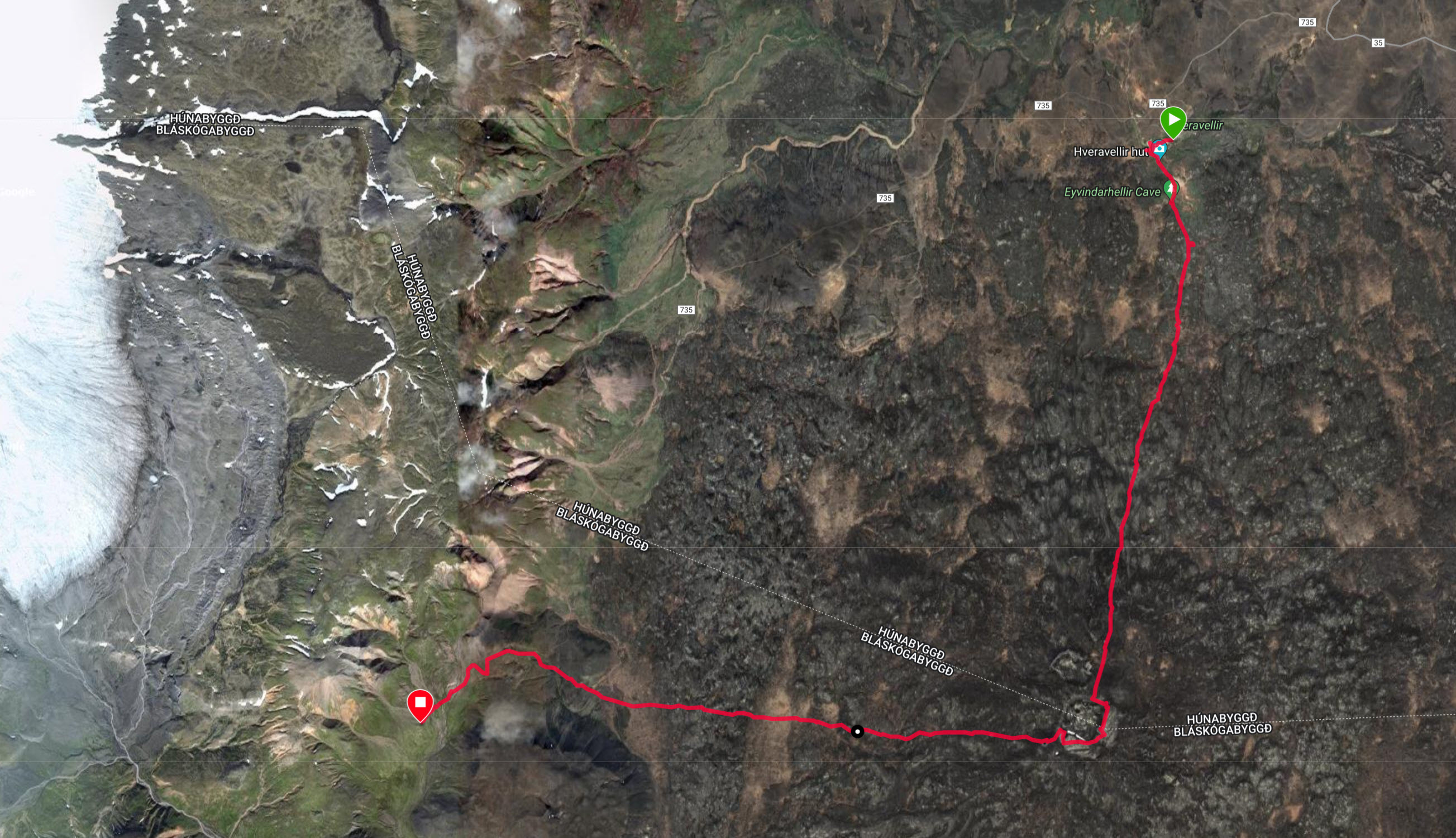
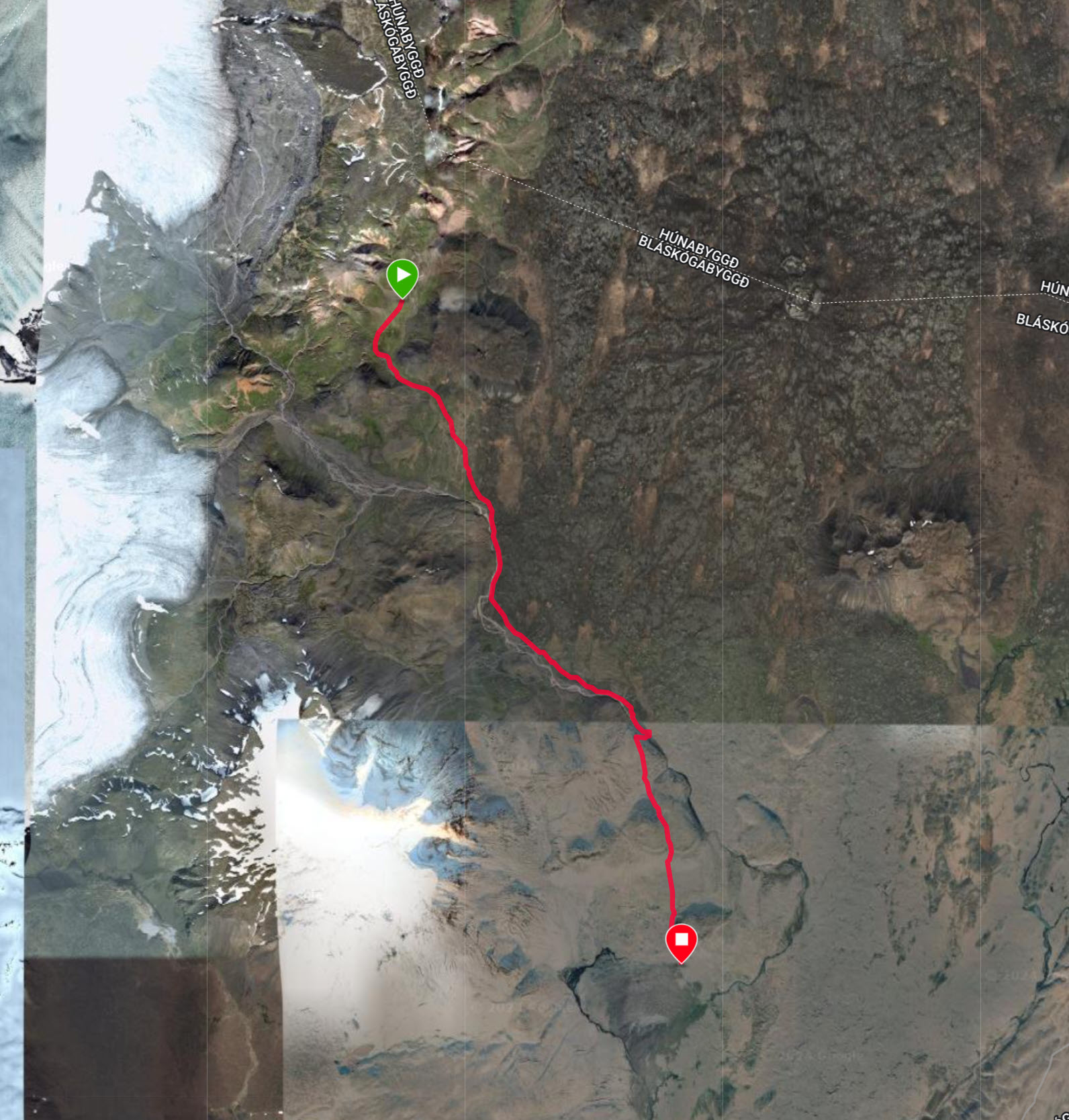
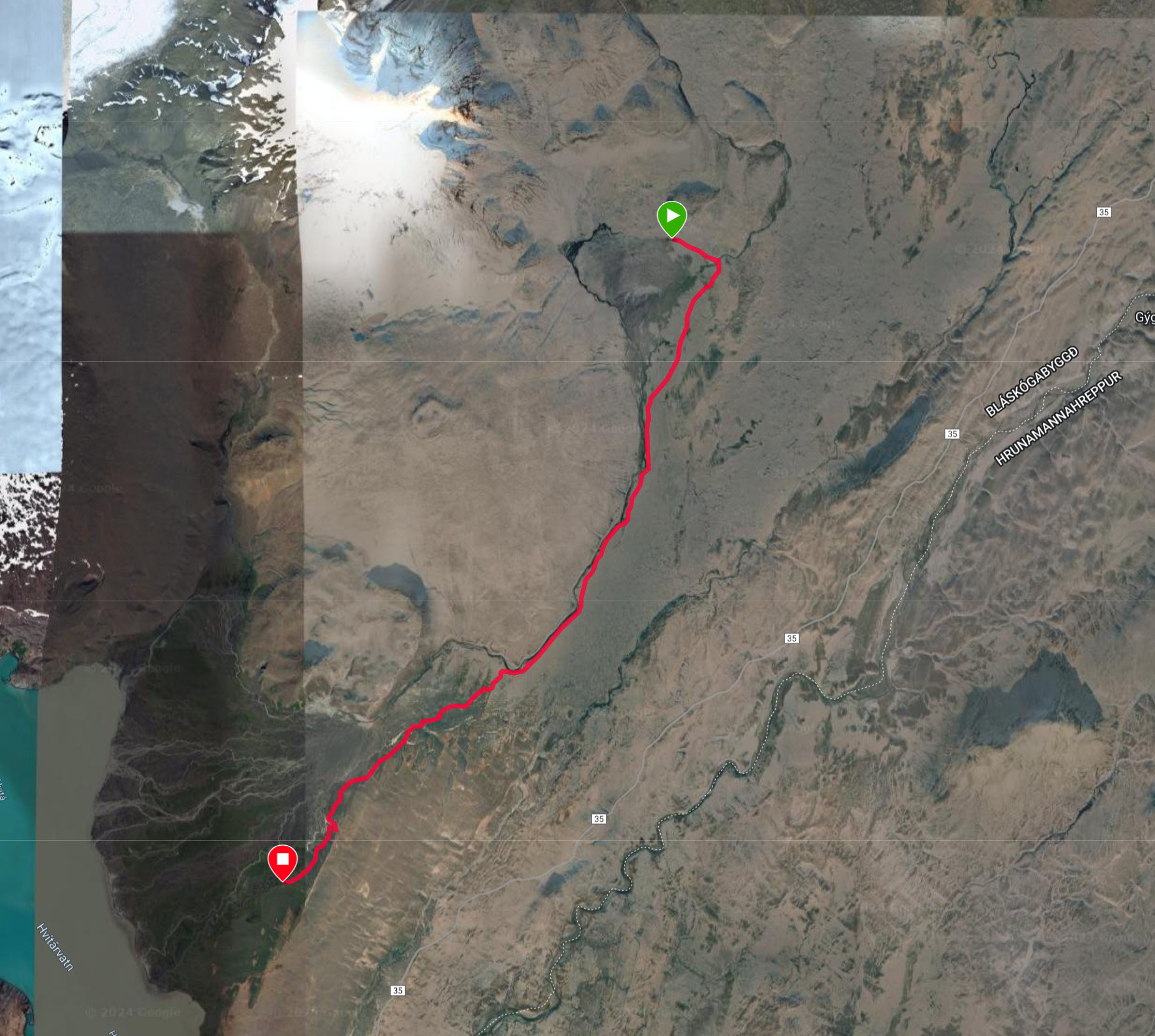
Here are maps, statistics and some pictures of the four main hikes we did in Iceland:
Hike 1
July 31, 2024 – 8:00 miles, 6:35 on the trail, including all rests and stops.
This hike was the most strenuous. We climbed up into the mountains and did a circle of vast hot springs area, known as the Hveradalir Geothermal Area. The wind was fierce and we needed all our layers to wear. It was basically in and out on the same trail.
Here is Trisha on the trail after coming up a steep ridge.
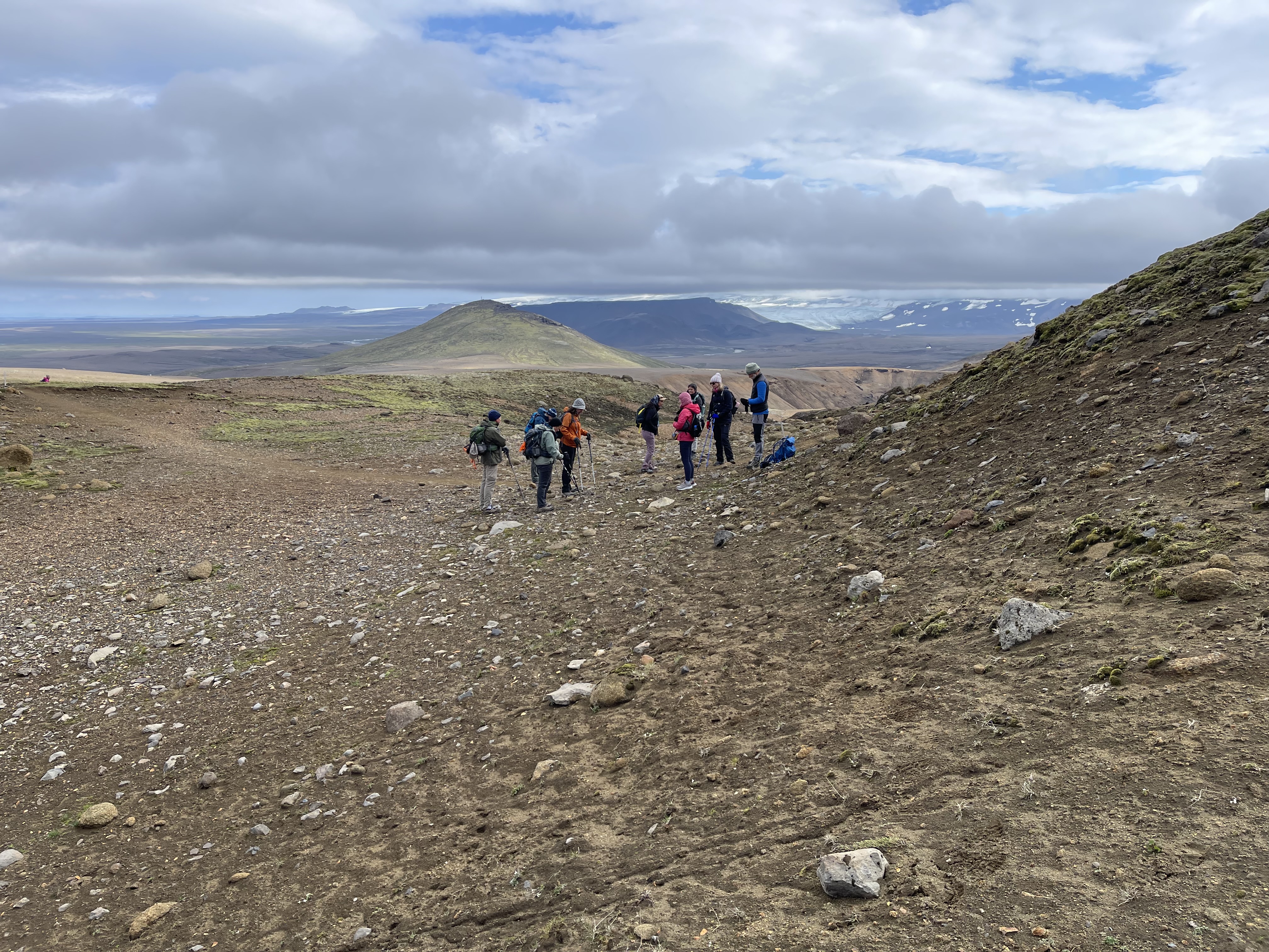
And here is our whole group, getting oriented by our guide Jonas on the right side. In the background just over Jonas’ head you can see a part of the Hofsjökull glacier, which is located in the center of the country.
Here is a better view of the Hofsjökull glacier:
Some of the terrain was quite steep, and there were rudimentary stairs installed. That’s me in the very back getting ready to come down.
The landscape at Hveradalir is in front of us, deep valleys with many colors, greens, red, yellow and lots of browns, ocres and whites. Plumes of steam and occasionally sulfur wafts around everywhere. You have to be careful where you step. There could be a very thin crust over boiling water.
Our team makes it way along the ridges.
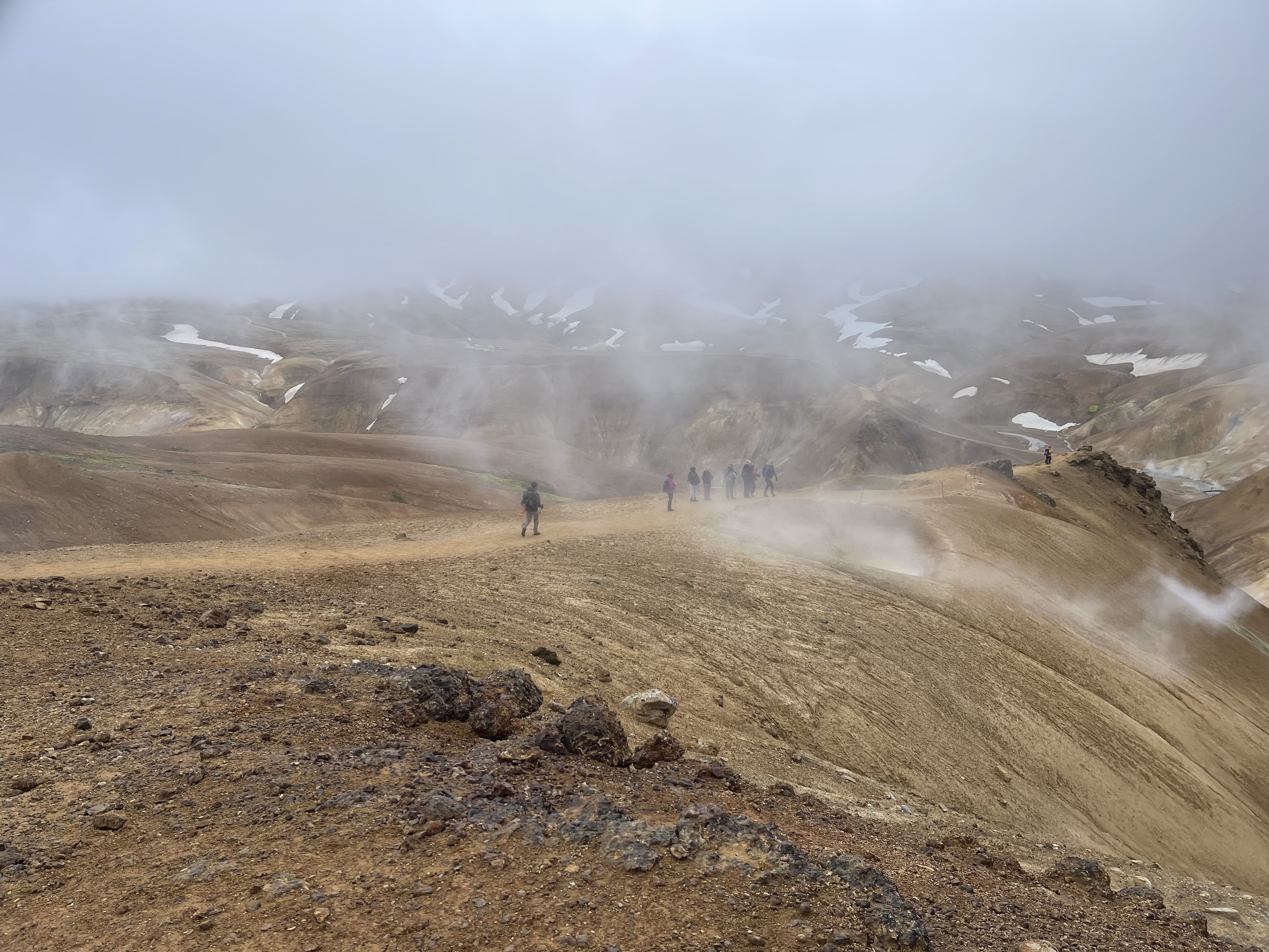
All colors of the rainbow abound. Note also the thick cloud cover that seems to reach down into the valleys. Occasionally when walking through a cloud of hot steam my glasses would fog up and I’d be instantly blind. This happened a number of times.
Here you can see what a 40 miles per hour wind will do with a steam plume.
There were also the occasional snow fields that we needed to cross.
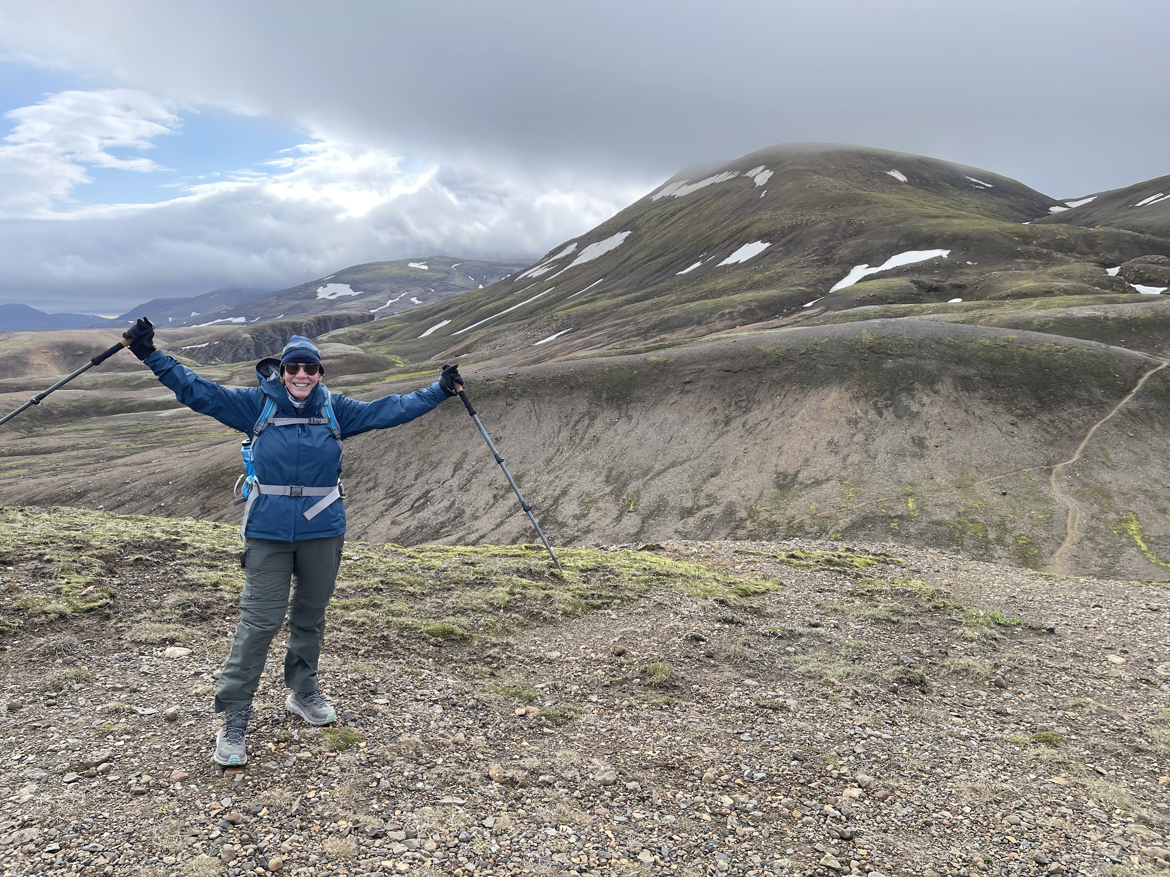
In the end, this was a rewarding hike. There we are, happy campers.
Hike 2
August 1, 2024 – 9.68 miles, 6:30 on the trail.
Our guide improvised this hike. The first section was on a trail up to a crater. He had never been there himself. Some of us hiked around the crater rim. We had fantastic views from the top of the rim. A few of us went around the back way, where we met up again. Then the second half of the hike was across the open tundra. No trail. It was rough on the feet and legs, and we were all exhausted from the hike, the cold and the occasional rain by the time we got to the (very tiny) hut.
This was probably the roughest day for most of the group.
Near the hut where we spent the night was this historic building. We had dinner in it. It used to be a shelter for sheep herders. They’d spend the night in the hut, and brought in sheep to keep themselves warm.
One of the fascinating facts about Iceland is of course its harsh arctic climate. Without civilization, humans are basically helpless. During the endless winters this country is covered by snow and shrouded in darkness. You might notice in my pictures that there are no trees. There is literally nothing to burn. So even a hut like this one cannot be kept warm other than through body heat of humans or animals. How do you cook when there is nothing to burn?
Speaking of sheep – we saw many small groups of sheep, two or three together, never more – no herds – roaming the country.
Along the way, we crossed many ancient lava fields. Much of this hike reminded me of my hikes in Maui, Hawai’i, not too long ago. Except Maui is warm, and this is very cold.
We needed our rain gear on this hike. Everyone got wet.
Here we are inside the crater, with a good view of a small outlet section of the the Langjökull glacier in the distance to the west.
Dramatic lava formations form landmarks visible for dozens of miles.
Hike 3
August 2, 2024 – 8.99 miles, 5:31 on the trail.
This was a more leisurely hike, mostly flat.
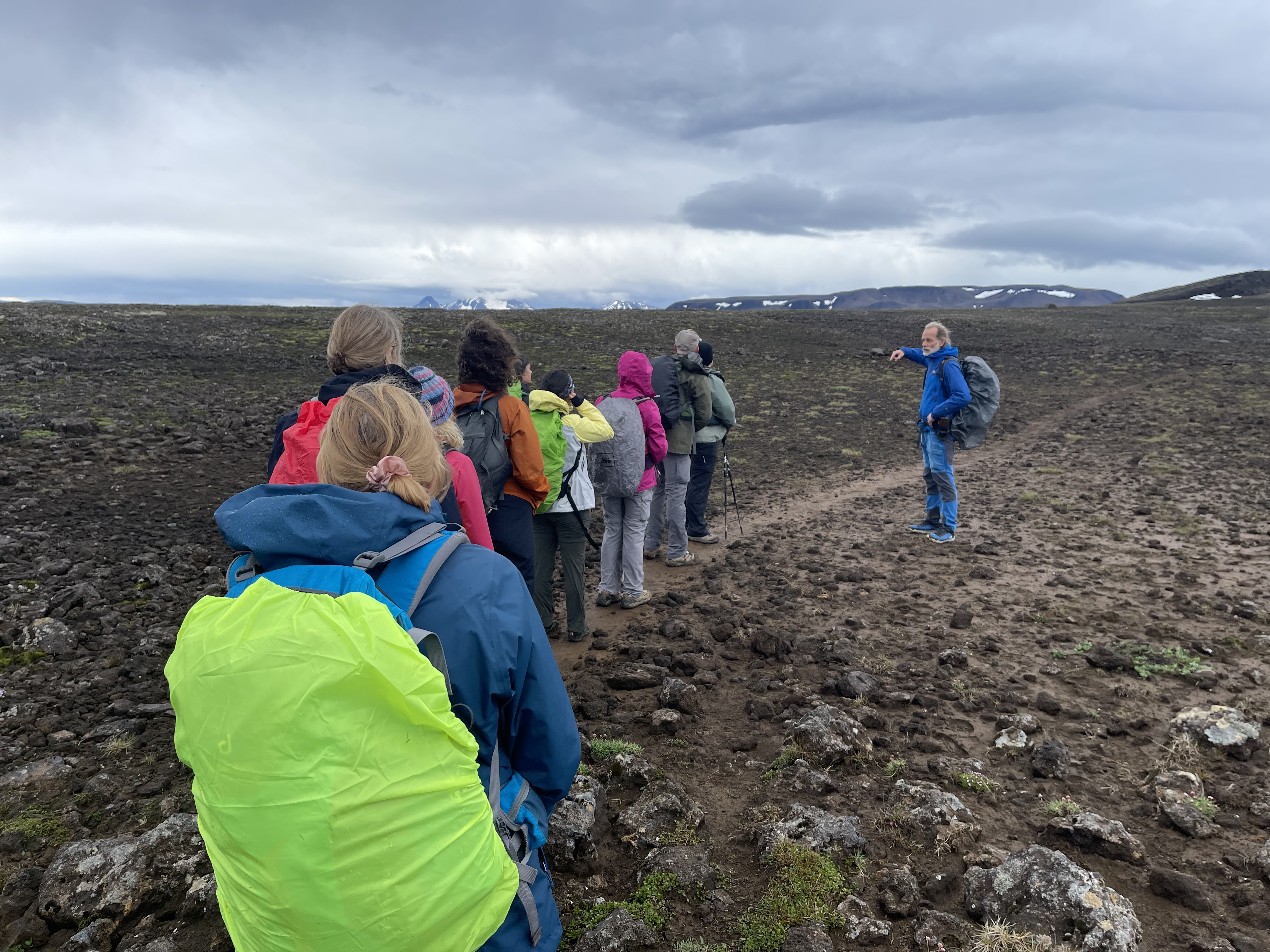
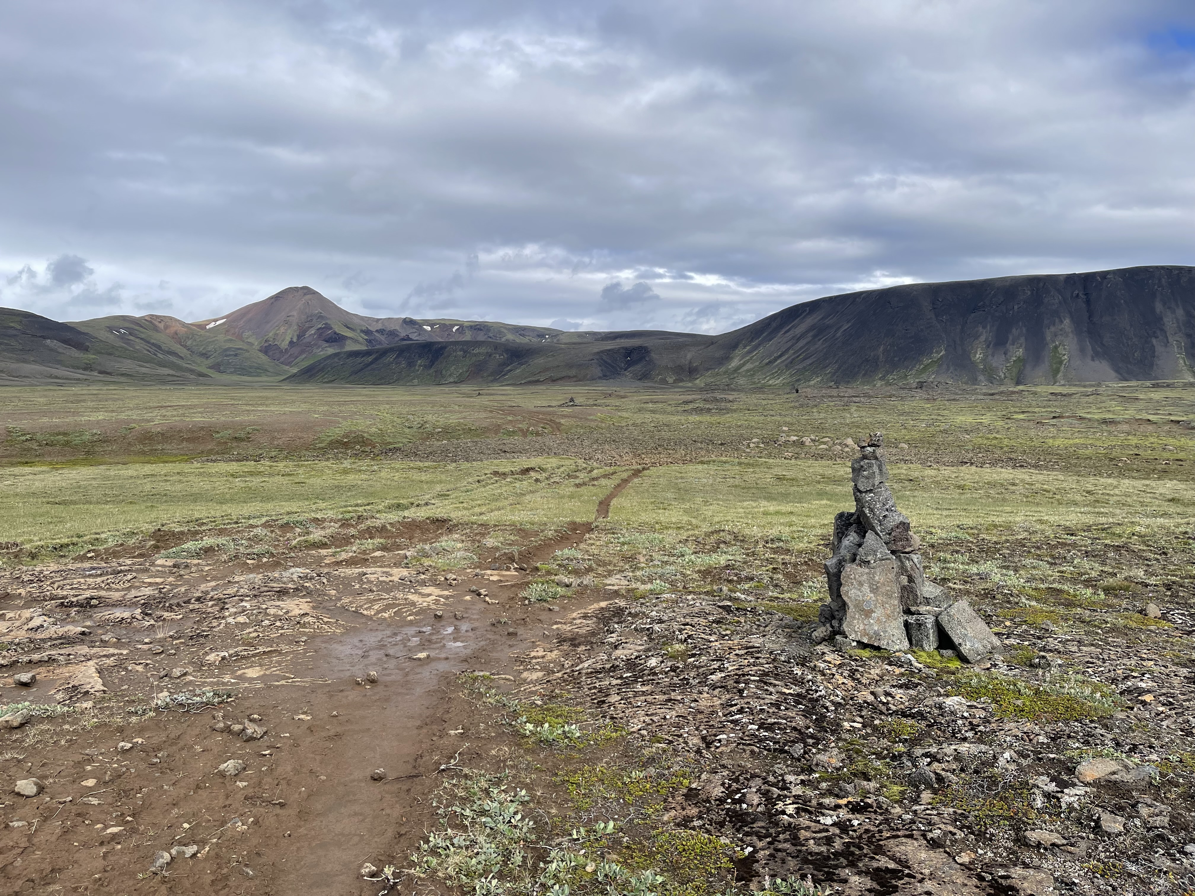
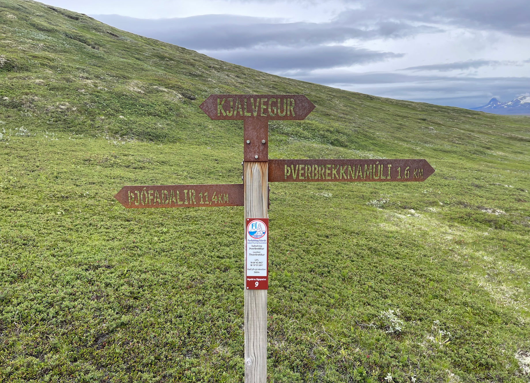
This part of the hike is on the famous Kjalvegur road. This path below is the “road.” No motor vehicle has ever driven on this road. On the right you see a cairn. These are marking the way, since the path sometimes completely disappears either in rock, water, grass or – of course – snow. The cairns are spaced apart just far enough so you can always see the next one, and hopefully the next two, so you have an indication of where to go.
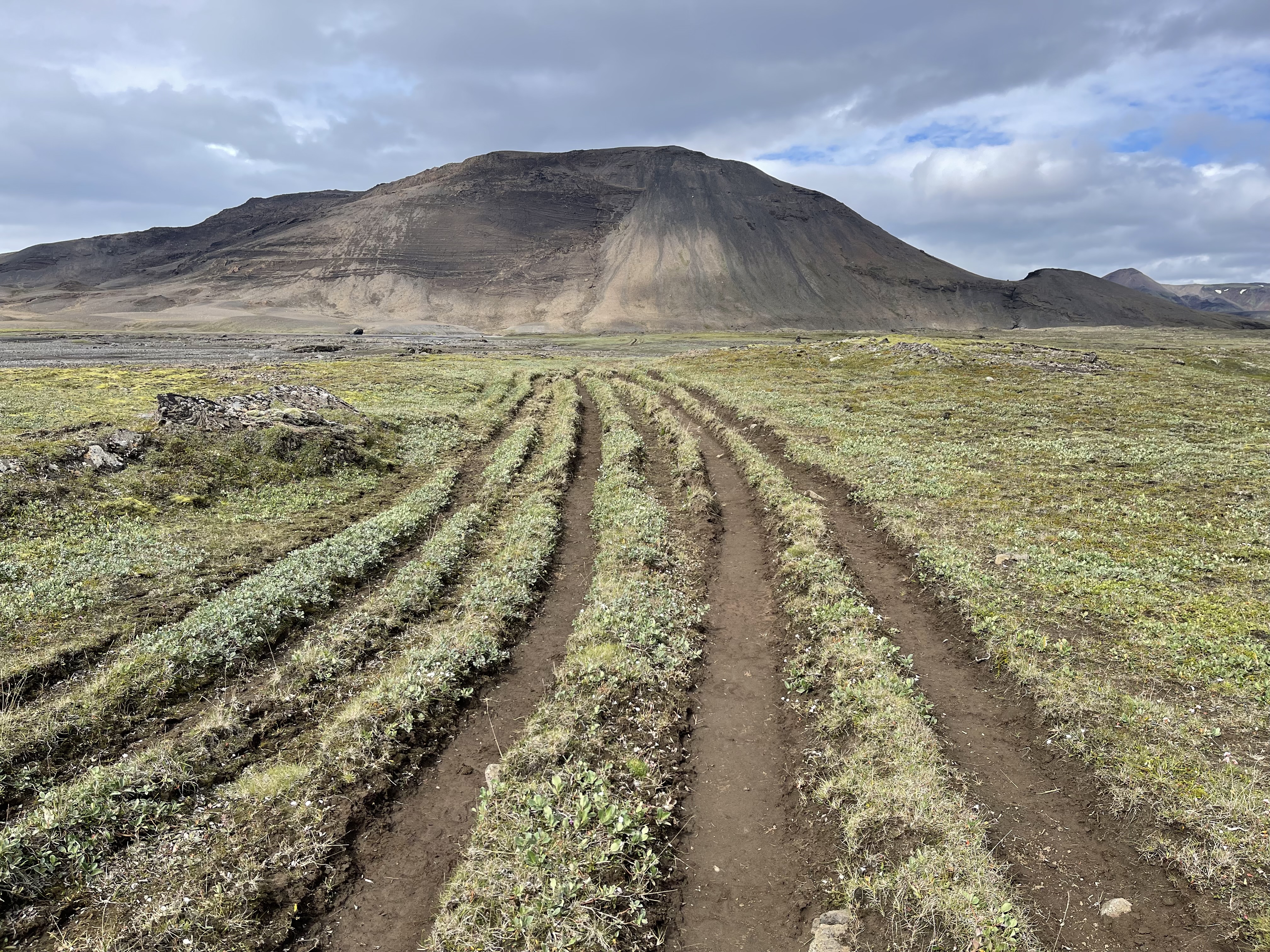
One interesting phenomenon is that the trail often is divided into many “lanes” like on a freeway. These are formed because when one of the grooves gets too deep, everyone goes to the side of it to a higher one. Also, when riding horses on these trails, a rider has to bring three horses, one to ride, and two to switch out. The other two horses usually walk alongside the rider, so three lanes of the trail get used up that way. Over the centuries, freeways like these start forming.
Here are nine of us, each in our own lane.
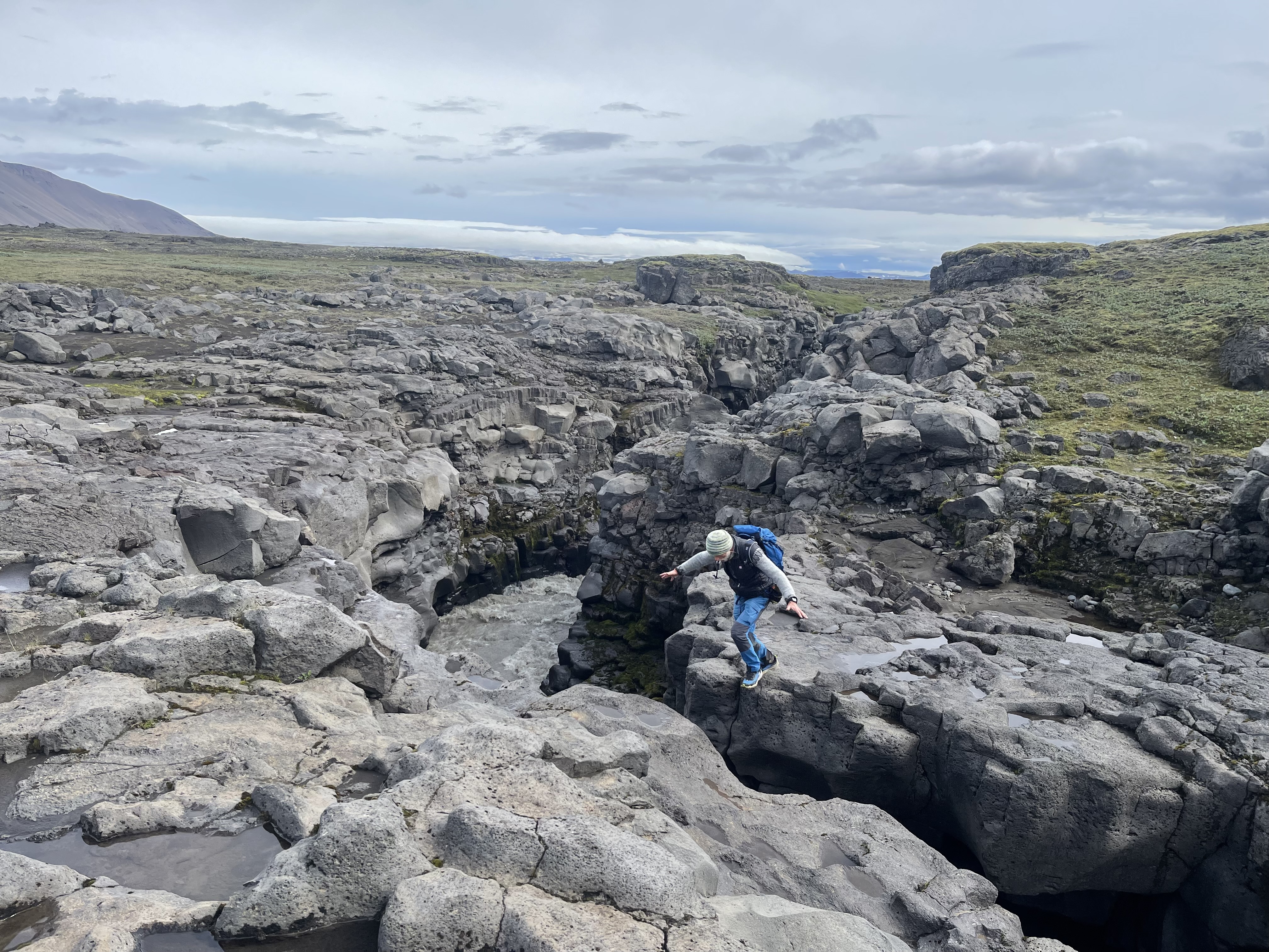
On this leg of the hike, there was a deep gorge from a river of glacier water from the Langjökull glacier. On this spot, it comes close enough together so a person can jump over it, although below there is a raging river. Here I caught our guide mid-jump.
A little further along is a little bridge which we needed to cross. Our guide told us that during the snowmelt season in the spring, the water comes up all the way to the bridge and it has been torn away from the rock before.
Here you can see some of our team crossing.
And a parting shot, where I am standing on the bridge, looking down. It’s hard to imagine that the water comes up to and actually above the bridge.
Finally, the hut at the end of the day.
Hike 4
August 3, 2024 – 10:25 miles, 5:32 on the trail.
This was our longest hike of all, and it was also the warmest day. Eventually most of us hiked in shorts. The only nuisance were the midges. Iceland has two primary types of midges: one resembling a mosquito but not biting, and another smaller, fly-like creature that does bite. They do not carry diseases, like mosquitoes. They buzz around your face, and eyes, and get ingested when breathing. They are not around when it’s windy, and it was mostly windy all week, so they were not a major problem.
We had to cross over a few mountains. Here is our team huddling.
We found a peaceful spring. This entire creek in the video below just came out of the ground as a spring not further than 300 yards from this spot. The water is clean. You can drink water from a spring in Iceland without needing a filter. We drank right out of the creeks during our Iceland hikes, the freshwater creeks that is, not the glacier creeks.
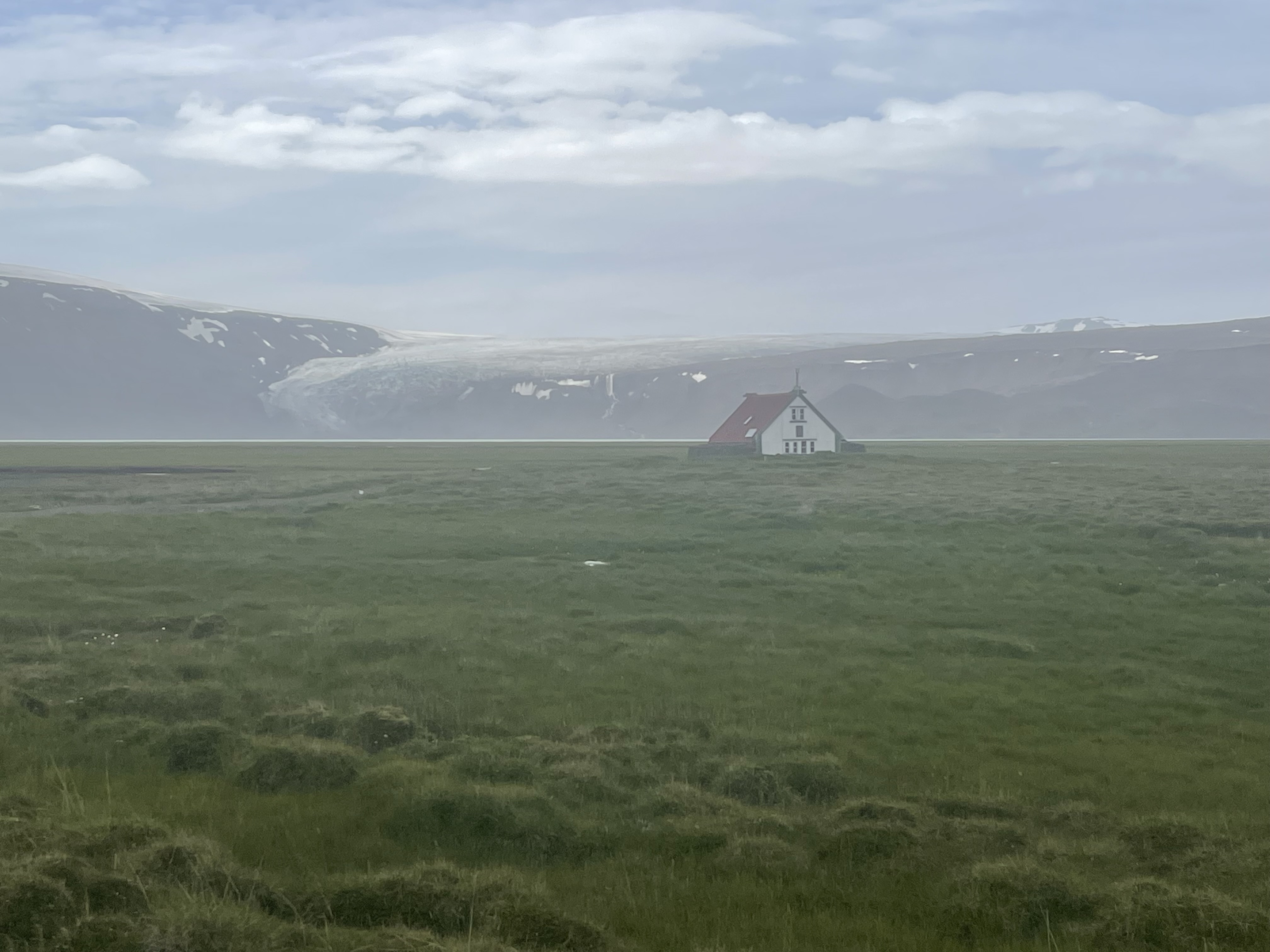
Here is the last hut, the haunted one, after a long hike. In the back, you can see the Longjökull glacier draining all the way into the lake below. You can see the lake in the left lower corner of the map above. He hut is at the red bubble.
While we were there, the sun set around 10:30pm. Here is a picture from our hotel in Reykjavik taken at 10:15pm:
The sun is setting on the other side of the hotel behind us. We only see the reflection of the sunset in the window on the buildings across the parking lot. Notice also the rainbow to the right of the building. Somewhere behind us it’s raining. While the sun goes down, it really just dips below the horizon and it never really gets fully dark, even in early August. The latitude is approximately that of Fairbanks, Alaska.
The summer season is very short in Iceland. Snow is still on the ground in the highlands in June. Sometimes it snows already again at the end of August, but definitely in September. While we were there, from end of July through beginning of August, it was as cold as the high 30ies in the mornings and it sometimes warmed up to the low 60ies. We saw the sun a few times, but it was mostly cloudy and sometimes very windy, with gusts up to 40 miles an hour.
That is enough wind to blow your hiking poles sideways when you lift them up, and a time or two it almost blew me over. The wind was most prevalent on exposed trails and ridges, of course.
In the video below you can see the wind whipping Trisha’s pants as she hikes along the ridge with the steam clouds drifting by.
Here is another one:
Here you can see the fierceness of the wind as it blows the steam plume over the trail. You might turn on the sound on your computer to hear it. The person in the picture is our guide Jonas.
A long time ago I read the biography about John Adams by David McCullough. When Adams left Boston in the deep freeze of February of 1775 on horse to get to the Congress in Philadelphia, it was a multi-month journey. Along the way, he and his fellow travelers had to stay at inns. In those days, you didn’t get hotel rooms to yourself like we do today. If there were beds, sometimes you had to share them with some other fellow traveler, and you may have had no idea who it was you slept next to.
So it is in the highland huts of Iceland. You can make reservations until all the bunks are full. Just because we were a travel group, there was no guarantee that we’d have the hut to ourselves. In Hut 2 there were some teenagers who bunked in the loft upstairs. Hut 4 was called þverbrekknamúli.
Good luck pronouncing that name – I learned how to do it, but I can’t describe it here.
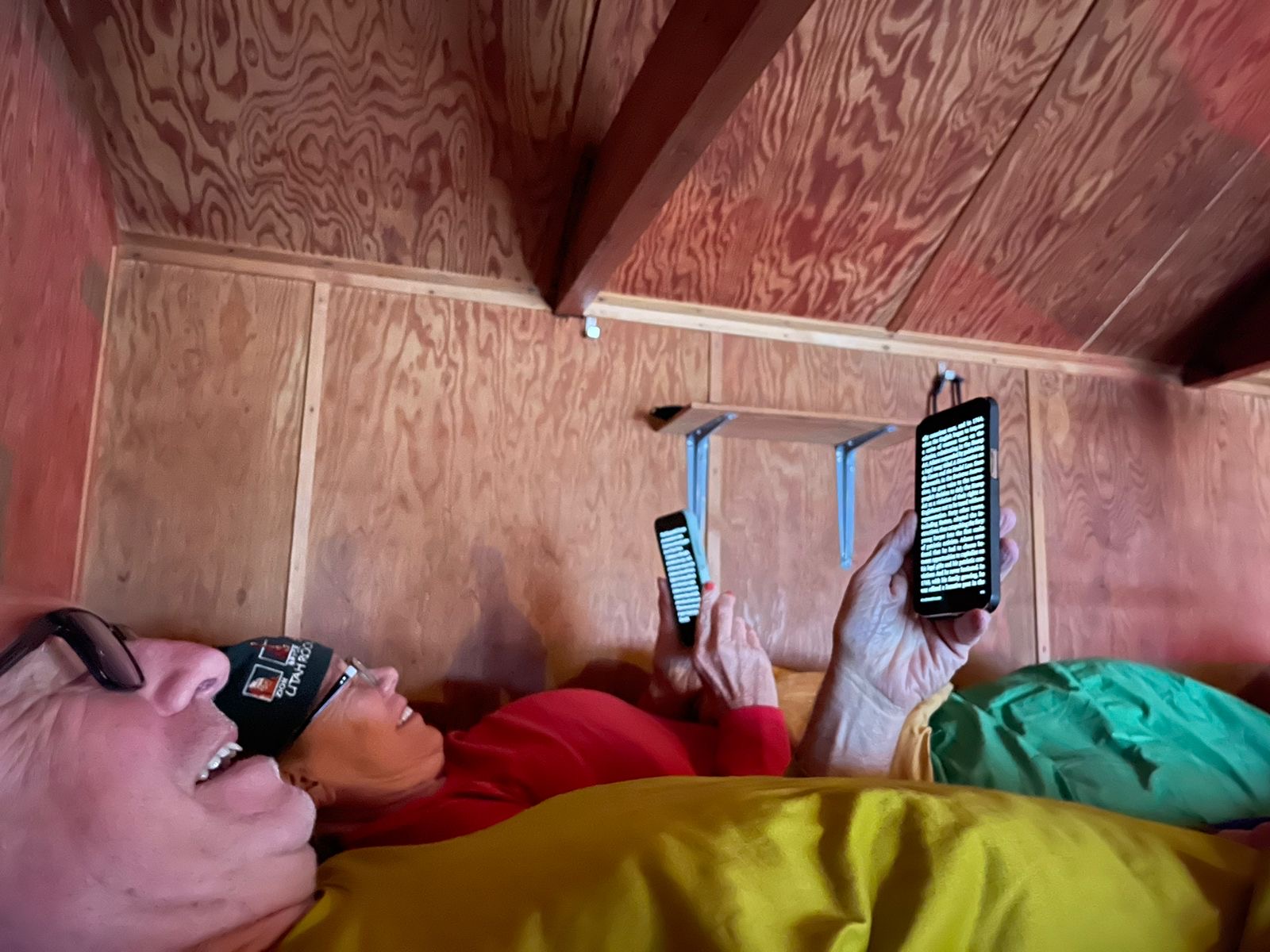
At þverbrekknamúli, as we were all getting ready to sleep, my wife and I had doubled up in one bunk. There were not enough bunks in the hut for everyone to have their own. Here we are, reading before going to sleep. Note how little head-room there is.
At about 10:00pm, there was some rumbling outside. Our guide Jonas was just getting ready to crawl into his sleeping bag when the commotion started. He got up, went outside and found out there were two men with backpacks who were also planning to stay the night – and worse – make dinner first. Since Jonas didn’t want all of us to be kept awake by cooking activities, and since we had leftover food from our meal, he offered it to the travelers. He joined them at the table and the three of them were whisper-chattering away in Icelandic until about 11. Jonas, who had the bunk next to us, gave up his for the two travelers, and pushed over our driver and double-bunked with him. I was still awake when the two newcomers climbed up into their sleeping bags next to our feet. And thus we had strange bedfellows whose heads spent the night not 8 inches away from my feet in my sleeping bag.
Morning came and we went about our routine. The visitors were friendly enough as we prepared breakfast and got ready for our departure. One of them actually took some group pictures for us, including the group shot, with Jonas in it:
We said our good-byes and went our way. Later, during a break in our hike, Jonas told us that one of the visitors was Guðmundur Ingi Guðbrandsson, the Icelandic Cabinet Minister of Social Affairs and the Labour Market and head of the Left-Green Party. Before that, he was Minister for the Environment and Natural Resources. Jonas didn’t want to reveal his identity while we were there out of respect for his privacy.
It was good that he did, since I would have loved to have a chat with him and learn about environmental policy in Iceland.
As it goes, we were just strange bedfellows.
On language:
The character ð is pronounced like a very soft “th” in English, with a lot of air flowing through your teeth, like in the word teeth.
The character þ is pronounced like a very hard “th” in English, like in the Viking name Thor.
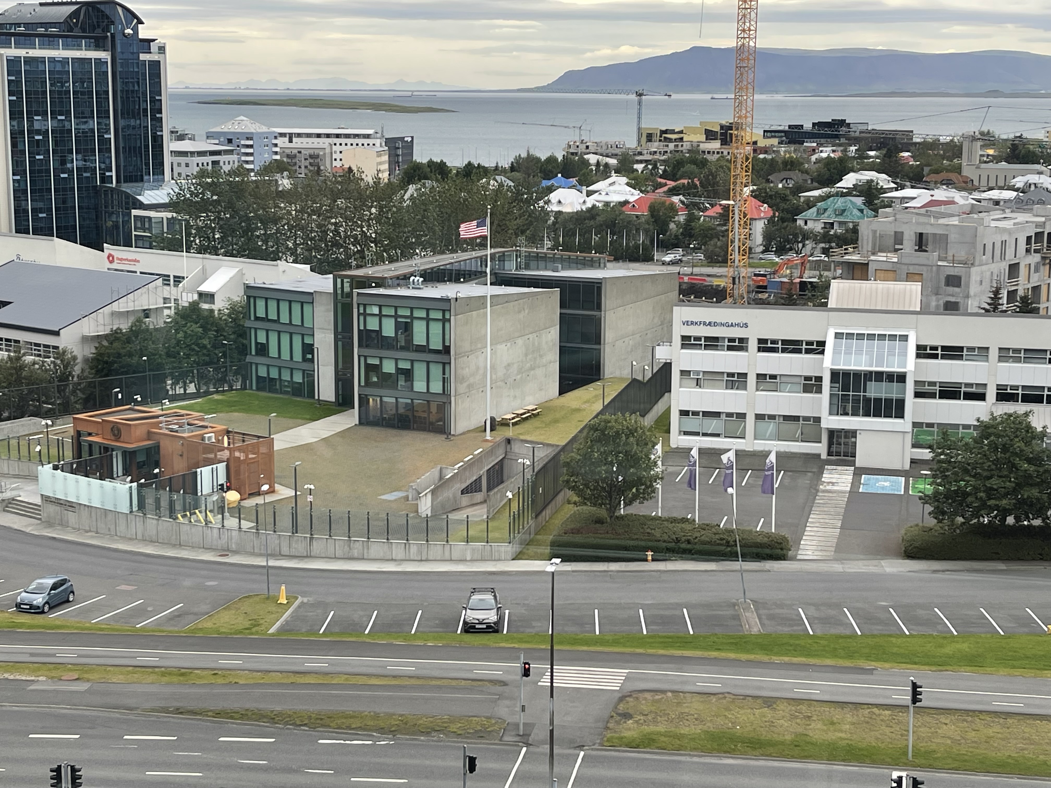
After an all-day summit meeting at the U.S. Chamber of Commerce, I walked across the street and through Lafayette Park on my way to an Uber. This was my view: