Here are maps, statistics and some pictures of the four main hikes we did in Iceland:
Hike 1
July 31, 2024 – 8:00 miles, 6:35 on the trail, including all rests and stops.
This hike was the most strenuous. We climbed up into the mountains and did a circle of vast hot springs area, known as the Hveradalir Geothermal Area. The wind was fierce and we needed all our layers to wear. It was basically in and out on the same trail.
Here is Trisha on the trail after coming up a steep ridge. 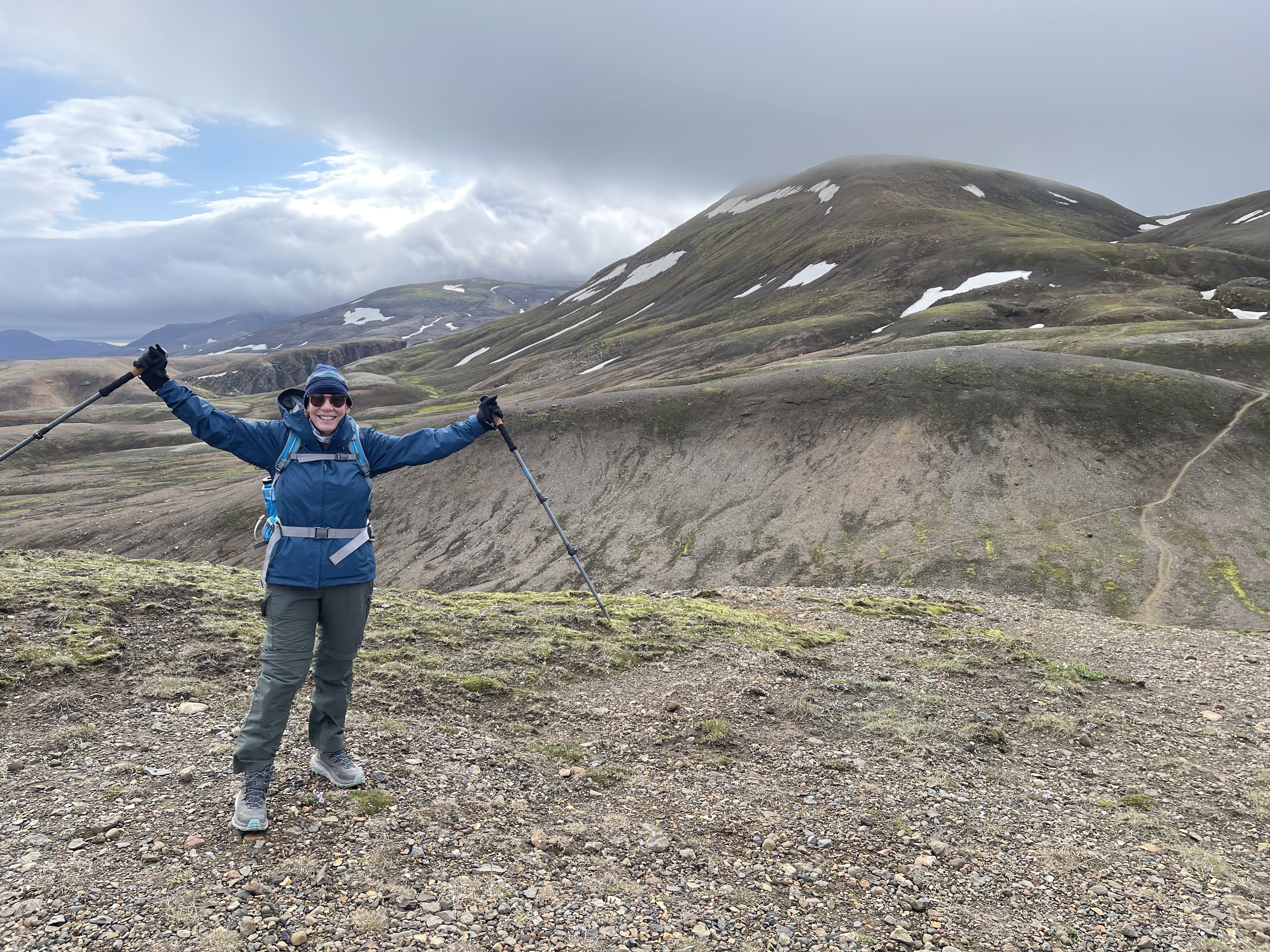
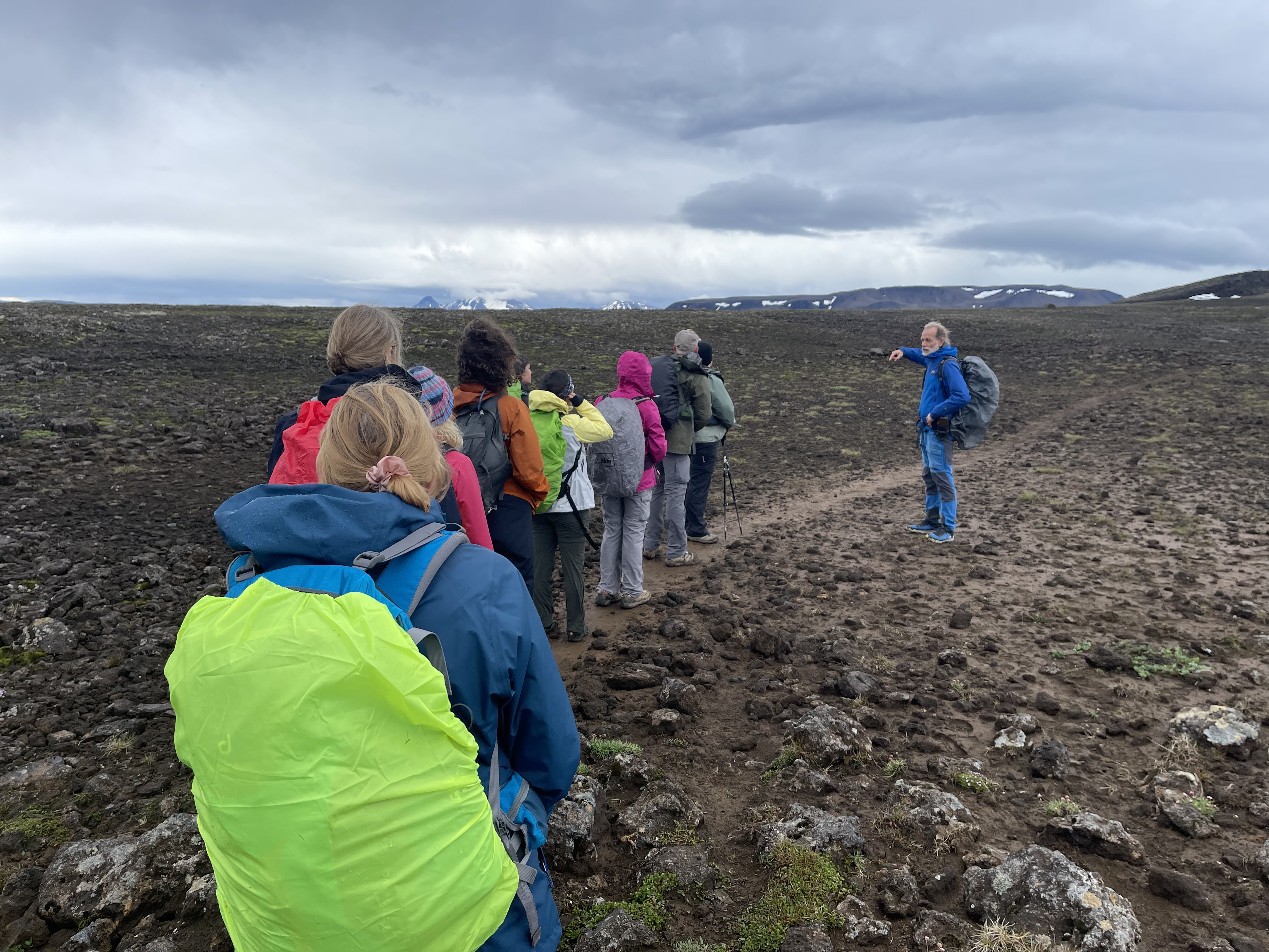
And here is our whole group, getting oriented by our guide Jonas on the right side. In the background just over Jonas’ head you can see a part of the Hofsjökull glacier, which is located in the center of the country.
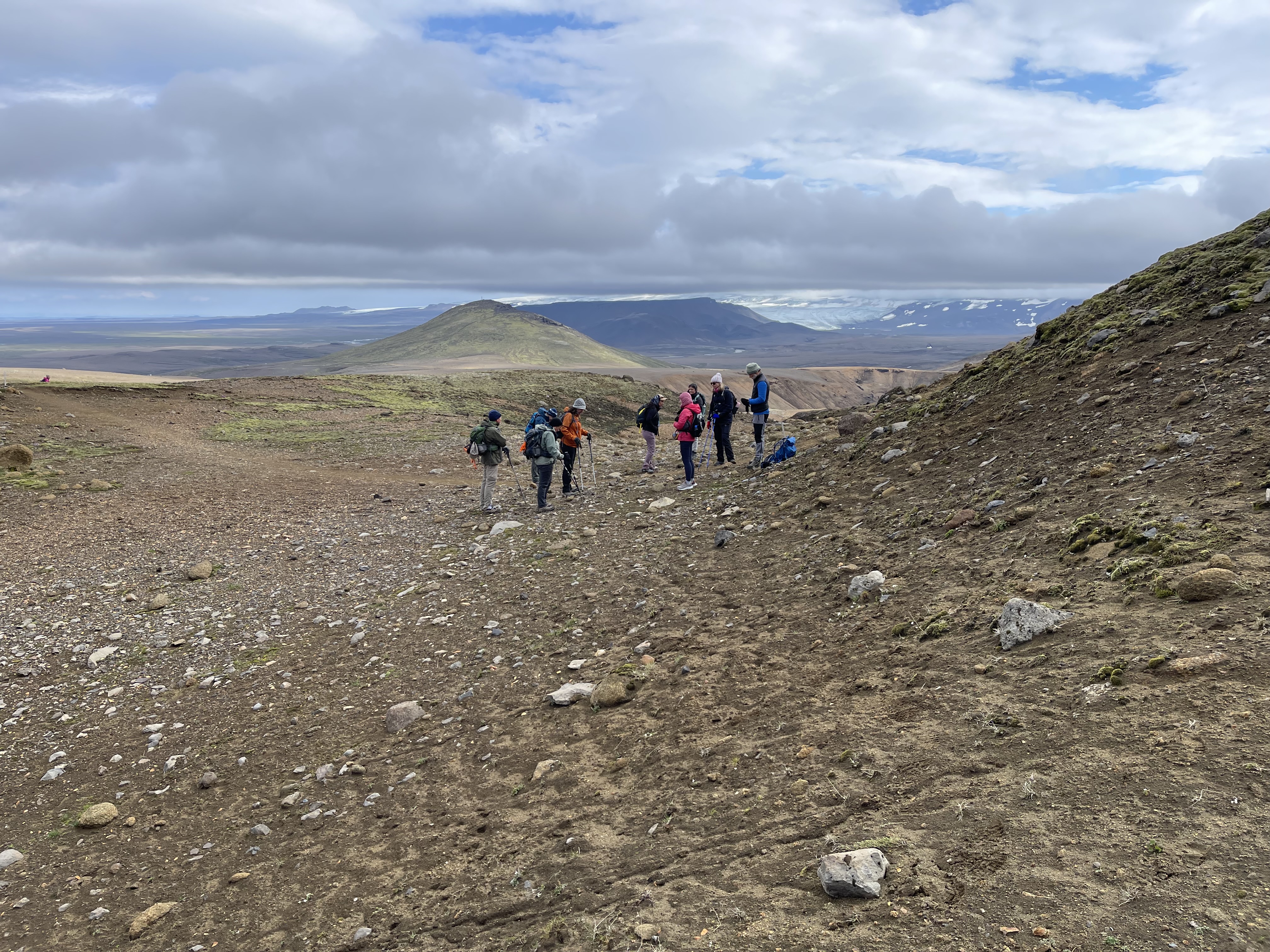
Here is a better view of the Hofsjökull glacier:

Some of the terrain was quite steep, and there were rudimentary stairs installed. That’s me in the very back getting ready to come down.

The landscape at Hveradalir is in front of us, deep valleys with many colors, greens, red, yellow and lots of browns, ocres and whites. Plumes of steam and occasionally sulfur wafts around everywhere. You have to be careful where you step. There could be a very thin crust over boiling water.

Our team makes it way along the ridges.
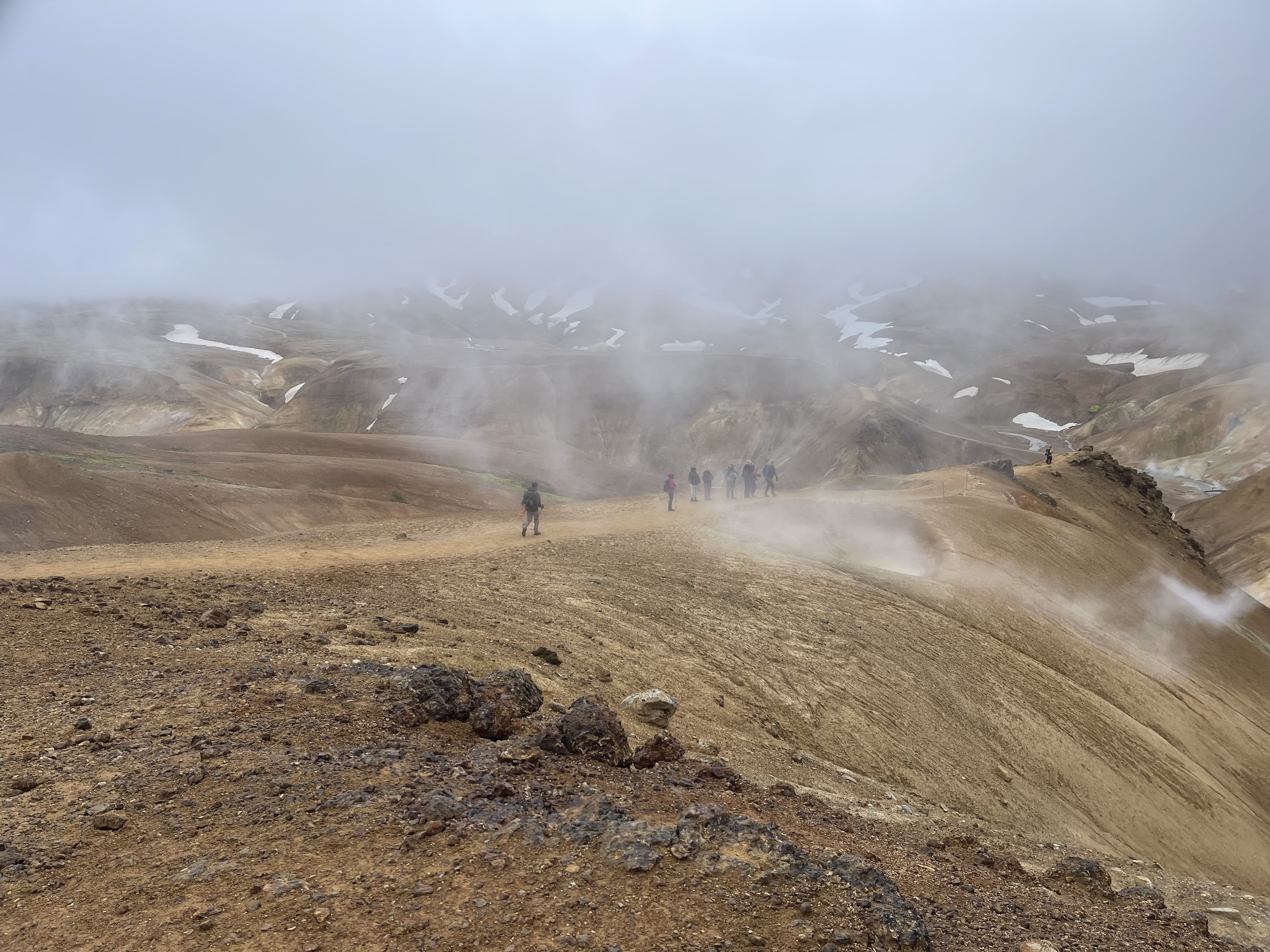
All colors of the rainbow abound. Note also the thick cloud cover that seems to reach down into the valleys. Occasionally when walking through a cloud of hot steam my glasses would fog up and I’d be instantly blind. This happened a number of times.

Here you can see what a 40 miles per hour wind will do with a steam plume.
There were also the occasional snow fields that we needed to cross.
In the end, this was a rewarding hike. There we are, happy campers.

Hike 2
August 1, 2024 – 9.68 miles, 6:30 on the trail.
Our guide improvised this hike. The first section was on a trail up to a crater. He had never been there himself. Some of us hiked around the crater rim. We had fantastic views from the top of the rim. A few of us went around the back way, where we met up again. Then the second half of the hike was across the open tundra. No trail. It was rough on the feet and legs, and we were all exhausted from the hike, the cold and the occasional rain by the time we got to the (very tiny) hut.
This was probably the roughest day for most of the group.
Near the hut where we spent the night was this historic building. We had dinner in it. It used to be a shelter for sheep herders. They’d spend the night in the hut, and brought in sheep to keep themselves warm.

One of the fascinating facts about Iceland is of course its harsh arctic climate. Without civilization, humans are basically helpless. During the endless winters this country is covered by snow and shrouded in darkness. You might notice in my pictures that there are no trees. There is literally nothing to burn. So even a hut like this one cannot be kept warm other than through body heat of humans or animals. How do you cook when there is nothing to burn?
Speaking of sheep – we saw many small groups of sheep, two or three together, never more – no herds – roaming the country.

Along the way, we crossed many ancient lava fields. Much of this hike reminded me of my hikes in Maui, Hawai’i, not too long ago. Except Maui is warm, and this is very cold.

We needed our rain gear on this hike. Everyone got wet.
Here we are inside the crater, with a good view of a small outlet section of the the Langjökull glacier in the distance to the west.

Dramatic lava formations form landmarks visible for dozens of miles.

Hike 3
August 2, 2024 – 8.99 miles, 5:31 on the trail.
This was a more leisurely hike, mostly flat.
This part of the hike is on the famous Kjalvegur road. This path below is the “road.” No motor vehicle has ever driven on this road. On the right you see a cairn. These are marking the way, since the path sometimes completely disappears either in rock, water, grass or – of course – snow. The cairns are spaced apart just far enough so you can always see the next one, and hopefully the next two, so you have an indication of where to go.
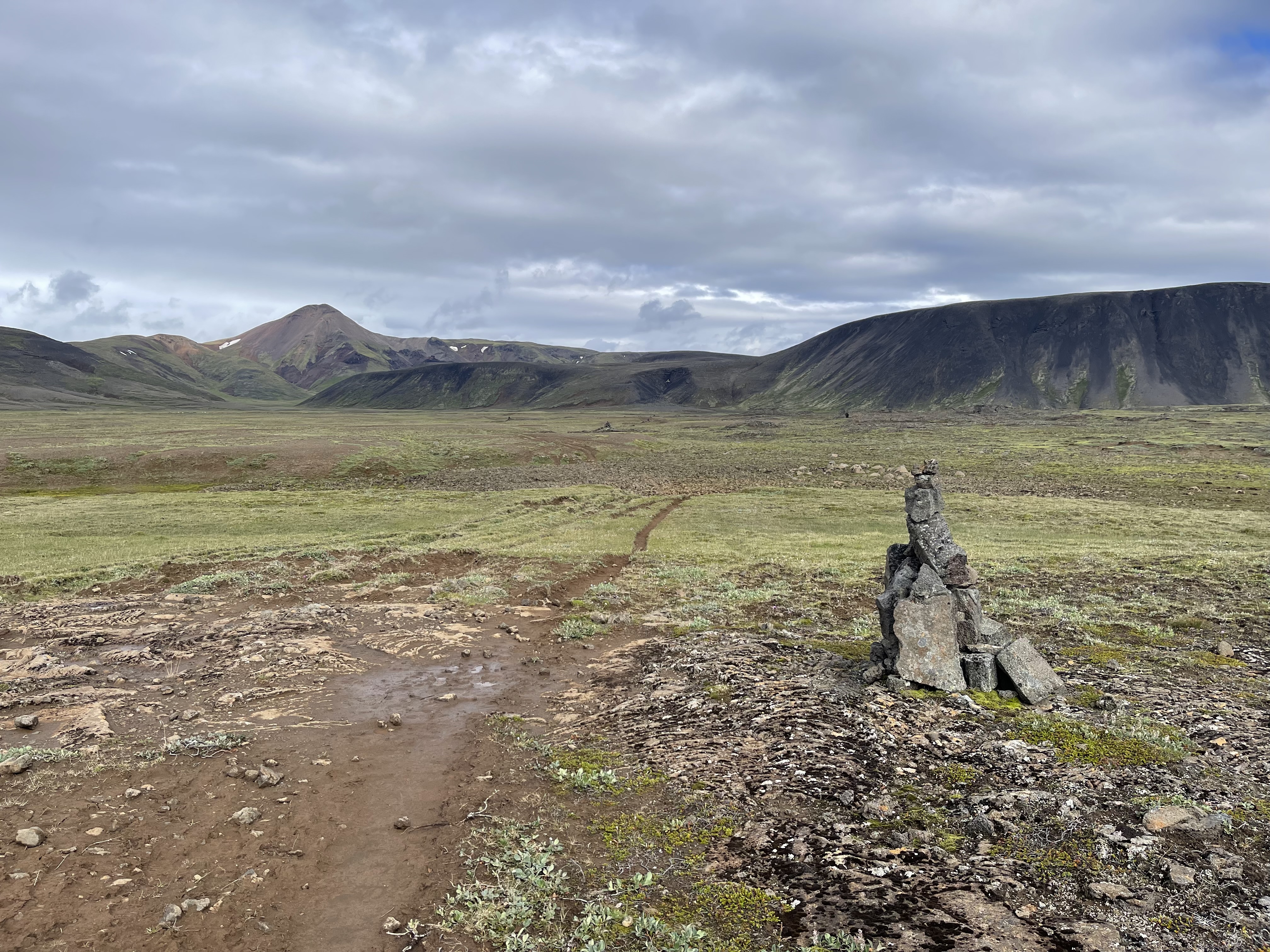
One interesting phenomenon is that the trail often is divided into many “lanes” like on a freeway. These are formed because when one of the grooves gets too deep, everyone goes to the side of it to a higher one. Also, when riding horses on these trails, a rider has to bring three horses, one to ride, and two to switch out. The other two horses usually walk alongside the rider, so three lanes of the trail get used up that way. Over the centuries, freeways like these start forming.
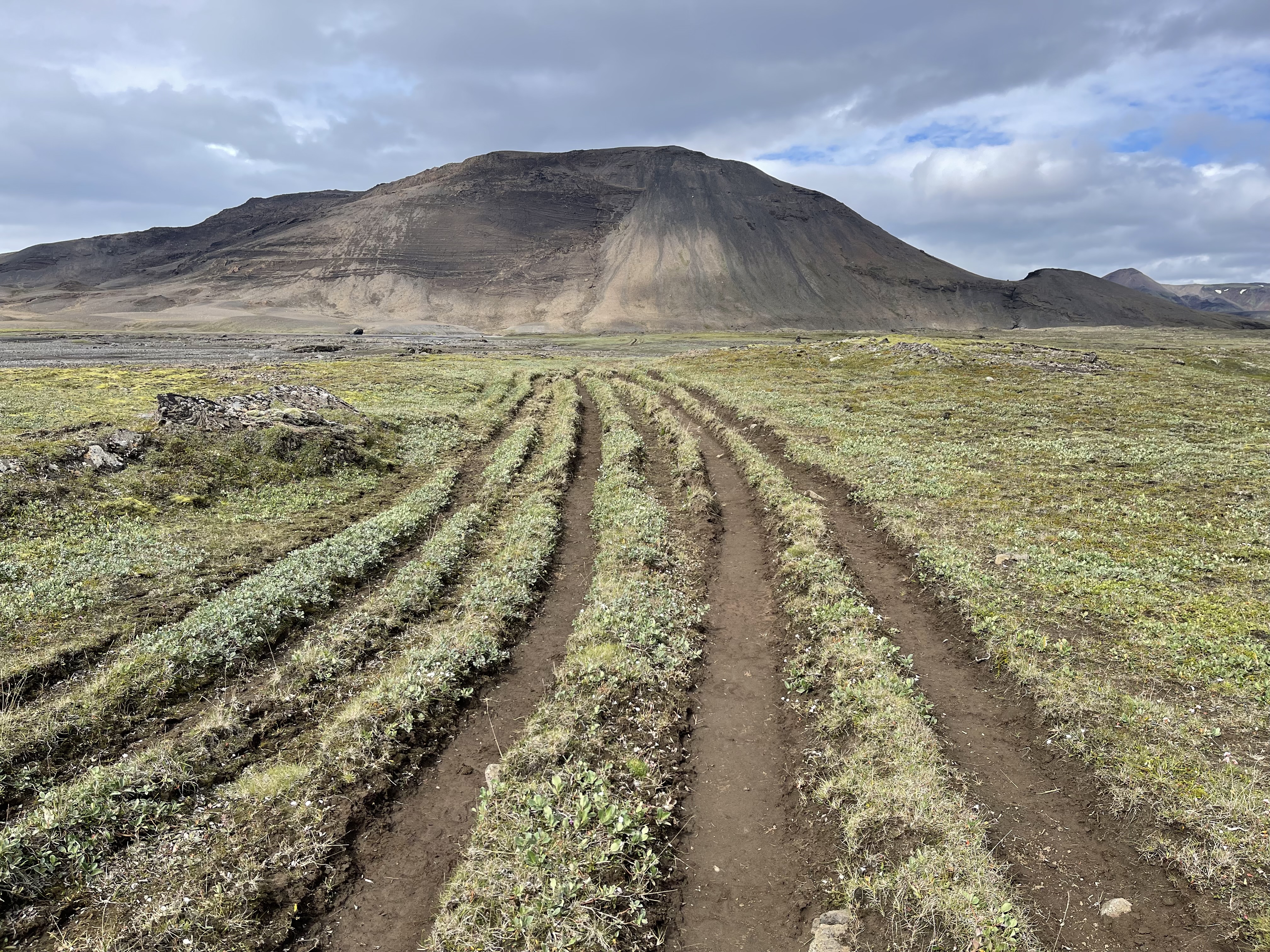
Here are nine of us, each in our own lane.

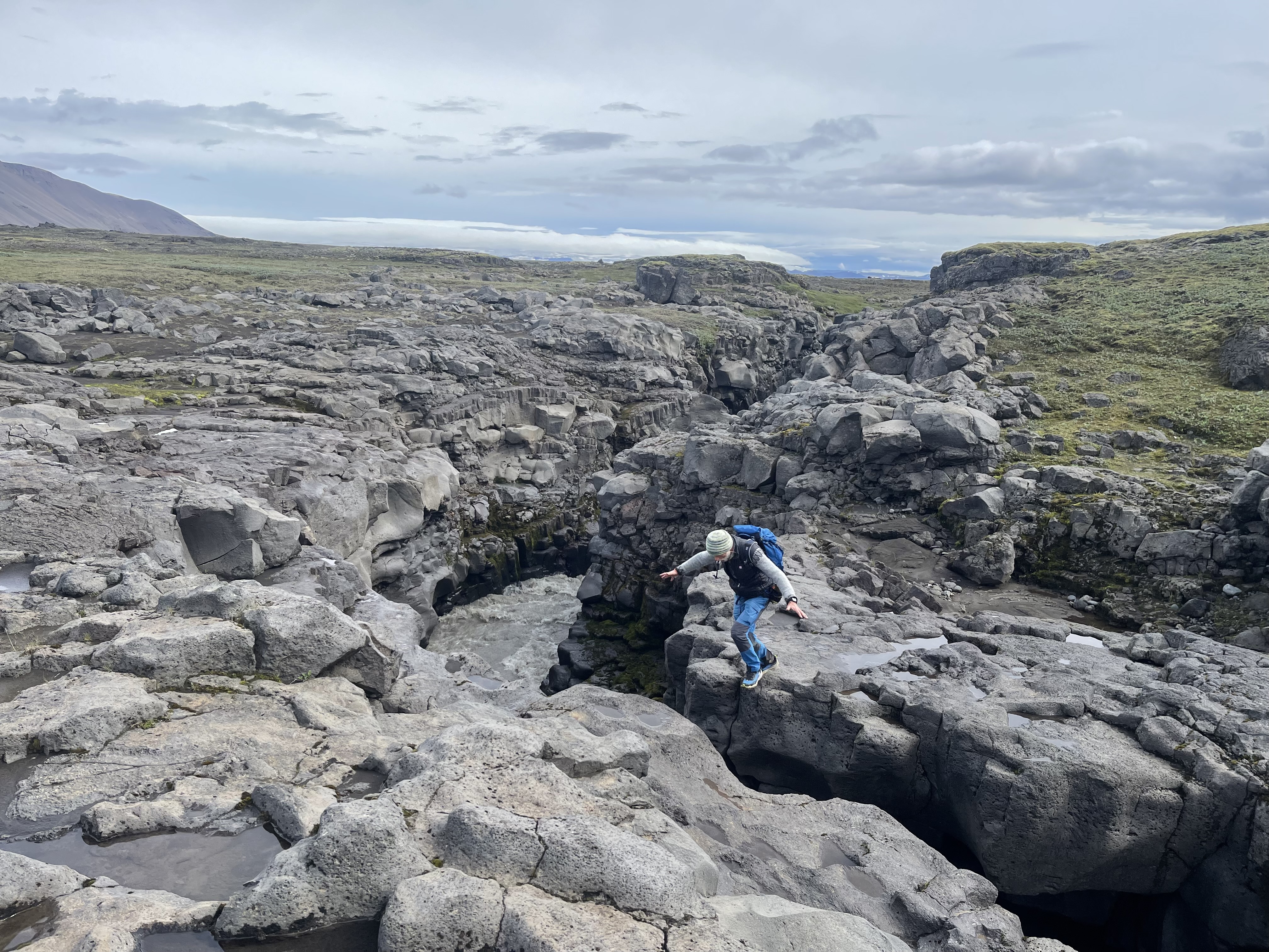
On this leg of the hike, there was a deep gorge from a river of glacier water from the Langjökull glacier. On this spot, it comes close enough together so a person can jump over it, although below there is a raging river. Here I caught our guide mid-jump.
A little further along is a little bridge which we needed to cross. Our guide told us that during the snowmelt season in the spring, the water comes up all the way to the bridge and it has been torn away from the rock before.

Here you can see some of our team crossing.
And a parting shot, where I am standing on the bridge, looking down. It’s hard to imagine that the water comes up to and actually above the bridge.
Finally, the hut at the end of the day.
Hike 4
August 3, 2024 – 10:25 miles, 5:32 on the trail.
This was our longest hike of all, and it was also the warmest day. Eventually most of us hiked in shorts. The only nuisance were the midges. Iceland has two primary types of midges: one resembling a mosquito but not biting, and another smaller, fly-like creature that does bite. They do not carry diseases, like mosquitoes. They buzz around your face, and eyes, and get ingested when breathing. They are not around when it’s windy, and it was mostly windy all week, so they were not a major problem.
We had to cross over a few mountains. Here is our team huddling.

We found a peaceful spring. This entire creek in the video below just came out of the ground as a spring not further than 300 yards from this spot. The water is clean. You can drink water from a spring in Iceland without needing a filter. We drank right out of the creeks during our Iceland hikes, the freshwater creeks that is, not the glacier creeks.
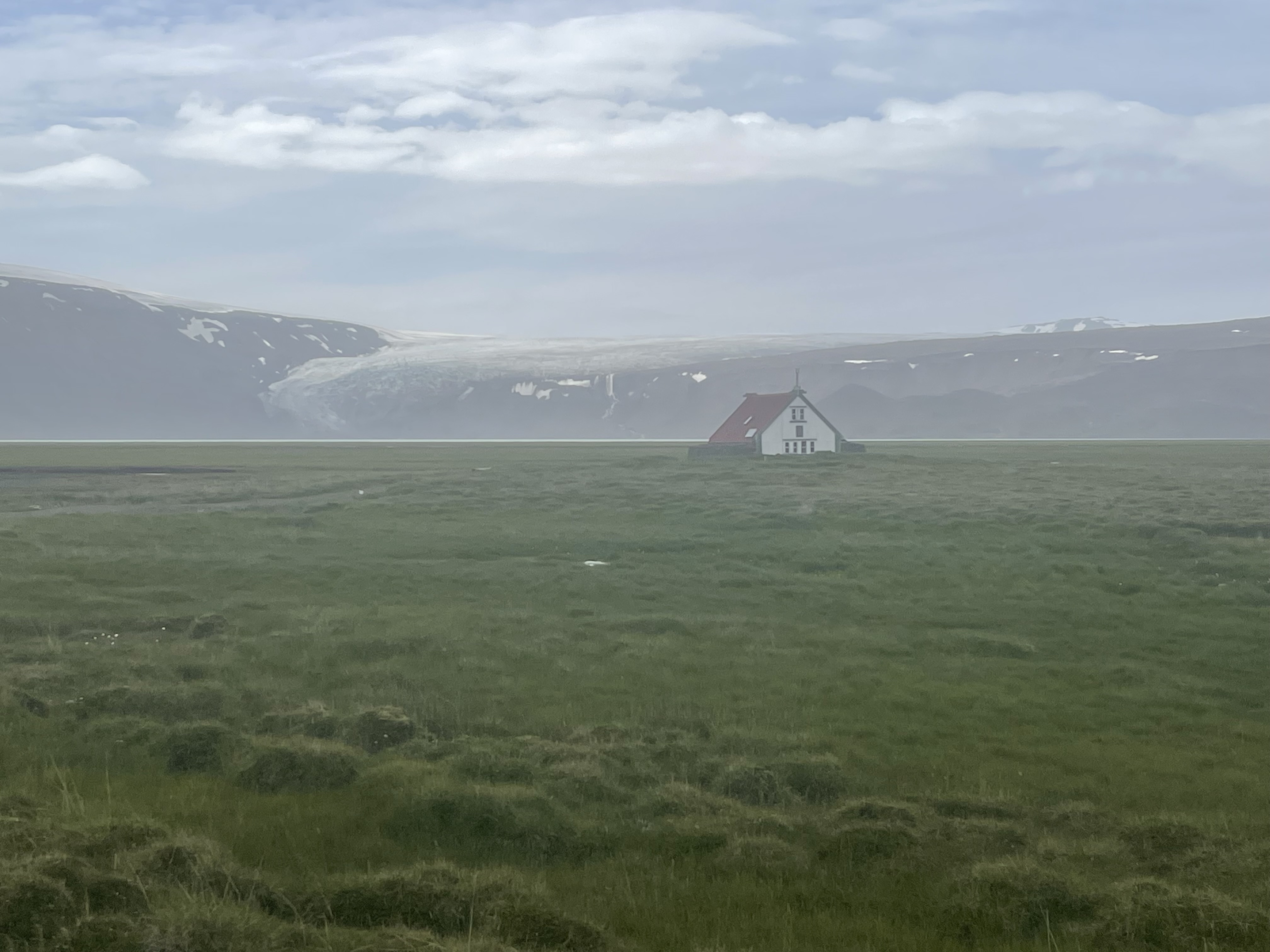
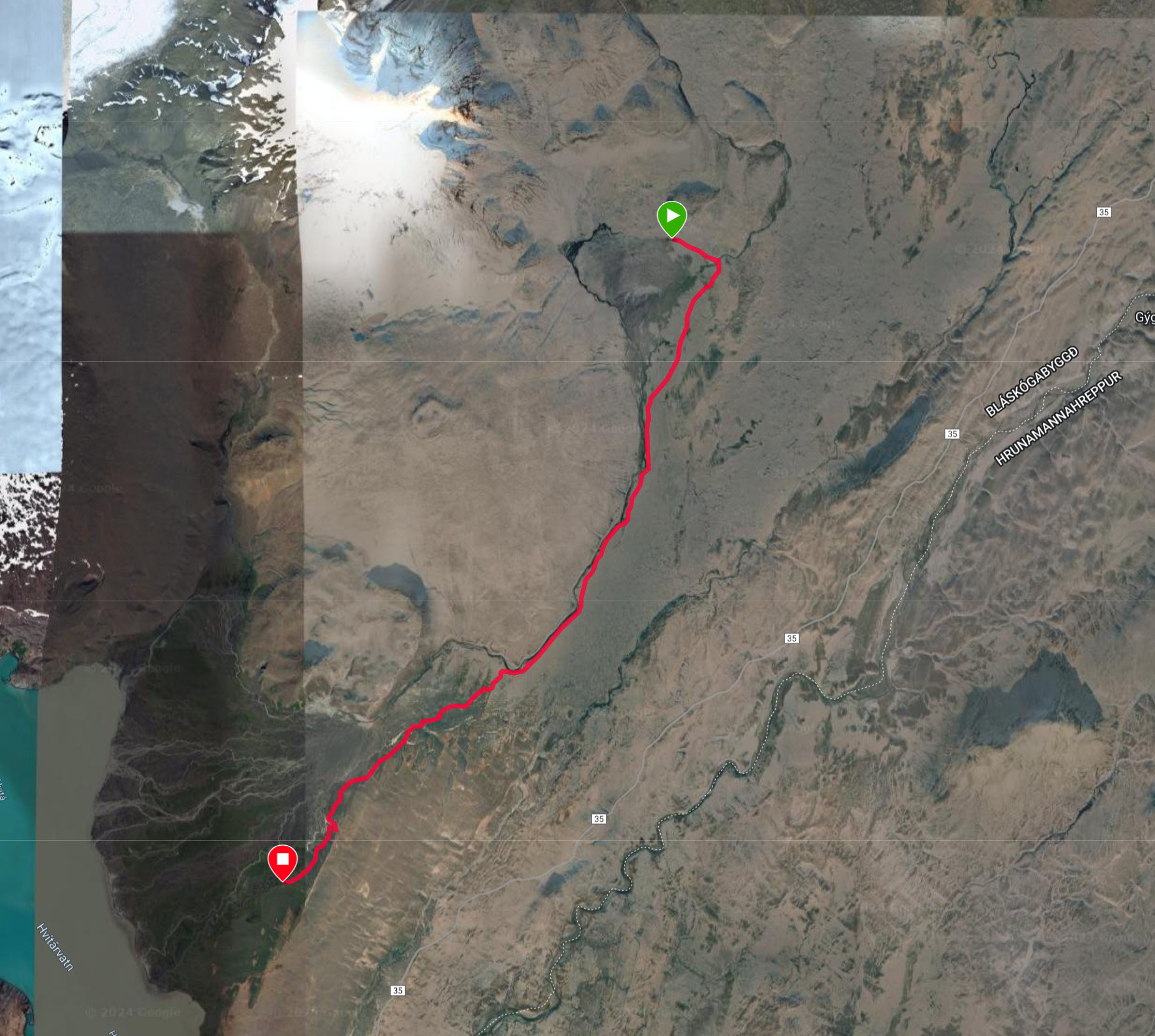
Here is the last hut, the haunted one, after a long hike. In the back, you can see the Longjökull glacier draining all the way into the lake below. You can see the lake in the left lower corner of the map above. He hut is at the red bubble.