Bighorn Sheep in Borrego Springs

I did another annual solo hike up my favorite ridge in Borrego Springs. There is no trail, no other people, just rough terrain high up on the mountain. When I hike there alone I have to be hyper alert since I can’t misstep so I don’t twist an ankle, or worse. Most of the time I am huffing and puffing, looking down for every placement of my boots.

Imagine then when I look up to catch a breath and find myself almost in the middle of a small herd of bighorn sheep. I am literally 30 feet away from them, just standing there, transfixed. And so are they.

If you click on the images you can zoom in. Some of them wear collars with trackers. Others have tags on their ears. The park service monitors and studies them closely, I guess.

As long as I am still and quiet, they just mind their own business.

I took an alternate route around them, so I would not disturb their grazing. They kept an eye on me nonetheless.

Here are a couple of videos I took, just so you can see them in their natural habitat.

Running into a herd of bighorn sheep during a hike always makes my day. It’s an awe-inspiring experience to be surrounded by these creatures who are superbly adapted to the rough environment of the desert mountains.

Hiking El Cajon Mountain – Take Two

The hike up El Cajon Mountain is a 5.65 mile trail, making for an 11.3 mile round trip. It took me 7 hours and 13 minutes.

I first hiked this trail Christmas 2012 with my son. Here is my report from then. I stand by every word, so I won’t be repeating some of the pictures and my lamenting. But I can’t help it. I just recently hiked the Haleakala Crater, and then down hiked Pikes Peak. Both were strenuous hikes in their own right, both were of similar length, both were at much higher altitudes, but in terms of exhaustion, El Caj0n takes the cake.

Two reasons:

I talked about the first reason when I hiked it 13 years ago that it’s uphill, both ways. How can that be? Let’s look at the elevation profile over time:

As you can see in the graph above, after you go up, have have do descend quite a bit, before you get to climb again. The trail is very step everywhere, so going downhill is hard on the knees, and it’s dangerous because it’s easy to slip, fall or trip. And then you get to climb again. This is bad on the way out, but twice as bad on the way back, when you just want to get to the car, and there are all these terrible hills to climb.

The second reason is because it was hot. The trail is exposed to the sun all day, and it was one of those high 80ies in November days with a blue sky.

In the photograph below taken at the beginning of the trip, you can see the peak in the distance. That’s where I am going, 5.6 miles uphill, both ways.

Here is a closeup, about 20 minutes before I reached the top. You click on the image and zoom in and you can make out the faint trail with some people on it. The white arrow points to a person, if you look very carefully. The rocks on the top are huge boulders. That’s the peak.

Finally, after 3.5 hours, I am there. In the background you can see the mountains of East County, San Diego.

Looking southwest from the peak is San Diego. You can’t make it out in this picture. It’s too far away in the haze, but the bright line in the distance is the Pacific Ocean.

I said earlier that it was hot. Uncharacteristically, I didn’t bring enough water for this hike. I had only packed two liters. I needed more. Lucky for me, the park service, or some trail angels, left caches of water. I refilled my bottles here on the way up, and on the way down. If it hadn’t been for these caches, I would not have been able to make the hike. I consumed at least four liters over the seven hours.

Thanks, trail angels!

In summary, when all the guide books for hikes in San Diego tell you El Cajon is a very strenuous hike, believe them. This is not for the casual hiker. You can get  yourself into serious trouble on this trail if you are not experienced, if you don’t have the right equipment or stamina, and if you don’t have enough water.

I was exhausted when I got home, but it was a good exhausted. Let’s see if I will want to do it again in 13 years.

Hiking Down Pikes Peak

Pikes Peak is the prominent mountain just west of Colorado Springs. The summit at 14,115 feet (4,302m) above sea level is higher than any point in the United States east of its longitude.

There are only 96 mountains in the United States that are over 14,000 feet tall. They are generally referred to as the Fourteeners. 53 of them are in Colorado.  There are 29 in Alaska, 12 in California and 2 in Washington.

Pikes Peak is only the second Fourteener I have been on. Mount Whitney, the tallest mountain outside of Alaska, being the first one.

The view at the summit of Pikes Peak is commonly believed to have inspired the songwriter and poet Katharine Lee Bates to write “America the Beautiful” in 1893.

I decided that I needed to get to know this mountain. It is fairly unique, since there is a road that allows cars to drive to the top. There is also a cog railway which takes tourists to the top in about 75 minutes. I took the cog railway to the top and then hiked down. I figured this was a safe way to “get to know the mountain” without taking any undue risks to my health and safety. I am glad I did.

The trip from the peak down back to the train depot was 12.5 miles long, descending through 7500 vertical feet from 14,115 to about 6,500 feet. I left the top at 10:30. It took me about 6.5 hours. My 69-year-old feet and knees were mush by the time I got to the bottom. But I did it, and I am glad for it. There are more hikes on Pikes Peak waiting for me, no doubt.

Below is the view from my hotel window in Colorado Springs the morning of my hike. The tall peak in the back is Pikes Peak. You can see it got a dusting of snow in the previous few days. I was equipped to deal with that. I had additional layers of clothes and my micro spikes for my boots, in case the trail was icy.

I took the famous cog railway to the top. The ticket is about $80 round trip. I had a round trip ticket since I didn’t know what the conditions at the top would be and I needed to be able to abort my quest, just in case. The train holds about 260 people, tourists of all ages. It takes about 75 minutes to get to the top, and then they allow you about an hour to tool around before going back down. Most people are not accustomed to 14,000 foot altitude. There is a noticeable lack of oxygen at the top of the mountain.

Below is a view from the parking lot. This is also eerie, seeing cars at that altitude in that environment. In the background you can see the visitor center on top of the mountain. It is a huge building, with restaurants, gift shops, museums, and all you might look for at a tourist attraction.

Here is a picture of the train we came up on. The trail starts on the other side of the tracks. I had to walk around the front of the train.

Here I am at a small set of wooden steps down from the train platform to my right, and the trail starts here. It was snowy, packed with about 6 – 12 inches of snow, but not icy, and I decided to just walk in my boots. I never used my spikes.

After a few minutes, the train station, and the tourists, and all of gross-national-product-land was left behind. I was utterly alone, on top of a huge mountain, on a snowy trail, with more than 12 miles of walking ahead of me.

Here is a photo of the trail in the snow.

As I descended the many switchbacks through the snow section, I was able to look down into the distant valley of Colorado Springs. Looking east to the horizon, that would be Kansas. I am about to leave the snow fields.

Another view down into the valley where I am going, from the edge of the snow.

From that point, I turned around and looked back from where I had just come from. On the top you can just see the roof of the giant visitor center at the top of the mountain.

Here is  the trail where I finally leave the snow behind.

On the upper sections, between 13,000 and 12,000 feet of elevation, the trail is actually quite easy, sandy and fairly level.

Again, with the trail in the foreground, we can see to summit ridge in the distant back.

After about an hour and a half of hiking, I finally entered the tree line at 12,000 feet.

Four miles down, looking back up, I saw this sign. It warns hikers going up that they are entering a danger zone. “Your life depends on your ability to hike back down.” This does not seem so bad when the weather is nice like it was for me, but it can be deadly for an unprepared hiker getting caught in inclement weather this high on the mountain.

There are sections at this altitude where the trail is quite easy and fairly level.

Further on down, there are planks that stabilize the trail, which make hiking a bit harder, as they require larger steps over them. There are hundreds and hundreds of those, making walking challenging.

About halfway down there are mile-long sections of trail that are almost flat. I made very good time in those. They are shown in red on the trail map above. Red indicates high hiking speed.

Here is a look back to the top of the mountain from where I came.

Below is the same view as the top, but zoomed in on the mountain. You can still make out the visitor center as a little nubby on the top. The ice field to the left of the center is where I hiked down through switchbacks.

Finally a good view of Colorado Springs.

In the lower sections, the boulders are gigantic, and the trail sometimes goes right under and through them.

The trail at this level is more maintained, with fences along the side, although the fences are often in a state of disrepair.

Here is a view of the bottom cog rail station from the trail. That’s where I need to go. When I took this picture, my legs were rubbery already, and my knees and feet screamed for relief.

At about 5:00pm I looked down and saw the train with tourists arrive. The last train leaves the top at 4:00pm, and it takes about an hour to come down.

And always with any hike, there are  the last steps. Here is the parking lot where anyone hiking up the mountain starts from.

Ahh, I have finally made it.

Ironically, I saw no wildlife on the entire trail. But this is what greeted me on the parking lot. Mule deer.

Hiking down Pikes Peak was an amazing experience and a great way to get to know the mountain. I loved every minute of it. My feet and knees were in pain in the last few hours, but that’s expected at my age. Now as I am writing this post about two days after the hike, my muscles are still sore, but it’s a good sore, and I am already wondering what my next big hike will be.


Hiking the Pipiwai Trail on Maui

The Pīpīwai Trail is one of Maui’s most iconic rainforest hikes, located in the Kīpahulu district of Haleakalā National Park on the island’s south-east side. It is very remote and it takes over two and a half hours or more, depending on the route, to get there from the urban areas of Maui, like Kahului or Kihei. It is also the most spectacular bamboo forest hike on the island.

The hike starts at the Kipahulu Visitor Center in the Haleakala National Park. As usual, there is an entrance fee for the park. We got in for free, probably due to the government shutdown currently in force.

The trail is about 2 miles long, making for a moderately difficult 4-mile round trip. Unfortunately, you hike back out the same way you hiked in. The whole hike took us about two and a half hours, and there was plenty of time for picture stops at the more scenic places. The trailhead is at about 130 feet of elevation, and the end point is at 750 feet. So there is some climbing involved.

Be prepared to get wet from sweat and muddy from the trail.

The hike begins with a climb to Makahiku Falls. This waterfall was completely dry when we got there, due to the dry season this year.

I might note here that I need to give photo credit for all the photos below to my wife.

Along the way there is a large Banyan tree where there is usually a small crowd of people resting and taking pictures. So did we:

At about one mile into the hike, the bamboo forest starts:

The path is often narrow and more like a tunnel than a hiking trail. From time to time, when the wind is stronger, the bamboo trunks bump into each other and a clackety-clack ruckus permeates the forest. I tried to take some videos when this was happening, but the sound quality I got was not close to doing it justice to what it was in real life. Noise from wind in a bamboo forest is unlike anything else in nature.

Here you have me under a bamboo canopy. I am wearing camouflage, so you can hardly see me!

Good portions of the trail are built up by plank ways to avoid having hikers slip and slide in the permanent mud below.

There are also many bridges that span over gorges or pools below.

Here is one such pool that was visible below one of the bridges.

Of course, looking to the side of the trail, often unnoticed, are many treasures of nature. This one might end up in a painting one day.

At the end, the highlight of the trail, is Waimoku Falls. This is a 400-foot waterfall that looks absolutely spectacular, even with just the trickle that we saw. After rains, this must be a truly roaring waterfall.

Overall, this is a truly memorable hike in a tropical forest. The only challenge is how long it takes to get there. It’s two to three hours or more away from the urban centers of Maui, so doing this hike takes an entire day out of your schedule. However, I might add that the drive, whether you take the northern “road to Hana” or the southern road, is an entire adventure of its own. I don’t recommend either if you easily get car sickness, or you are scared of driving along sheer cliffs with no guardrails.

’nuff said.

I strongly recommend the Pipiwai Trail hike.


Hiking Across Haleakala Crater – Take Two

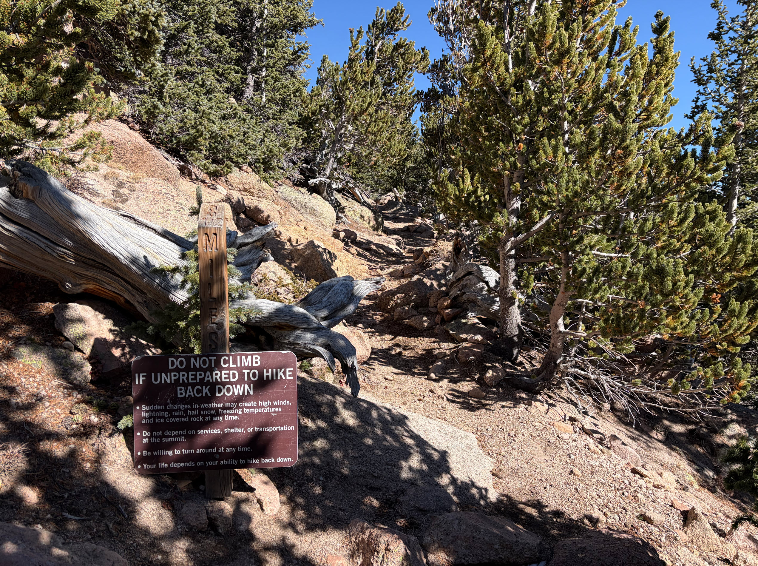
Last year I hiked Haleakalā crater, and here is my report from that trip. At the end I said I was going to do this again, but the other way around. Well, I didn’t go the other way around, but I added about 2.5 miles inside the crater, going all the way to Kapalaoa hut, and then looping around through the heart of the crater on the way out. This extended the trip to 13.87 miles and the hike took me 7 hours and 4 minutes. The total descent was 3,454 feet, and the total ascent was 1,804 feet, pretty much all of that during the last 90 minutes on the way out, what I call “the switchbacks.” The high point at the top of the mountain was 9,771 feet (2,978 meters). The low point, at the bottom of the switchbacks, was 6,715 feet.

My pictures and my narration of this trip is somewhat repetitive of what I showed in May 2024, but I can’t help it. The absolutely stunning beauty of this landscape, and the epic-ness of the hike just overwhelms me, and I can’t help myself. I have to show it off. So forgive the repetitive information – it’s new every time for me.

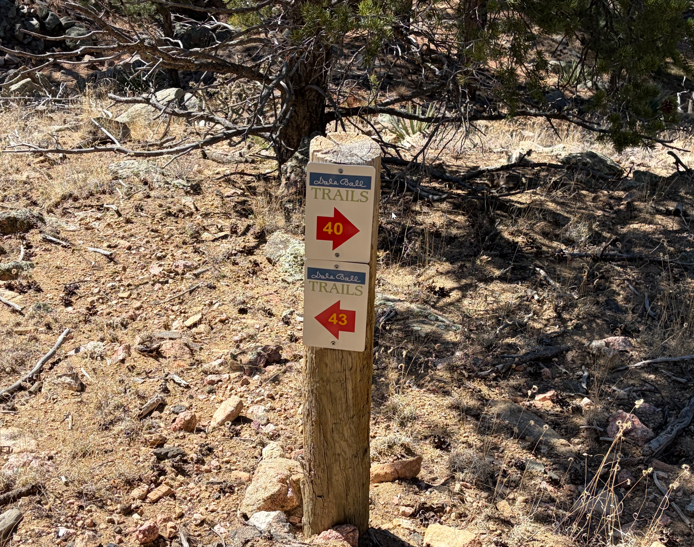
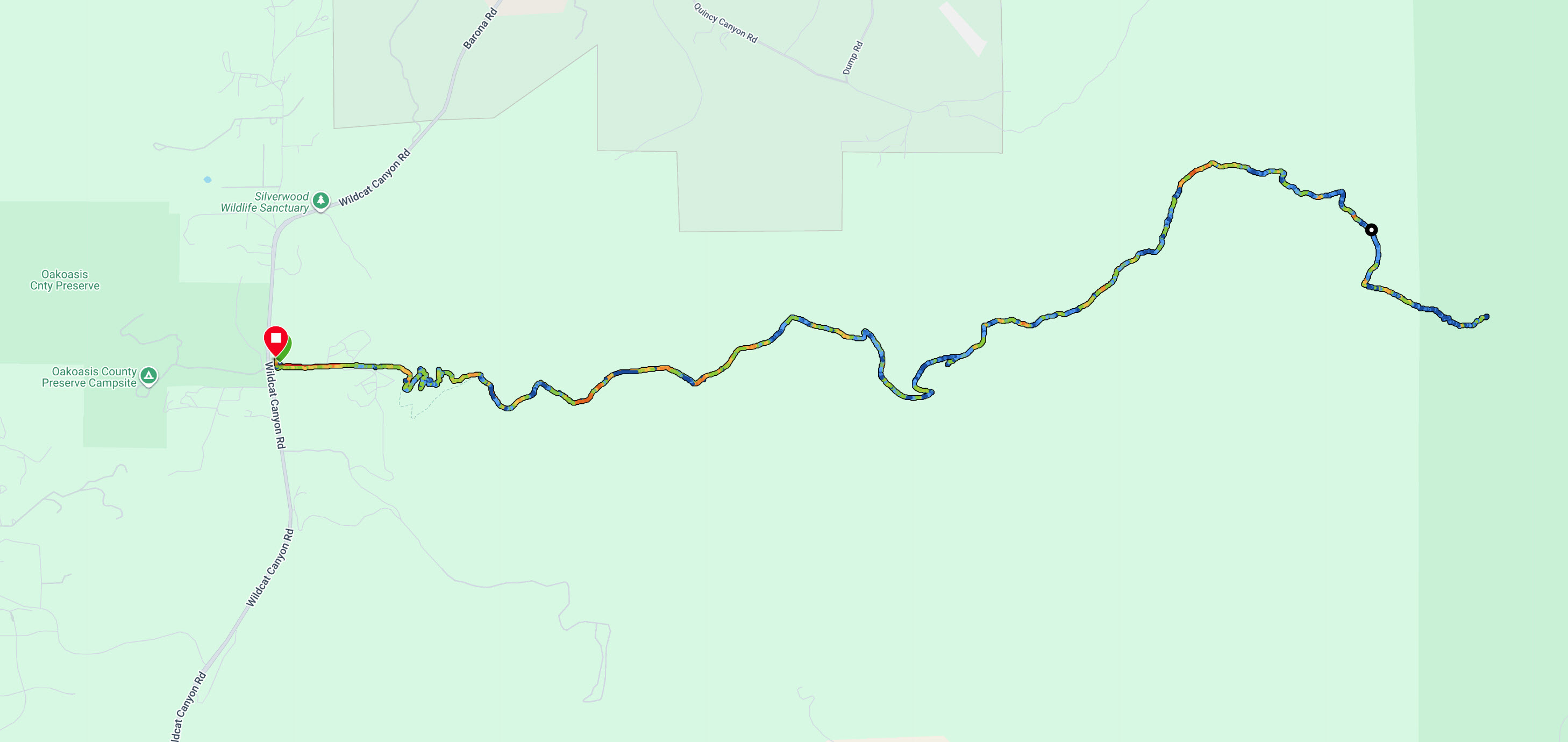
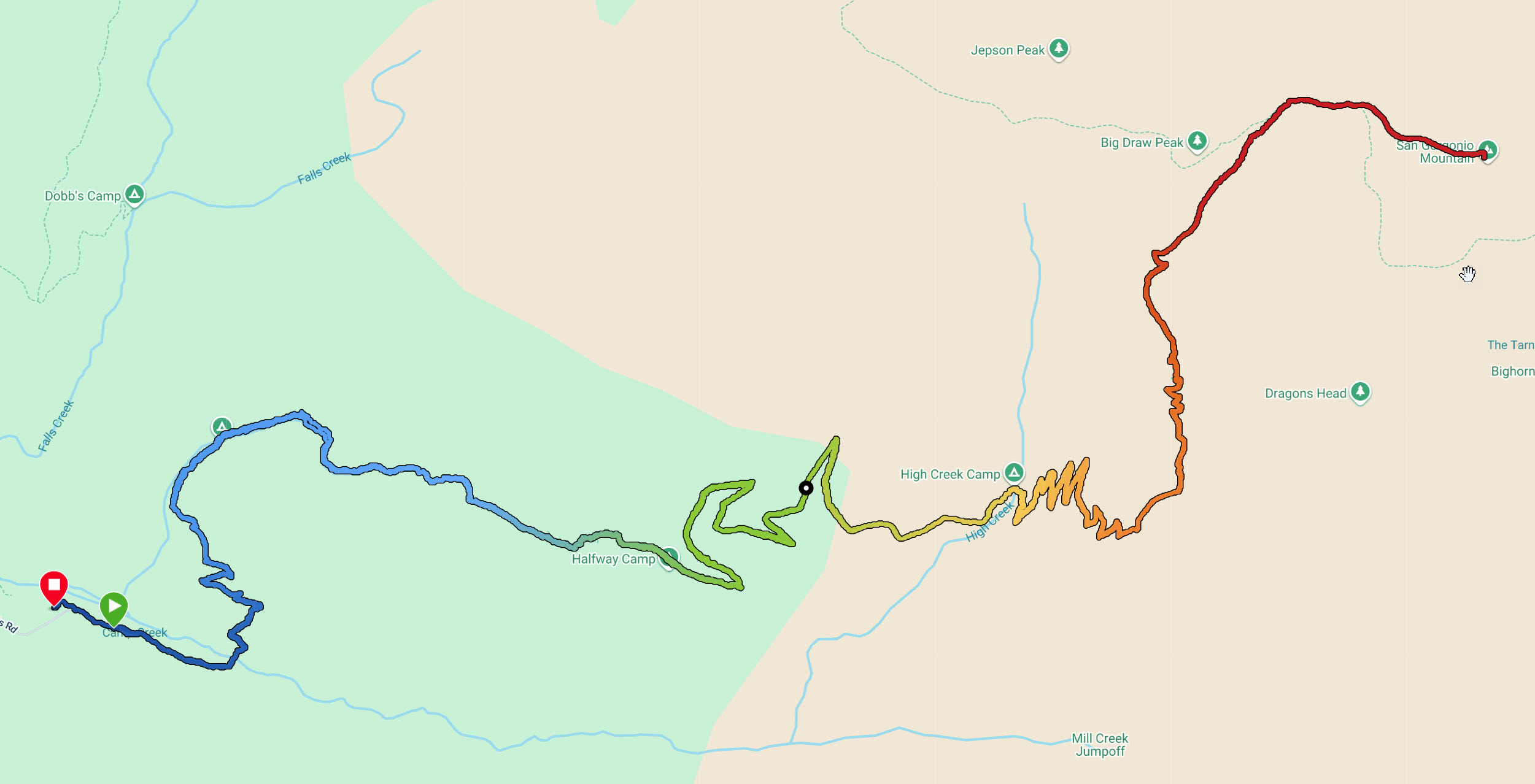
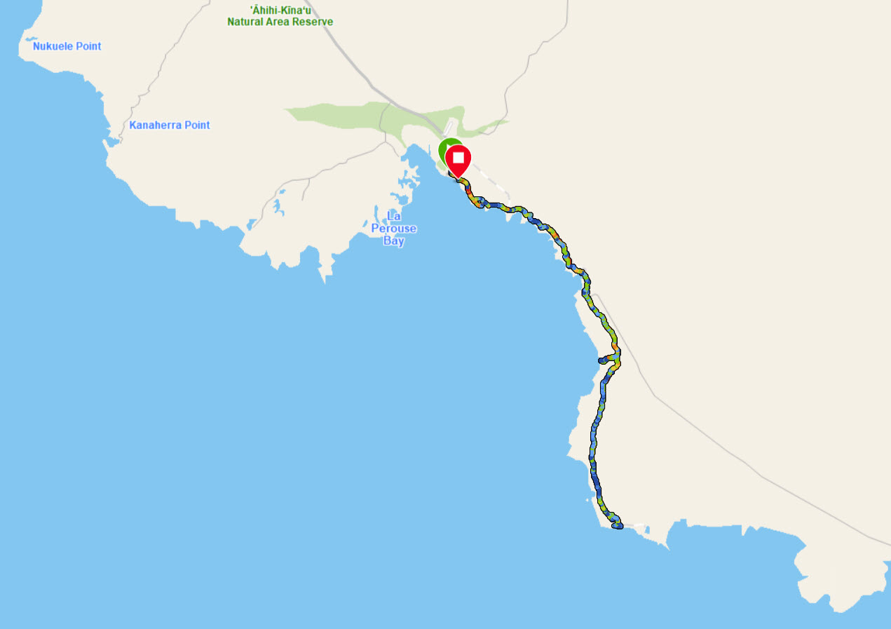
Here is the map of the hike. Red colors are indicative of fast hiking, blue are slow. I started at the green arrow and ended after the switchbacks at the red bubble. The Kapalaoa hut was at the rightmost point.

Trisha dropped me off at the top of the mountain and she took a selfie for the good-bye. She’d pick me up 7 hours later at the Halemau’u Trailhead.

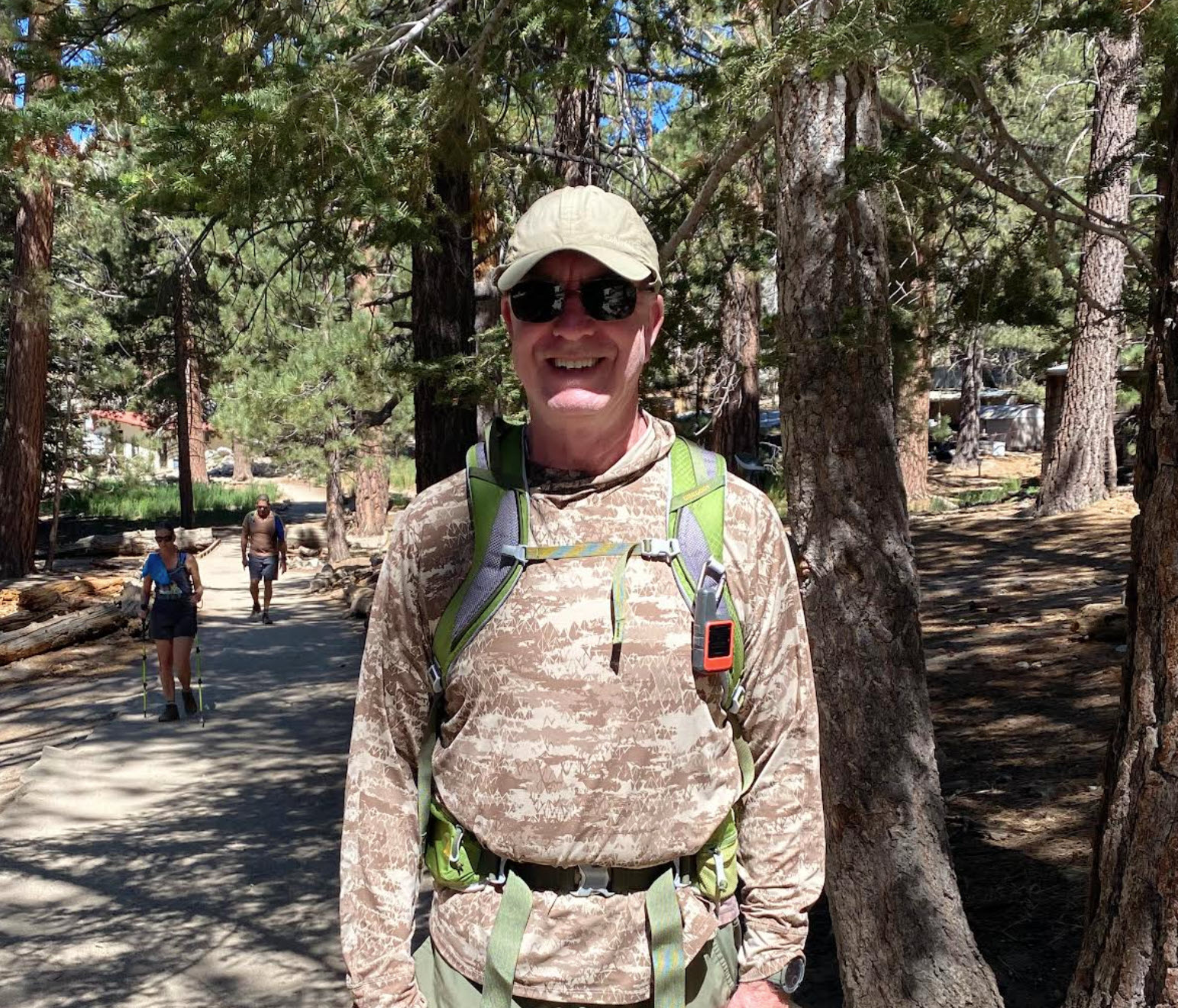
Before I left, she took one more picture of me at the start. The shortest way to Halemau’u is 11.2 miles, but I’d take a 14 mile route.

Looking down into the crater from the rim is always breathtaking. The crater is gigantic. If you look to the left of the picture, you see clouds below, and in the distance, the blue is the Pacific Ocean, 10000 feet below us.

Here is another view looking east over the crater. The morning sun is reflected in the distant ocean. On the right side you can see the start of the Sliding Sands trail as it makes its way down.

An hour and a half later, I am in the bottom of the crater. It’s at about 7,200 feet elevation, and it’s basically completely flat, surrounded by the rim 2,500 feet higher, in all directions.

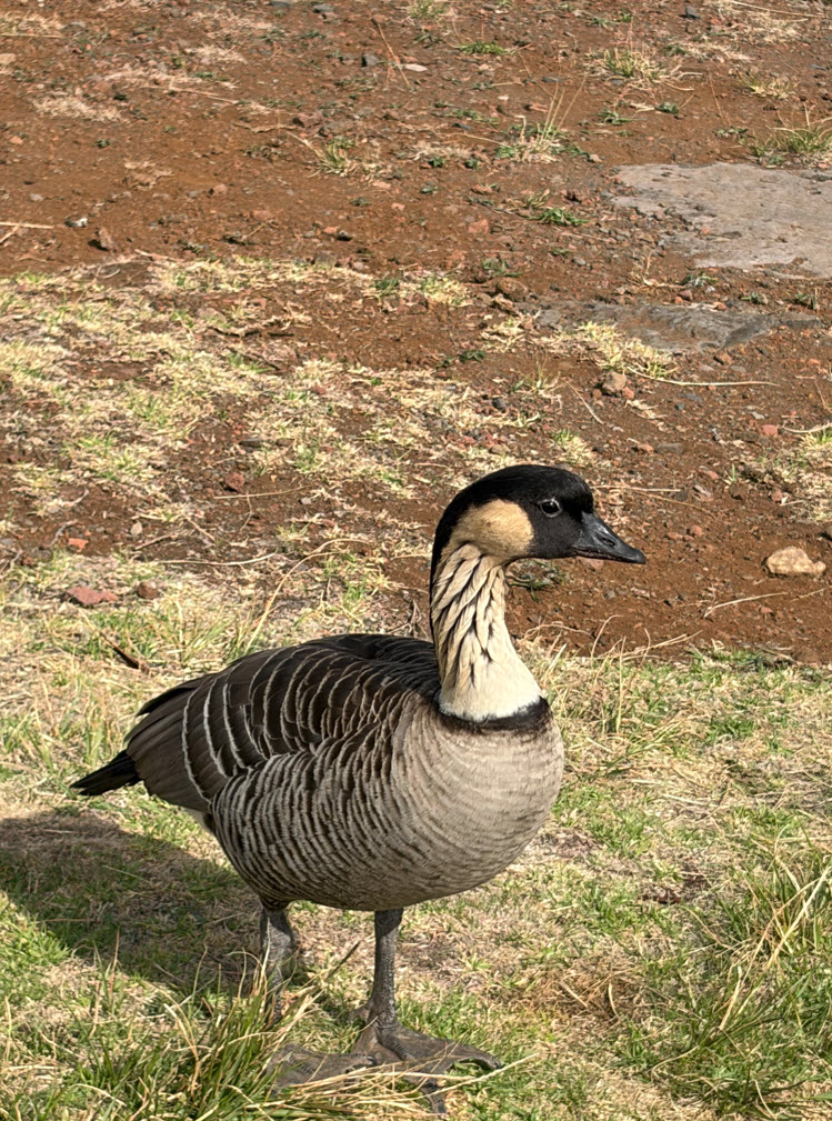
The state bird of Hawai’i, the Nene, originally came to the islands many thousands of years ago from Canada. They are related to Canadian geese, but have evolved to thrive in the Hawai’ian environment. They are surprisingly unafraid of humans, probably because hikers have fed them occasionally (even though they should not).

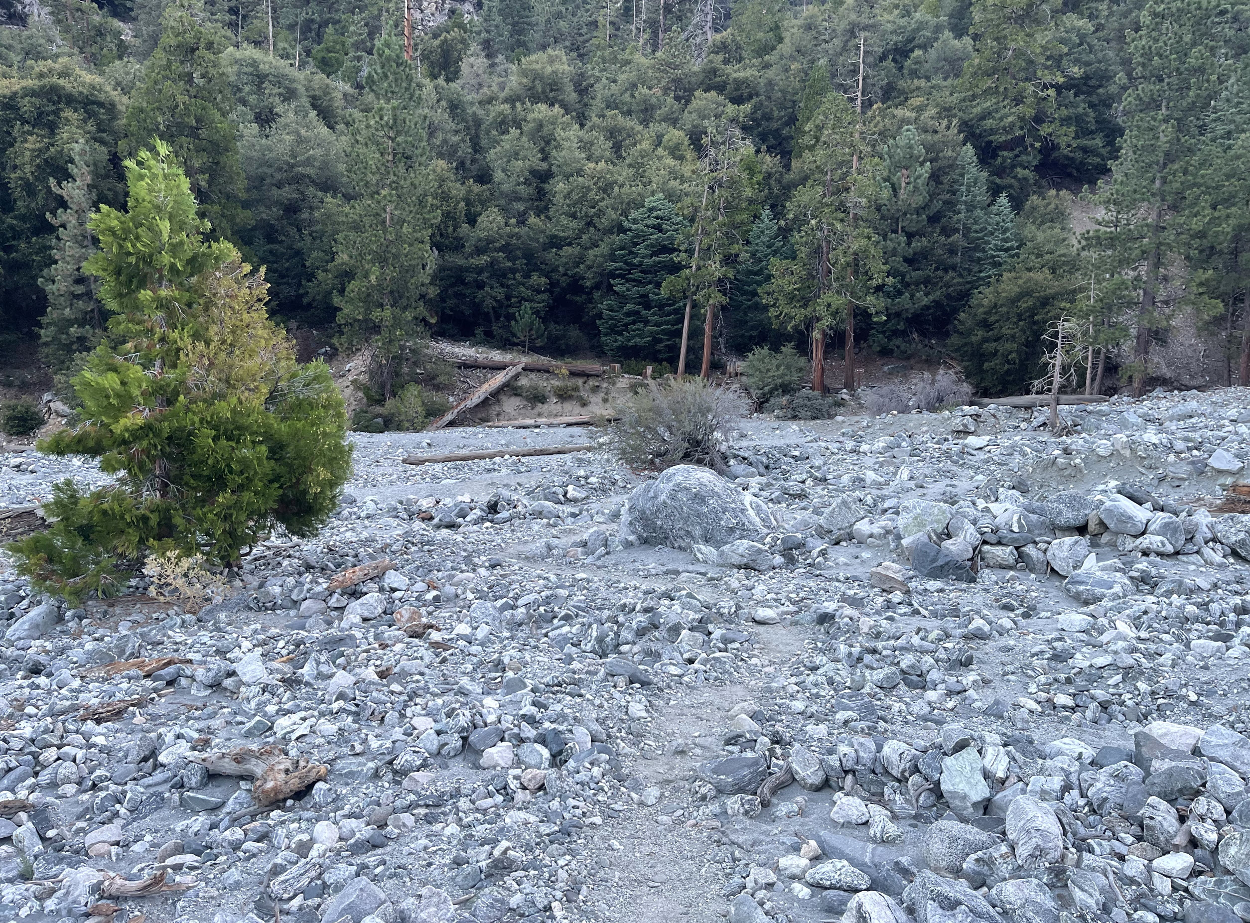
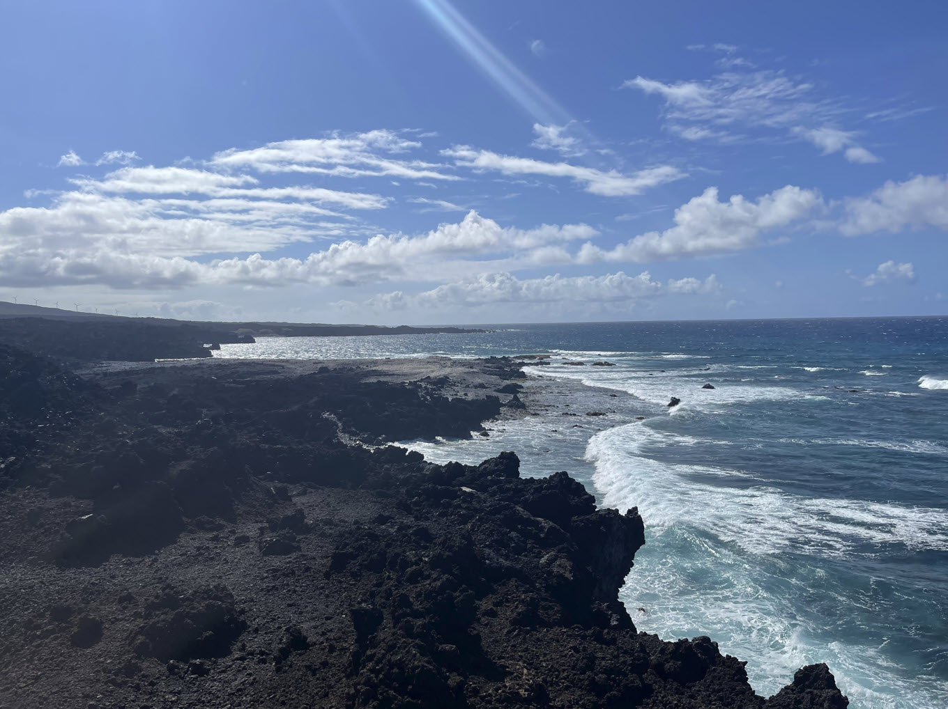
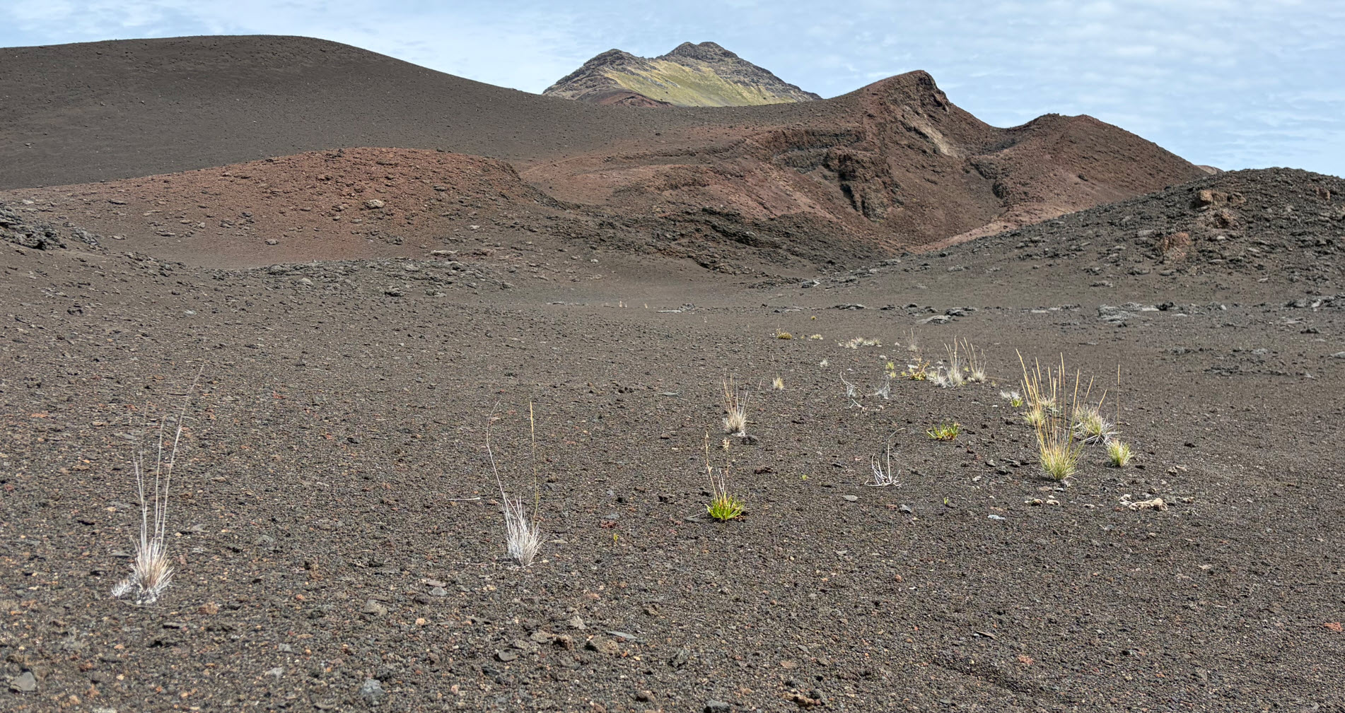
Much of the interior of the crater reminds me of a moonscape. However, there are some hardy survivors here and there, growing out of sheer gravel.

The Haleakalā silversword is a strikingly beautiful plant which is only found on the island of Maui at elevations above 6,900 feet on the summit depression, the rim summits, and surrounding slopes of the Haleakalā crater. It has been a threatened species since it was classified on May 15, 1992. Prior to that time, excessive grazing by cattle and goats, and vandalism inflicted by people in the 1920s, had caused its near extinction. Since strict monitoring and governmental protection took effect, the species’ recovery is considered a successful conservation story.

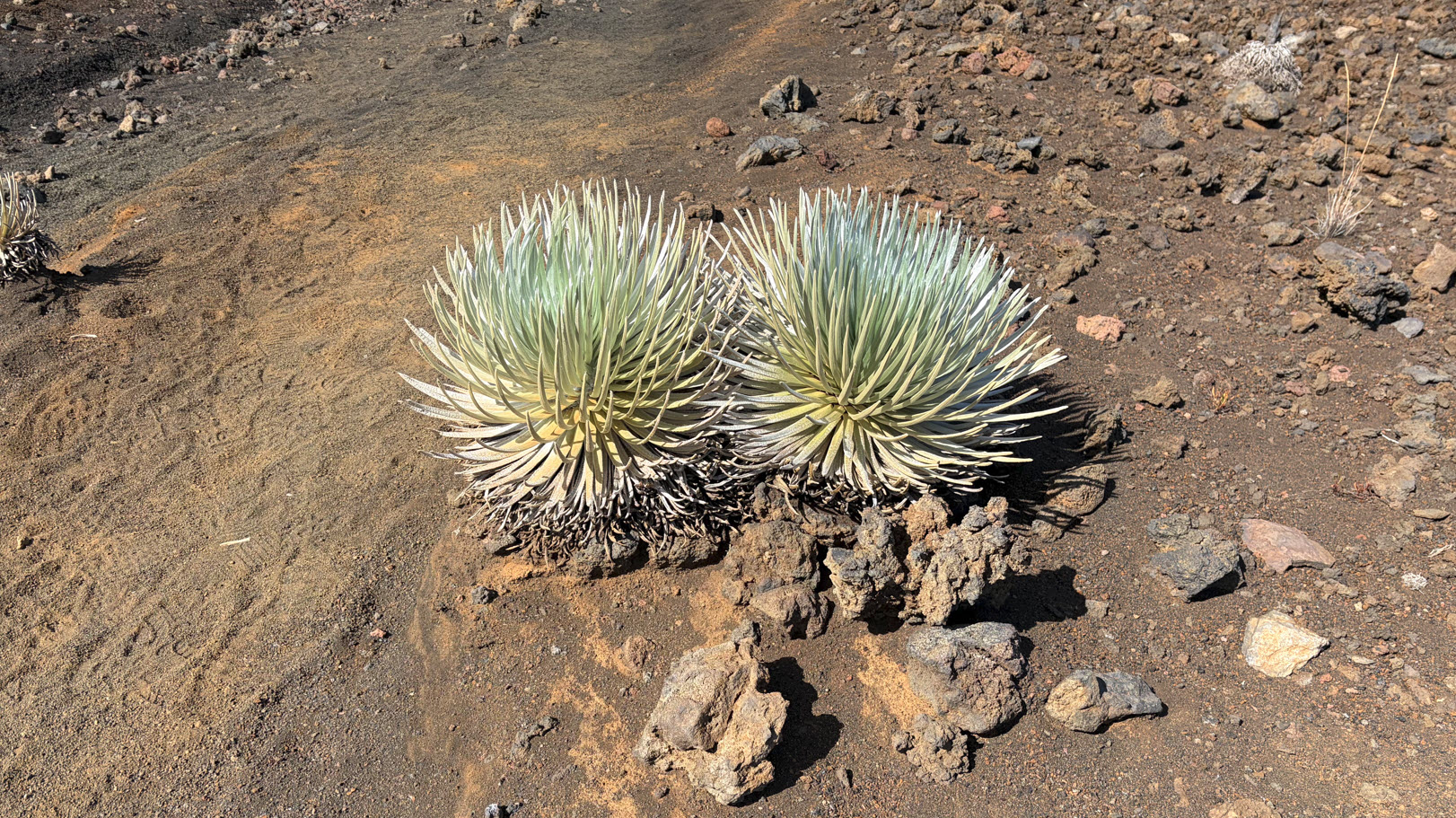
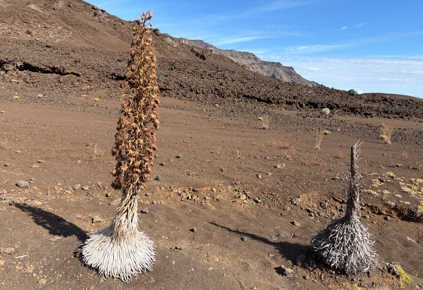
The plant has white leaves which feel rubbery to the touch. They eventually grow a stalk, bloom, and then die. This is the only place in the world where these plants exist.

Hiking in the crater, I am awestruck by the harsh beauty.

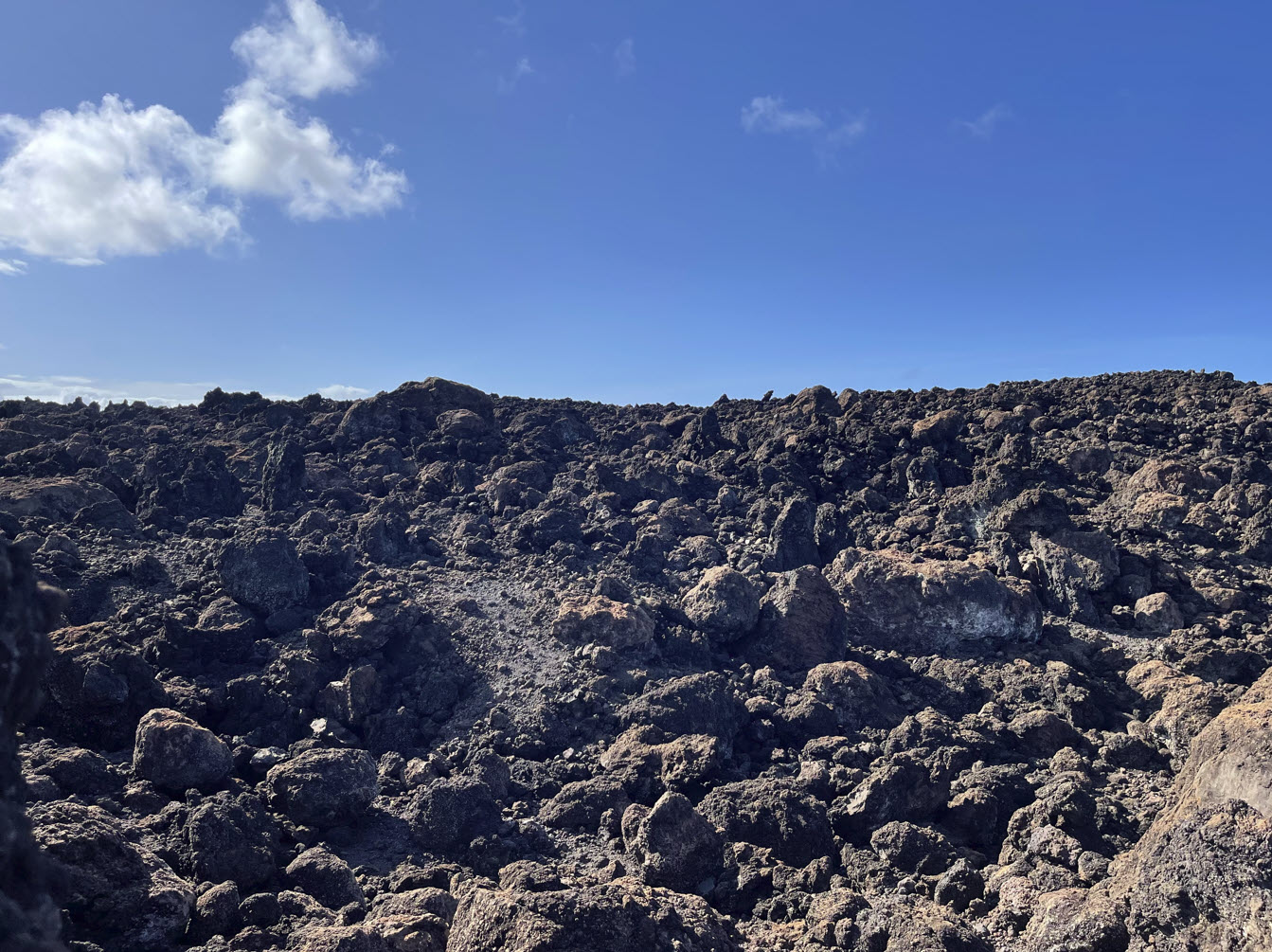
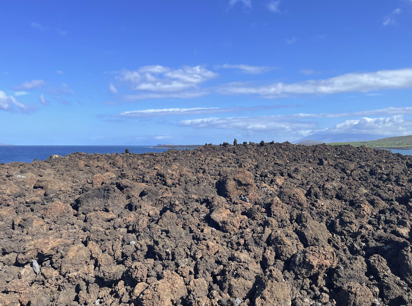
The cinder cones in the middle of the crater often show many different colors, very reminiscent of our hike in Iceland in 2024. The only difference between Iceland and here is that in Iceland, there are geysers of hot water, bubbles of popping mud, and pungent sulfur smells along with the colors. Here on Haleakalā, it’s only the colors. The most recent volcanic activity on Haleakalā is estimated to have occurred sometime between AD 1480 and 1600.

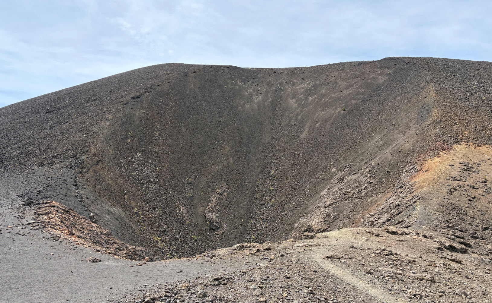
Here is another view of the colors in the crater. Note the red box in the distance and then look at the next photograph below, where I enlarged that view.

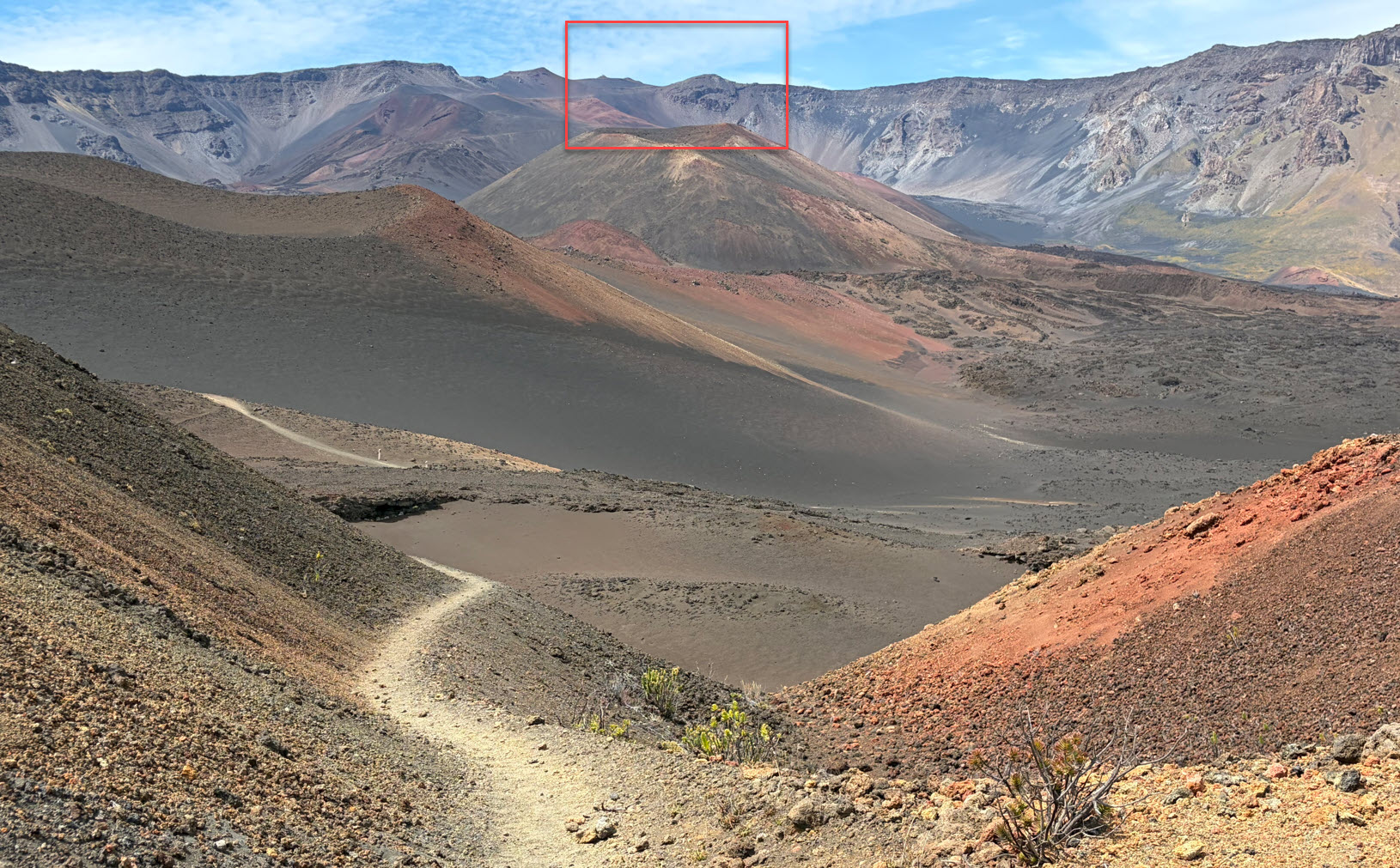
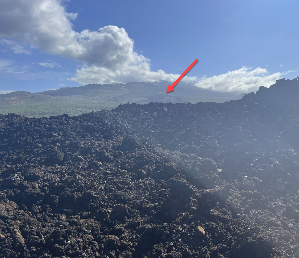
Here you can see where I came from. The red arrow points to one of the telescopes visible on the summit. The blue arrow points to the beginning of the Sliding Sands trail, the point where I took one of the pictures above. And on the right by the green arrow, that nubby is the visitor center on the rim. That’s how far most visitors to Haleakalā get.

Around the cones, we can find some interesting shapes. For instance, this is a huge gravel funnel, probably a hundred yards across. One of the strange things in the crater is that distances and sizes of features are hard to estimate, since there are no reference points.

Not far from the funnel there was this area with a sturdy steel fence around it. I wondered what it was. It is known as the “bottomless pit.” It used to be thought as bottomless, but they now know it’s 65 feet deep. In Hawaiian legend, the bottomless pit is associated with tales of Pele, the volcano goddess, and her siblings. Some stories say that her sister attempted to use that opening to reach down and cool or put out Pele’s fires below. Some older legends said that Hawaiians placed umbilical cords of Kaupo babies in this bottomless pit as a sacred custom.

I was in awe standing in front of a feature that has been part of the local legends for centuries, doubtless visited by generations of Hawaiians, throwing in their umbilical cords. And here I was alone, the only person in the universe at that time, nobody else around for many miles, staring down.

I leaned over the fence and pointed my phone down, afraid it might slip out of my hands, and took this picture. This gaping hole is about 10 feet across and there is no way to see the bottom. This is how close I dared to get.

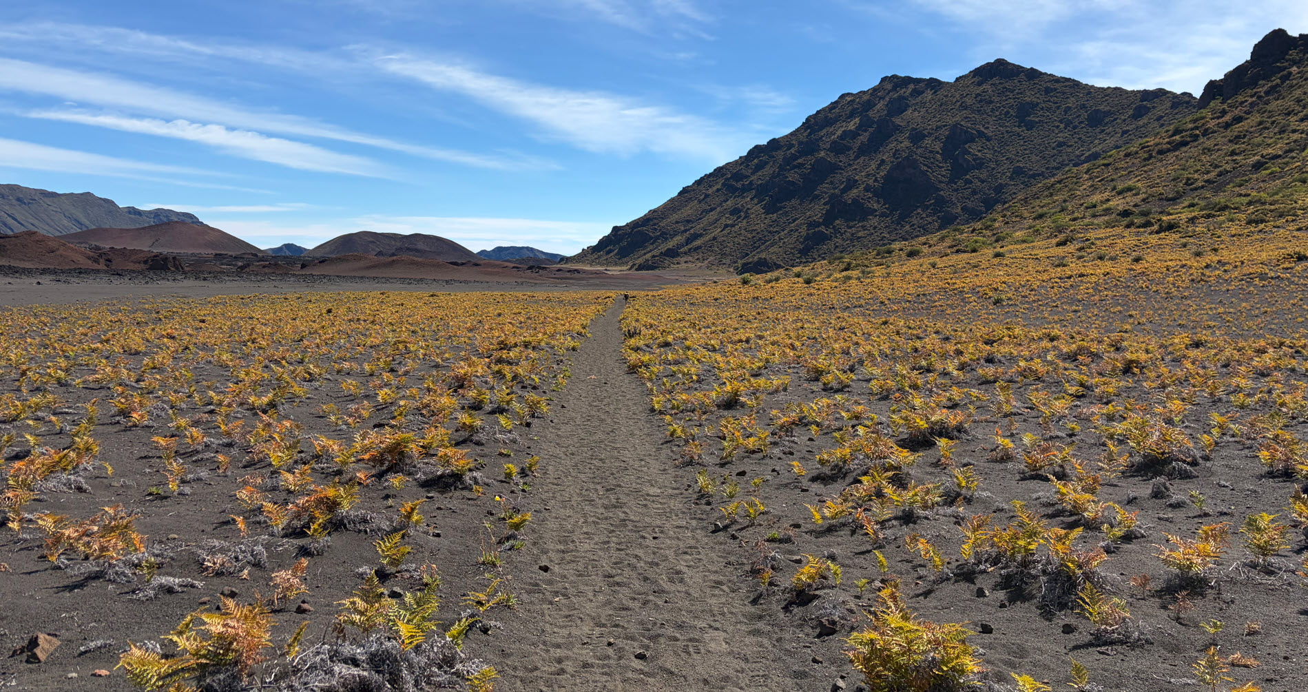
As I crossed the crater, the moonscape kept my attention, or shall we call it the “mars scape” since the picture below looks like something we see on YouTube taken by the panoramic camera on the rover on Mars. The rocks in the foreground, the untouched sand, the dunes, the colors. The only thing that reminds me I am on Earth is the blue sky.

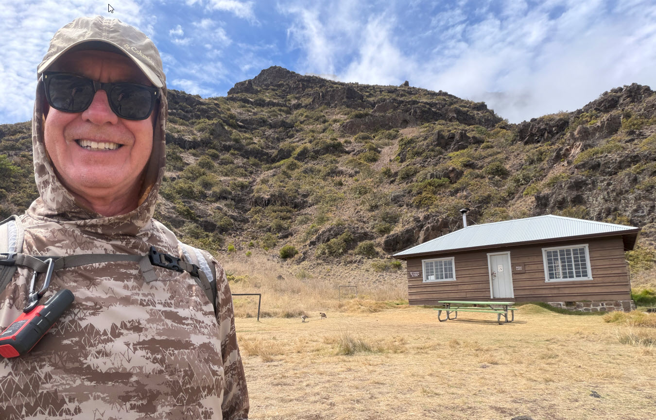
Finally, after about 10 miles of hiking, I arrived at the Holua hut and I took a selfie to honor my friends Mike and Susan, who where here last fall per my recommendation. They hiked down the switchbacks, arrived at this hut at the 4-mile point, and then turned around from this spot. Here’s to Mike and Susan.

I stopped here to eat my last sandwich before the final ascent back out up the switchbacks.

During this entire trip, I saw very, very few people. It’s almost scary, but there is nobody in the crater. I was mostly alone, except for one other hiker who I ran into early on the way down. We exchanged a few words while I was sitting on a log having my breakfast, and then he went ahead of me. I didn’t see him again for hours, and I thought he’d be way ahead of me.

Well, he wasn’t, and when he caught up with me just before the switchbacks he took several videos of me hiking in front of him, as he caught up to me. I didn’t know this was going on.

Here is a video he shot of the surrounding landscape, and about halfway through you can see that he hesitated when he spotted me and then zoomed in. That’s when he realized I was in front of him.

Here is the video he took just before he caught up with me.

Of course, since I mostly hike alone, I am not used to having pictures, or even videos of me during a hike.

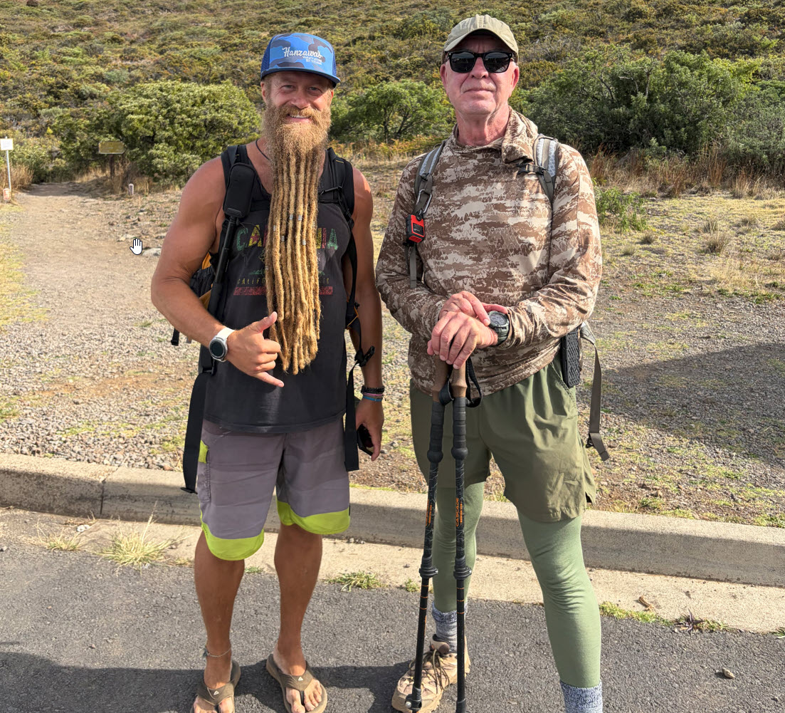
As we clambered up the switchbacks, there was plenty of time to chat and get to know each other. To protect his privacy, I shall call him J.R. here:

Note the flipflops. This guy is a “badass hiker” and therefore just my kind.

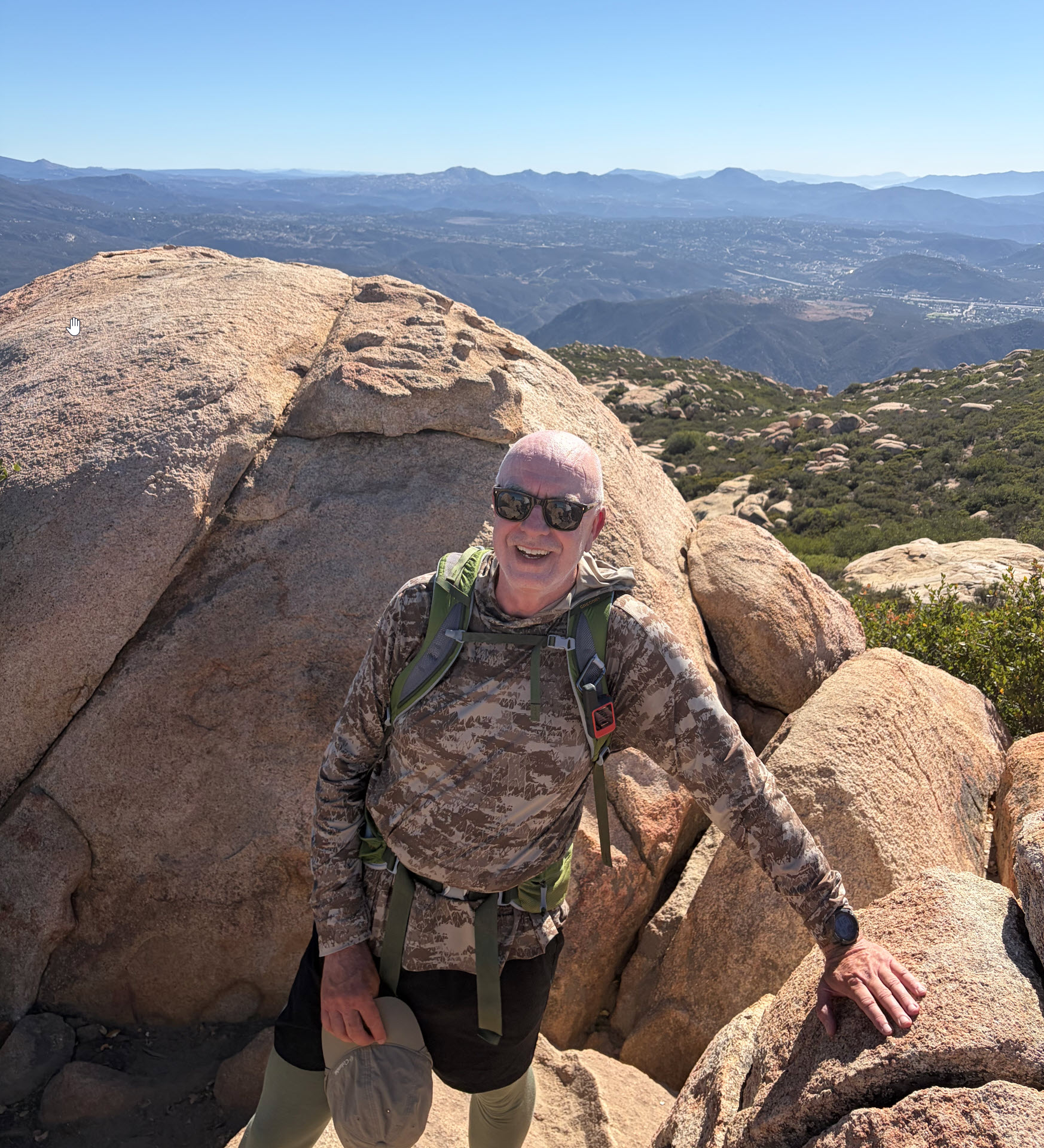
In the following few pages there are a few pictures of me, all credit to J.R.

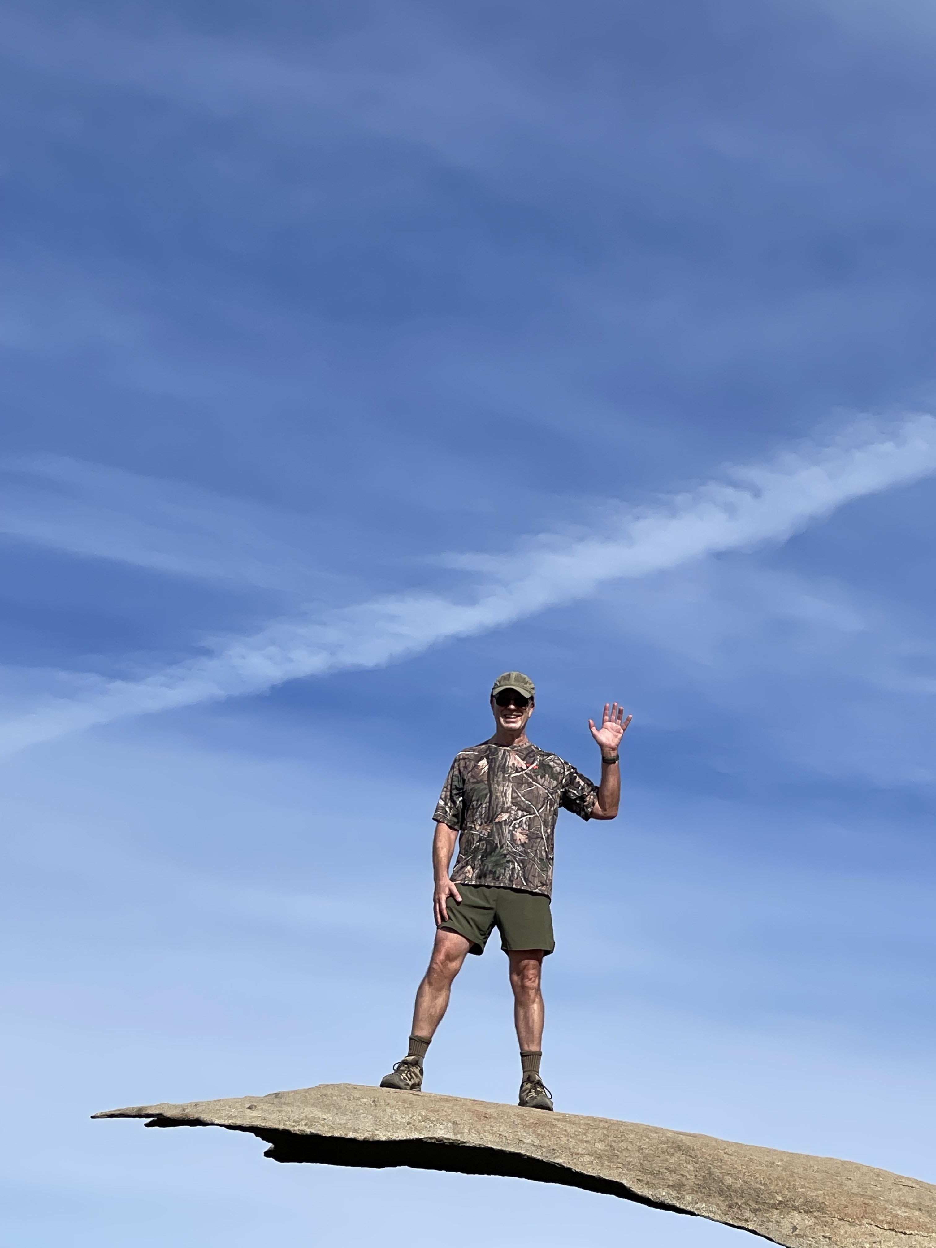
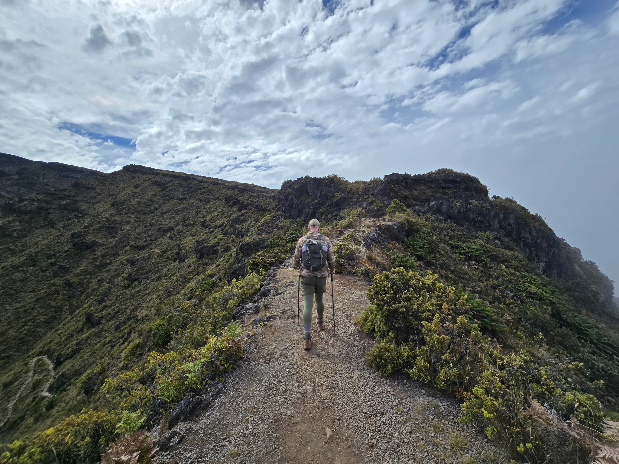
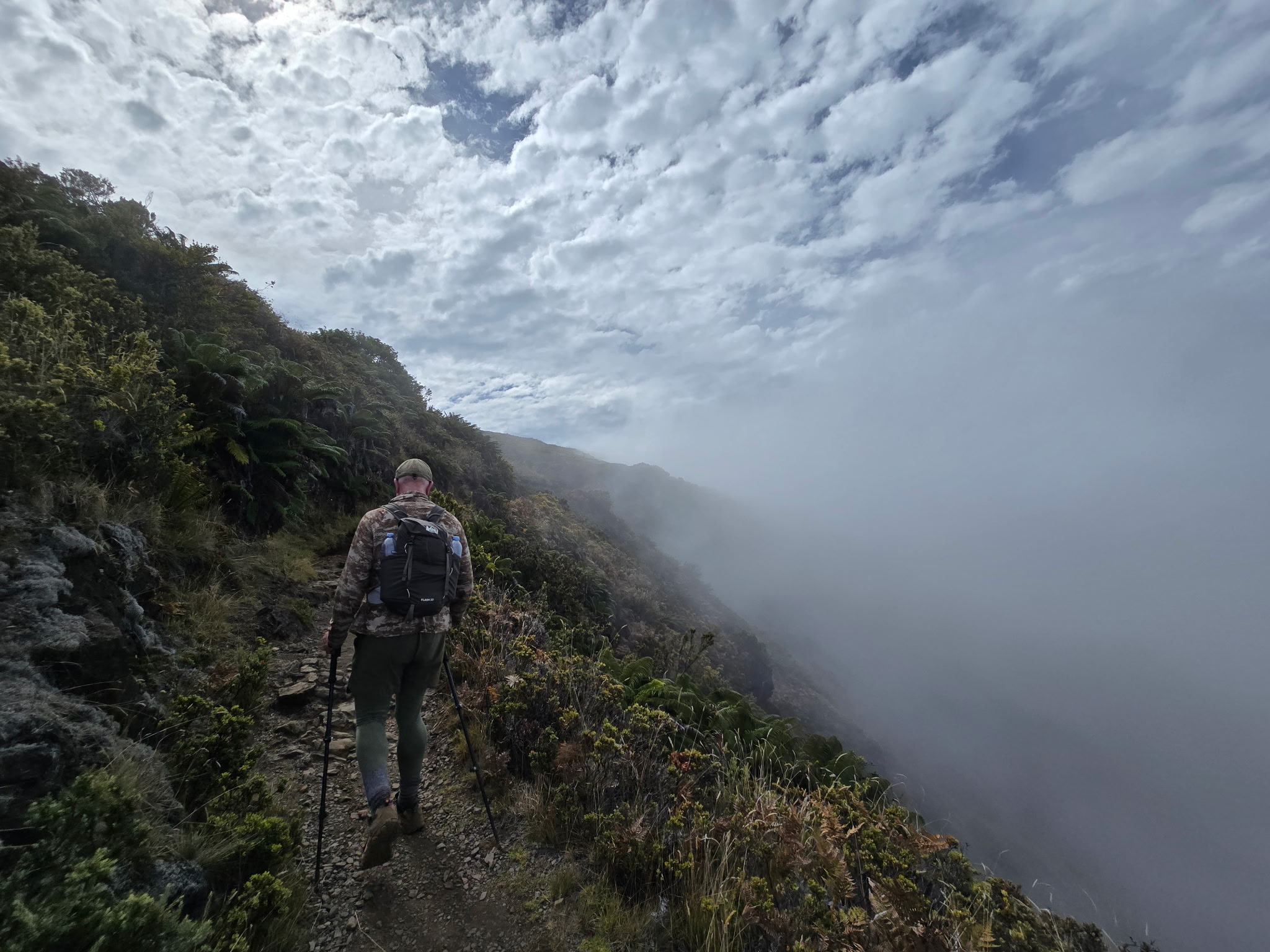
Here I am on one of the exposed ridges, with sheer drops of hundreds of feet on both sides.

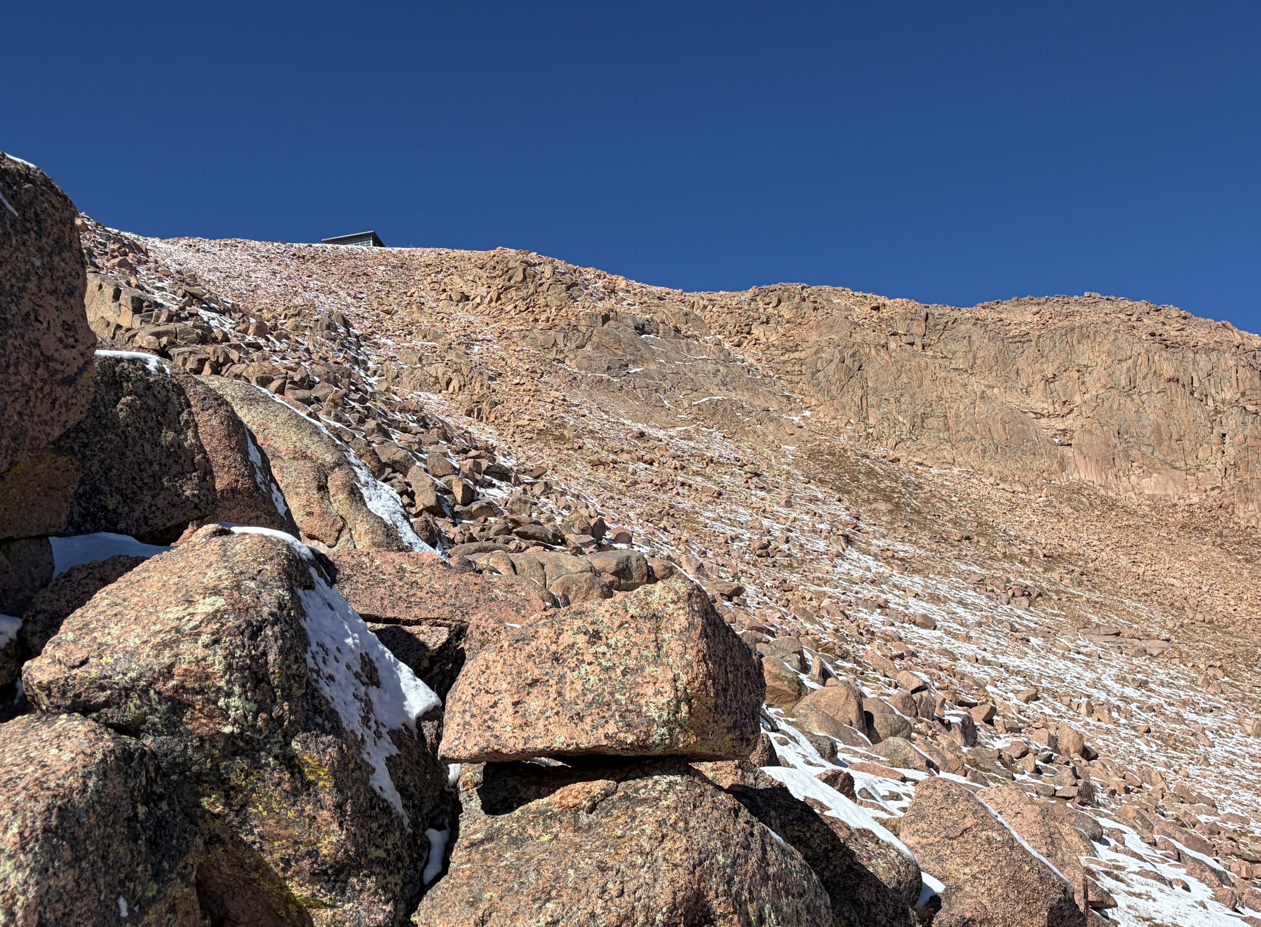
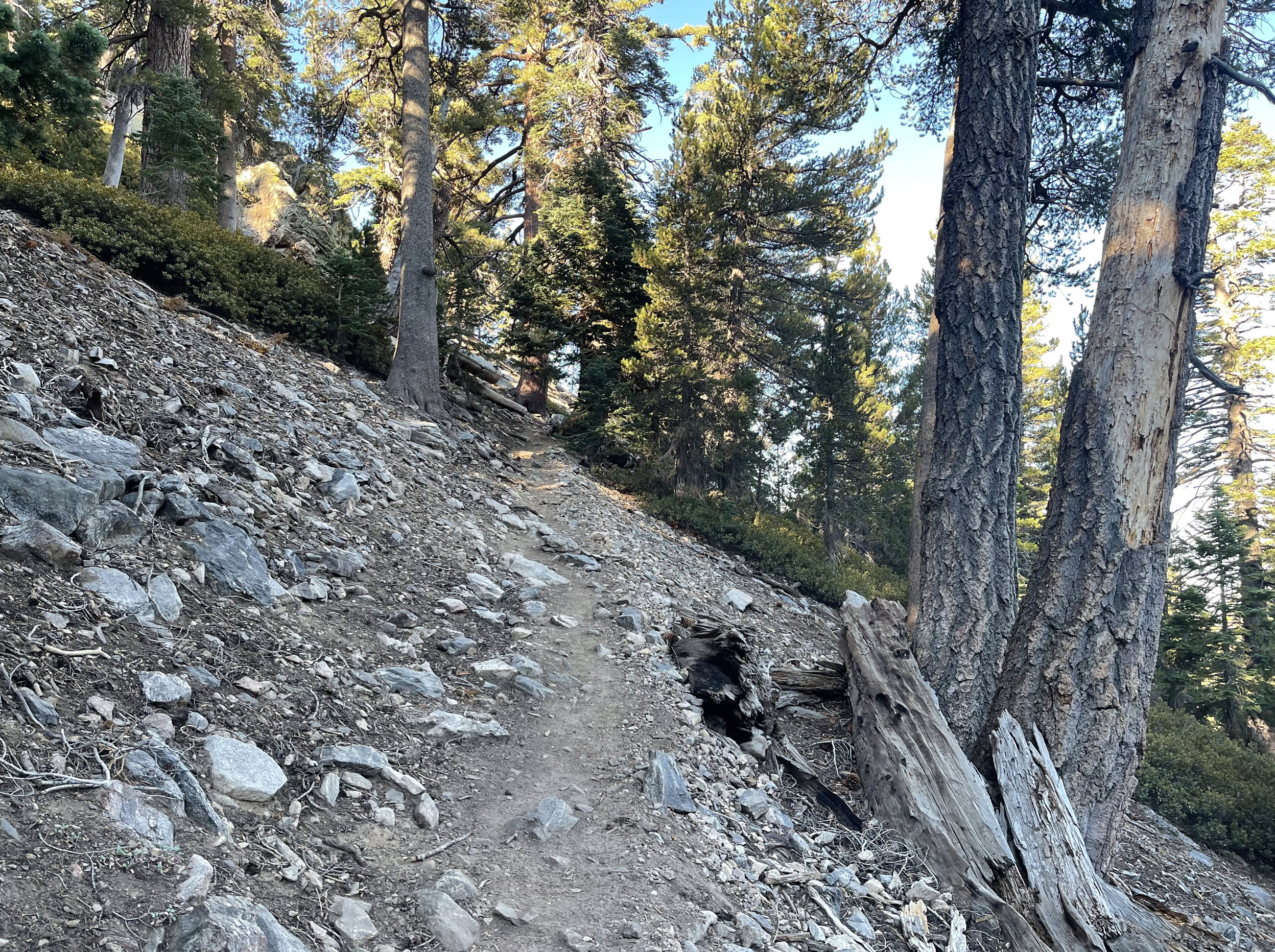
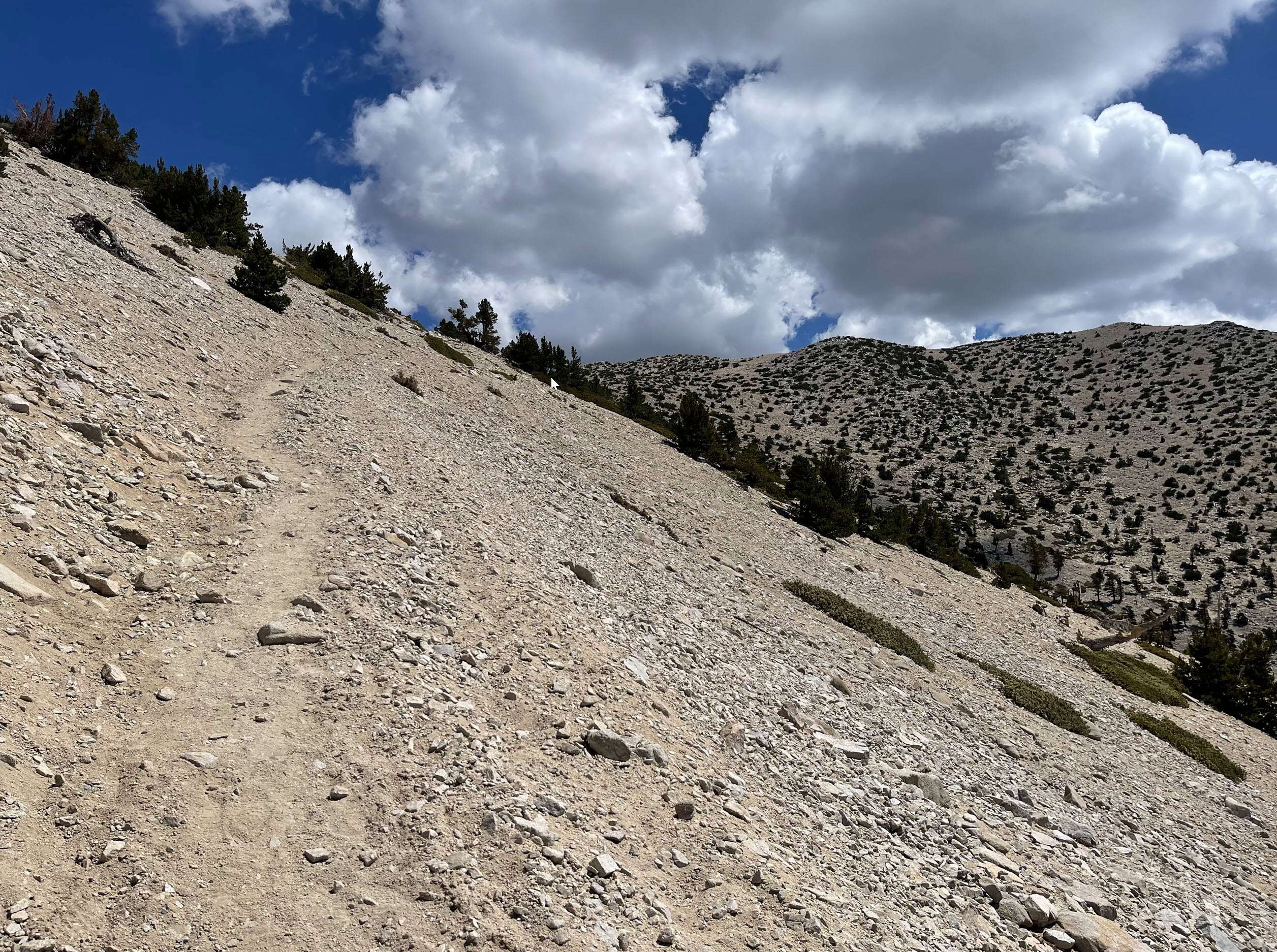
Here you can see how rocky and steep the trail is up the switchbacks.

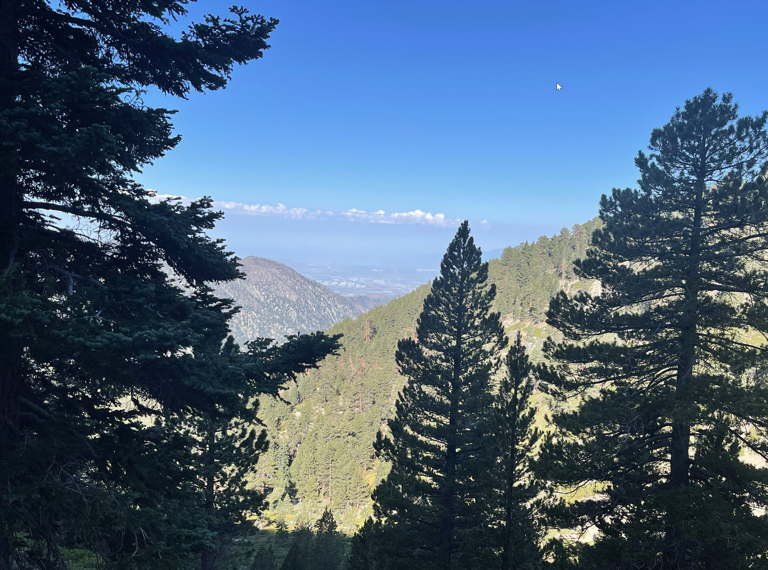
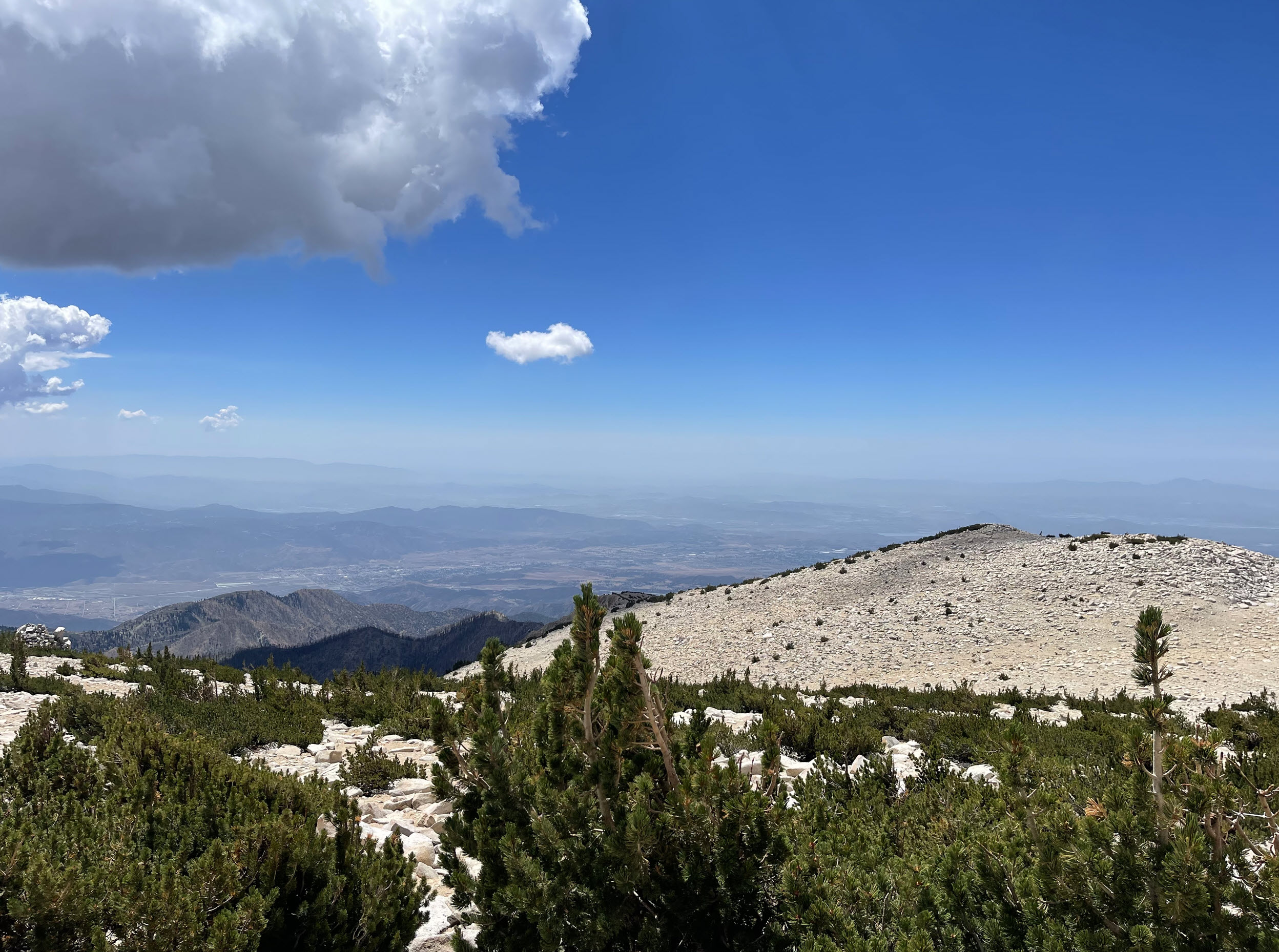
Looking out, the clouds that enshroud the mountain are below us.

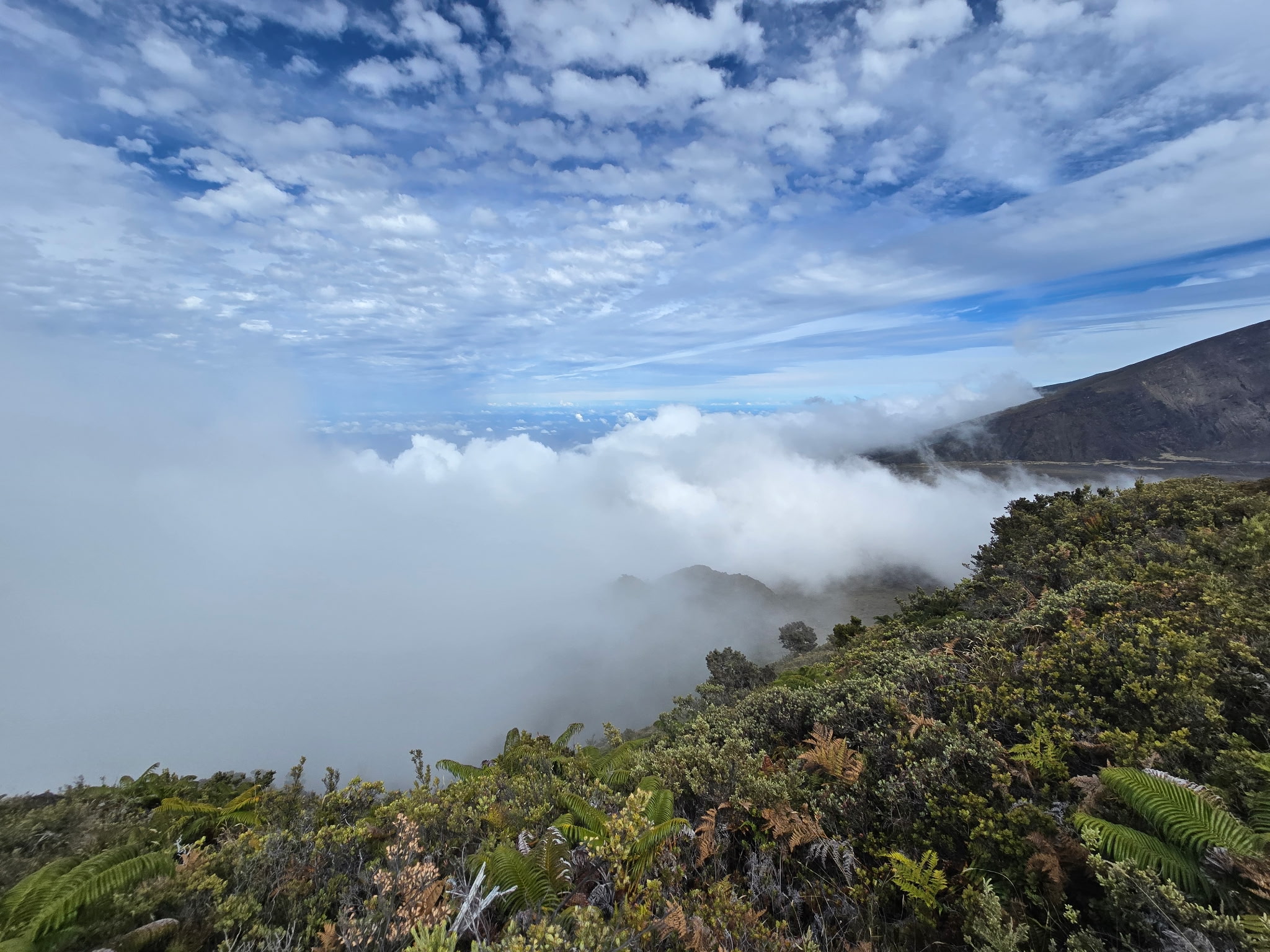
Sometimes they reach right up to us and feel like fog.

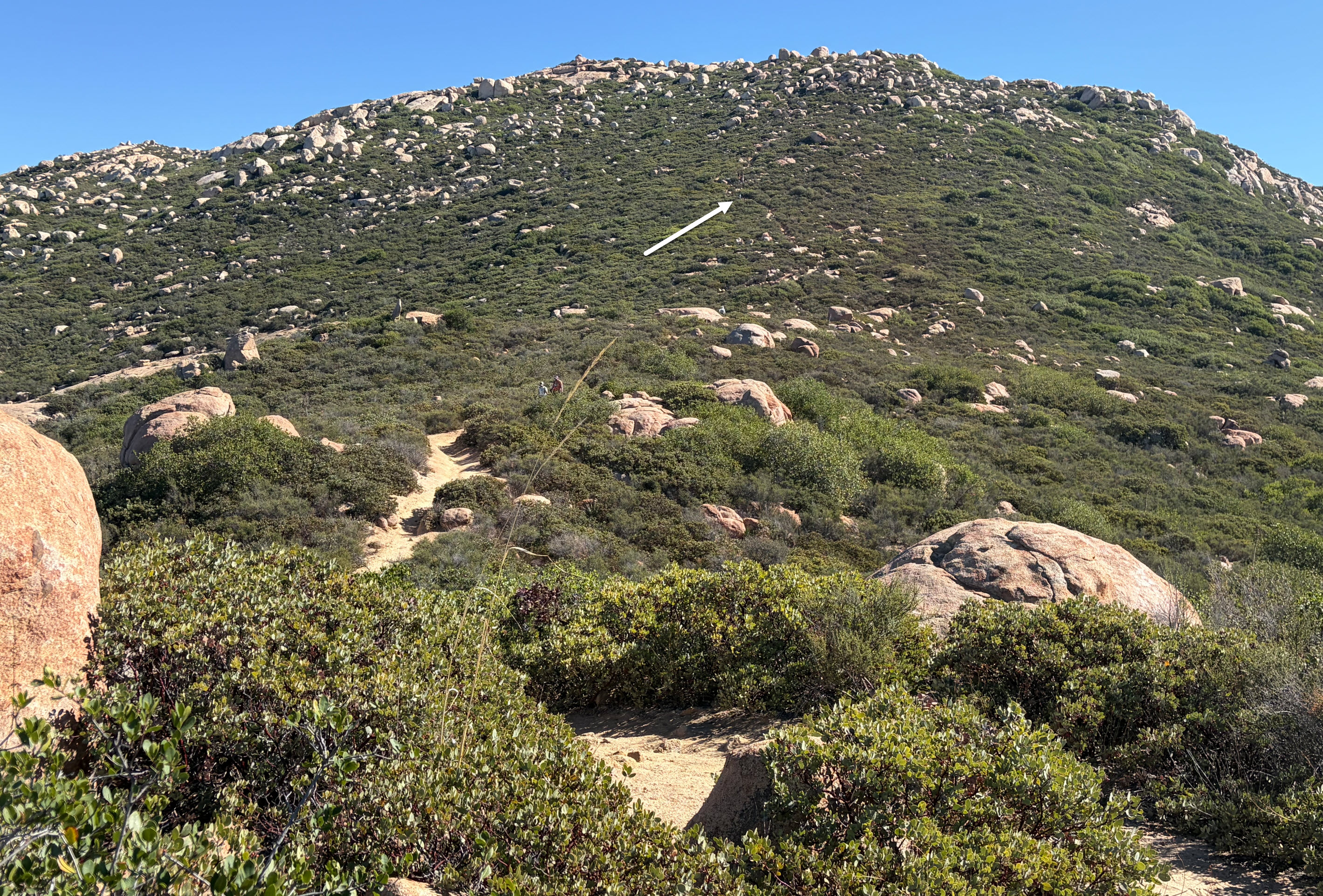
Here you see some of the switchbacks, and if you look carefully you can see tiny me about in the middle of the picture towards the right. You can click on the photo to zoom in.

And finally, after 7 hours and 14 miles, we arrived at the Halemau’u trailhead where Trisha waited for me and took this picture. It was beer’o’clock.

Thanks for sharing your pictures, J.R. and may we meet up for another awesome hike one day!


Hiking San Gorgonio Peak as a Day Hike

Last Sunday I hiked San Gorgonio Mountain as a day hike. San Gorgonio is by far the highest mountain in Southern California, with an altitude of 11,503 feet (3,506 meters).

In the map above you see the Vivian Creek Trailhead on the left side and the peak on the right. The trailhead is at 6,085 feet. The color coding is for altitude. The length of the route is 9.2 miles from the trailhead to the peak, and then, of course, back again, which makes for an 18.4 mile hiking day.

I started a little after 6:00am, just before sunrise. It took me 7 hours to get to the top, and (yes, I hike slowly downhill due to my aging knees) 7 hours to get back down. When I arrived the parking lot was pitch black. I always carry a head lamp. It was a life saver on this one in the last hour.

The hike was epic. I had a lot of time to think in those 14 hours on the trail. I realized that the last time I did a day hike to San Gorgonio Peak and was when I was in my 30ies. I am now 69. Ouch, the legs aren’t what they used to be.

I have been there a few other times since, but either didn’t go all the way to the summit, or I camped at High Creek Camp, about 5.5 miles up, and then day hiked to the top from there.

After hiking up from the trailhead for about half a mile, the trail crosses the mighty Mill Creek. There was not a drop of water there, but Mill Creek is famous for doing tremendous flooding damage downstream from here from time to time. It makes national news when that happens. The huge boulders and massive tree trunks in the creek bed are evidence of the power of water.

Here is a typical trail picture. Vivian Creek Trail is very steep at times, and rugged.

A couple of hours up I got a good view back down into the smog-filled San Bernardino valley in the distance. As always, you can click on the picture and zoom in, and you can see some of the industrial buildings in San Bernardino.

Last water is at High Creek Camp. I filled up my two liter bottles to make it to the peak and back from here, a 7.5 mile trek roundtrip.

The views are amazing.  In the distance you can see San Jacinto Peak, where I was just last month. See the post here.

There are also many tracts on this mountain that were ravaged by wildfires over the years. Here is one such spot. The left side of the ridge was spared, the right side was burned all the way down some years ago.

Here is a picture of the traverse to the summit ridge. Here we are at about 10,000 feet or so, and the wind is whipping somewhat fierce. The traverse is steep in some places, reminiscent of the ridge from hell we hiked in Iceland last summer. Some of my Iceland hiking friends will remember that ridge.

Close to the top, there is a major junction of three main trails coming up from very different directions. It’s important, on the way back, to pick the right one, or be doomed.

Finally, at the top. Or, as you might call it, men in tights. This photo does not look like I am at the top, but really, this is the peak. San Gorgonio is also called Grayback sometimes, since its top is huge and broad.  In the back behind me you can see good old San Jacinto, a good 800 vertical feet lower than where I am standing here.

Here is looking west from the peak. The broad expanse of granite is evident.

Here is looking east from the peak. Over the decades, hikers have built dozens of rock shelters against the wind. You can make some out on the ridge on the left. I have always wanted to stay a night up here. While talking to my wife about the Perseid meteor shower, it gave me the idea to come up here next year during the shower for a 3-day backpacking trip, and spend a night in the glory of high altitude, whipping winds, freezing nights, lack of oxygen, and — this makes it all worthwhile — unimpeded views of the meteors. I probably won’t get much sleeping done, but the experience will be glorious.

Time to put it on the calendar.

Hiking San Jacinto Mountain

I have hiked San Jacinto Mountain many times before, but the last time I remember reaching the peak must be over 10 years ago. I tried a couple of times in 2024, but didn’t make it for various reasons. One was too much snow. Here is the report of that trip.

This time I went later in the year, June 29, and I made it. I took the San Jacinto Aerial Tram to the mountain station, at about 8,600 feet elevation.

First the obligatory departure picture at the ranger station. My wife took that picture. She hiked the loop trail, about three miles, and then went back down to Palm Springs while she waited for me, before she picked me up at the valley station of the tram, seven hours later.

Here I am still fresh.

The first major milestone is Wellman Divide, about 3.5 miles up the mountain. It is a major junction of several trails, some coming from the south side from Idyllwild, and others coming from the north, where I started.

From that point, there are fantastic views south, east and west. Looking south, in the distance, you can see the ridge of Palomar Mountain. On a clear day, like this day, I was able to see the white dome of the Palomar Observatory (red arrow). You can click on the picture to zoom in.

From some of the higher sections of the trail past Wellman Divide, there are great views to the east. The tram station is visible in the distance (this picture is greatly zoomed in, so it looks close). The station is actually four trail miles from where I stand.

Finally, the main trail junction 0.3 miles from the peak. Almost there.

Just before the peak, there is a stone hut with a few bunks.

The final ascent to the peak requires scrambling over major boulders. There is no more discernible trail.

Almost at at the peak. I needed to use hands and feet to make it up those slabs of granite.

Looking southwest from the peak, I can see Diamond Valley Lake (red arrow) in the distance. This where where I sometimes go mountain bike riding. From that trail, I remember looking at San Jacinto, looming majestically in the distance.

Finally, here I am, at the peak. I was really there.

The round trip hike of 11 miles took me 7 hours and I ascended 2,500 feet. All good.


Back to Potato Chip Rock

It’s been a few years, but I enjoyed hiking back to potato chip rock this morning with my nephew.

Here for a little perspective:

Here is my nephew. You can see, he got a little closer to the edge.

The Natural Glory of California

I just flew back from Portland, Oregon to San Diego. I sat in the front of the plane, on the right side, with perfect weather. Here are some views of the natural glory of California. As always in my blog, you can click on an image and zoom in. For these pictures, it might be worth it.

First, I caught a good shot of the town of South Lake Tahoe. This is where my son lives. I waved, but I don’t think he saw me.

Then we flew over Yosemite Valley. I was able to see El Capitan, one of the most famous big walls for climbers in the world, and of course, Half Dome. I had fond memories of my climb of Half Dome almost to the day 12 years ago, which I chronicled here.

For those of you that don’t know what you’re looking at, here are some pointers. The red arrow points to El Capitan, and the blue one to the top of Half Dome.

I also took a zoomed shot of El Capitan, one of the most iconic rock formations in the world with more than 3,000 vertical feet of sheer granite.

I have lain on my back in the meadow below and looked up with binoculars. You can always find a few climbing parties on the rock, tinier than ants, on an impossibly tall and vertical wall. It is also made famous by recent rock climbing movies, such as “Dawn Wall” and “Free Solo.”

Iceland Hikes

Here are maps, statistics and some pictures of the four main hikes we did in Iceland:

Hike 1

July 31, 2024 – 8:00 miles, 6:35 on the trail, including all rests and stops.

This hike was the most strenuous. We climbed up into the mountains and did a circle of vast hot springs area, known as the Hveradalir Geothermal Area. The wind was fierce and we needed all our layers to wear. It was basically in and out on the same trail.

Here is Trisha on the trail after coming up a steep ridge. 

And here is our whole group, getting oriented by our guide Jonas on the right side. In the background just over Jonas’ head you can see a part of the Hofsjökull glacier, which is located in the center of the country.

Here is a better view of the Hofsjökull glacier:

Some of the terrain was quite steep, and there were rudimentary stairs installed. That’s me in the very back getting ready to come down.

The landscape at Hveradalir is in front of us, deep valleys with many colors, greens, red, yellow and lots of browns, ocres and whites.  Plumes of steam and occasionally sulfur wafts around everywhere. You have to be careful where you step. There could be a very thin crust over boiling water.

Our team makes it way along the ridges.

All colors of the rainbow abound. Note also the thick cloud cover that seems to reach down into the valleys. Occasionally when walking through a cloud of hot steam my glasses would fog up and I’d be instantly blind. This happened a number of times.

Here you can see what a 40 miles per hour wind will do with a steam plume.

There were also the occasional snow fields that we needed to cross.

In the end, this was a rewarding hike. There we are, happy campers.

Hike 2

August 1, 2024 – 9.68 miles, 6:30 on the trail.

Our guide improvised this hike. The first section was on a trail up to a crater. He had never been there himself. Some of us hiked around the crater rim. We had fantastic views from the top of the rim. A few of us went around the back way, where we met up again. Then the second half of the hike was across the open tundra. No trail. It was rough on the feet and legs, and we were all exhausted from the hike, the cold and the occasional rain by the time we got to the (very tiny) hut.

This was probably the roughest day for most of the group.

Near the hut where we spent the night was this historic building. We had dinner in it. It used to be a shelter for sheep herders. They’d spend the night in the hut, and brought in sheep to keep themselves warm.

One of the fascinating facts about Iceland is of course its harsh arctic climate. Without civilization, humans are basically helpless. During the endless winters this country is covered by snow and shrouded in darkness.  You might notice in my pictures that there are no trees. There is literally nothing to burn. So even a hut like this one cannot be kept warm other than through body heat of humans or animals. How do you cook when there is nothing to burn?

Speaking of sheep – we saw many small groups of sheep, two or three together, never more – no herds – roaming the country.

Along the way, we crossed many ancient lava fields. Much of this hike reminded me of my hikes in Maui, Hawai’i, not too long ago. Except Maui is warm, and this is very cold.

We needed our rain gear on this hike. Everyone got wet.

Here we are inside the crater, with a good view of a small outlet section of the the Langjökull glacier in the distance to the west.

Dramatic lava formations form landmarks visible for dozens of miles.

Hike 3

August 2, 2024 – 8.99 miles, 5:31 on the trail.

This was a more leisurely hike, mostly flat.

This part of the hike is on the famous Kjalvegur road. This path below is the “road.” No motor vehicle has ever driven on this road. On the right you see a cairn. These are marking the way, since the path sometimes completely disappears either in rock, water, grass or – of course – snow. The cairns are spaced apart just far enough so you can always see the next one, and hopefully the next two, so you have an indication of  where to go.

One interesting phenomenon is that the trail often is divided into many “lanes” like on a freeway. These are formed because when one of the grooves gets too deep, everyone goes to the side of it to a higher one. Also, when riding horses on these trails, a rider has to bring three horses, one to ride, and two to switch out. The other two horses usually walk alongside the rider, so three lanes of the trail get used up that way. Over the centuries, freeways like these start forming.

Here are nine of us, each in our own lane.

On this leg of the hike, there was a deep gorge from a river of glacier water from the Langjökull glacier. On this spot, it comes close enough together so a person can jump over it, although below there is a raging river. Here I caught our guide mid-jump.

A little further along is a little bridge which we needed to cross. Our guide told us that during the snowmelt season in the spring, the water comes up all the way to the bridge and it has been torn away from the rock before.

Here you can see some of our team crossing.

And a parting shot, where I am standing on the bridge, looking down. It’s hard to imagine that the water comes up to and actually above the bridge.

Finally, the hut at the end of the day.

Hike 4

August 3, 2024 – 10:25 miles, 5:32 on the trail.

This was our longest hike of all, and it was also the warmest day. Eventually most of us hiked in shorts. The only nuisance were the midges. Iceland has two primary types of midges: one resembling a mosquito but not biting, and another smaller, fly-like creature that does bite. They do not carry diseases, like mosquitoes. They buzz around your face, and eyes, and get ingested when breathing. They are not around when it’s windy, and it was mostly windy all week, so they were not a major problem.

We had to cross over a few mountains. Here is our team huddling.

We found a peaceful spring. This entire creek in the video below just came out of the ground as a spring not further than 300 yards from this spot. The water is clean. You can drink water from a spring in Iceland without needing a filter. We drank right out of the creeks during our Iceland hikes, the freshwater creeks that is, not the glacier creeks.

Here is the last hut, the haunted one, after a long hike. In the back, you can see the Longjökull glacier draining all the way into the lake below. You can see the lake in the left lower corner of the map above. He hut is at the red bubble.


Weather in Iceland in the Middle of Summer

While we were there, the sun set around 10:30pm. Here is a picture from our hotel in Reykjavik taken at 10:15pm:

The sun is setting on the other side of the hotel behind us. We only see the reflection of the sunset in the window on the buildings across the parking lot. Notice also the rainbow to the right of the building. Somewhere behind us it’s raining. While the sun goes down, it really just dips below the horizon  and it never  really gets fully dark, even in early August. The latitude is approximately that of Fairbanks, Alaska.

The summer season is very short in Iceland. Snow is still on the ground in the highlands in June. Sometimes it snows already again at the end of August, but definitely in September. While we were there, from end of July through beginning of August, it was as cold as the high 30ies in the mornings and it sometimes warmed up to the low 60ies. We saw the sun a few times, but it was mostly cloudy and sometimes very windy, with gusts up to 40 miles an hour.

That is enough wind to blow your hiking poles sideways when you lift them up, and a time or two it almost blew me over. The wind was most prevalent on exposed trails and ridges, of course.

In the video below you can see the wind whipping Trisha’s pants as she hikes along the ridge with the steam clouds drifting by.

Here is another one:

Here you can see the fierceness of the wind as it blows the steam plume over the trail. You might turn on the sound on your computer to hear it. The person in the picture is our guide Jonas.

Welcome to Iceland in the middle of summer.

The Huts of the Kjalvegur Trail in Iceland

Trisha and I did a 6 day hike of the Ancient Trails in Iceland. Here is an introduction and overview.

We were driven to Hut 1 on the first day and spent our first night there. All the huts were built in the 1960ies and 1970ies. This one is the second-oldest. In hindsight, it was also the most luxurious. It had a mudroom in the front, with a spacious kitchen and dining area behind it and hot running water.  Two indoor toilets. The dormitory was simple bunks. Some of us slept upstairs in the loft (attic) up a scarily steep staircase. It was freezing in the morning. You see us here with all our layers on just before departing. Trisha and I are on the left side.

Hut 2 also had one indoor toilet and a single room with bunks and a picnic table in the middle for meals with a small kitchen to the side. Right next to it was a natural hut tub. It consisted of a man-made basin fed by two water pipes. A hot one directly from one of the hot springs, running boiling water, and a cold one from the adjacent creek. The trick is to move the pipes so the water mixes in the middle making for a good temperature. We had to be careful not to slip over too close to the hot pipe. Boiling water is not good for the skin. When it got too hot, we could jump out into the creek for a dip in cold water.

Hut 3 was a trip. It was TINY:

We arrived there after a long and strenuous hike, with about 4 miles off trail across the tundra, with occasional high winds and rain. We were wet. Check out the picture below. This is the whole hut, and twelve of us (2 guides and 10 guests) slept in this. It’s literally no bigger than my home office where I am currently typing. There are four bunks on each side, two on the bottom, two upper ones you have to climb in. The length of the hut is perhaps 12 or 13 feet. Then there were another four sleeping spots upstairs in the loft. I didn’t even look up there since I thought it would be too claustrophobic.  The bunks were like coffins. Nobody slept well. If any one of us had to get up to pee in the middle of the night, I am sure everyone woke up.

There was a rickety outhouse this far away across a creek.

Here is a picture of part of our crew inside. I took this from my bunk. There was not enough room inside for everyone to be up at any time. Some of us needed to be in bunks to fit. The two ladies staring up are talking to the ladies in the loft above. They were sitting there with their feet hanging down over the table.

Here I am, refusing all my life sharing even a hotel room with a workmate all these years, with a minimum hotel grade standard, and lifetime Hilton Diamond membership. This was by far the coziest I have ever slept with twelve other people literally within an arm’s reach.

After the tiny hut, Hut 4 seemed luxurious. There were ten double bunks (about four feet wide). So most people could stretch out, but the two couples, Trisha and I being one of them, had to double-bunk, so we only had a shoulder-width for each of us.

Hut 5 is the oldest hut in the highlands and it is said to be haunted. It was the only one occupied by a caretaker, which they call warden. She told us some ghost stories before we went to sleep.

There was also an outhouse with two toilets and running water, but it was literally 200 yards away. Quite a walk in the middle of the night. At the right there is a grill table where the guides cooked a leg of lamb for dinner.

Here is a view of Hut 5 from the end of the trail where the bathroom was. You can see how long a trip it was to “go.”

In addition to bunks with mattresses, the huts have assortments of dishes, like plates, bowls and cups, knives, forks and spoons, and some pots and pans, to prepare food for as many people as there are sleeping accommodations. The dishes are in some state of disrepair. For instance, many coffee cups have handles broken off and plates and bowls are sometimes chipped.

But there was always plenty of toilet paper. There must be a Costco on the island.

Hiking the Ancient Trails in Iceland

From July 29 to August 4, Trisha and I went on a hut-to-hut hiking tour of Iceland’s Ancient Trails. We booked a 6-day tour with Norse Adventures. Our guide was Jonas Valdimarsson.

The Kjalvegur road crosses the Icelandic central highlands and was essential for connecting the north and the south through its long history. It was used by Viking armies, traders, shepherds and explorers despite the harsh conditions. We hiked about 50 miles from hut to hut over five days.

There were ten in our group, eight women and two men. Eight Americans and two English ladies. I was the second oldest. The oldest was a 75-year-old woman from Spokane.

Here we all are. Coincidentally, Trisha and I happen to be the two in the front and center. Yes, it’s the middle of high summer in Iceland. The temperature ranged from the 30ies in the morning to about 60 as a high during the day, when there was no wind. However, the wind often was fierce, with gusts of over 40 miles per hour along some high spots and exposed ridges.

We needed all our layers, gloves, hats, long underwear and rainproof outer shells just to be comfortable.

A support vehicle carried our gear between the huts, while we and our guide hiked. You can see me leaning on the tire for scale.

Notice the “snorkel” on the left side of the windshield. This is the air intake. Some river crossings have water come up to the windshield of the vehicle.

I will post a series of topical updates in the next few days for further reading.

Hiking Hoapili Trail on Maui

Driving south from Kihei or Wailea, the scenery changes quickly from the island’s most exclusive resorts, like the Grand Wailea, to ever more rustic scenes, including the Makena beaches, and on to the Ahihi bay with its world-famous snorkeling spots. The road gets sketchier with every mile, crosses over long stretches of lava fields and eventually it becomes rough dirt. And then it finally ends. You can’t drive any further. There is a small rocky parking area at Hoapili trailhead.

The Hoapili Trail is an easy hike at the southern coast of Maui.

We got there early, around 8:00 am, and there were plenty of parking spots. It fills up quickly later in the day. On the hike out, we encountered no other hikers, except one other couple at the end of the trail. There were a few groups we met on the hike back.

The whole 3.3 mile round-trip hike took about 2.5 hours, which included breaks for snacks.

You do not want to do this hike without proper shoes. We both had our hiking boots. It would be outright dangerous with sandals. Don’t even think about it. You need at least a quart of water per person, and you need sunscreen or protective clothing.

As the map shows, you go out and back on the same trail.  There are a few side loops, but we didn’t take any of those.

Here I am at the beginning section, before the trail reaches the lava fields.

And here is Trisha, coming up behind me.

There are dense and gnarly trees all around. The trail is pretty sketchy and sometimes tricky to find.

All along there are scenic views of great beaches, but really no good access to the water. The rocks are very sharp, the surf is rough, there really isn’t any convenient or safe access.

Right next to the beaches there are jungles everywhere. I am just glad there are no snakes in Hawai’i.

The trail traverses large lava fields. The rocks are sharp as knives and it’s best to stay on the trail.

Here is a look back on the trail across the lava flow, with Trisha for scale.

Looking west is the ocean.

And looking east we can see the massive slopes of Haleakala, with the peak shrouded in clouds, as usual. When you look at the arrow you can see black streaks, which is part of the lava flow we’re standing on here, just way up on the mountain from where it originally came.

Finally, we arrive at the end of the trail. This is Hanamanioa Point.

The guide book says there is a lighthouse. It’s really a pole with a light on it.

Here we are, the happy hikers. The only other person on the tail was resting there and took our picture. In the background you can see the island of Kaho’olawe. It is still uninhabited and off-limits after being used by the U.S. Navy during World War II for bombing practice.

On the hike back we were careful not to twist any ankles or fall on sharp rocks.

Here we are, back at the car, by around 10:30 am. The day was still young.


Hiking Across Haleakala Crater

After hiking the Halemau’u trail last June, I decided I wanted to hike through the whole crater from the peak and come back up on Halemau’u.

Last Sunday was the day. Trisha dropped me off at the peak of Haleakalā and I went on the approximately 12 mile hike, first descending from 10,000 feet down into the crater floor which is in the 6,500 to 7,500 foot range. At the end, of course, I would need to climb back out the 1,300 elevation change of the Halemau’u trail, ending back up at the trailhead at around 8,000 feet.

Here is the map of my hike. the green bubble is the starting point at the peak. The red bubble shows the Halemau’u trailhead.

Here I am at 9:00 am. It was cold (in the 50ies) and raining when I left. I am just outside the ranger station at the top, pointing down into the crater. I am ready to go.

Here is a view of the crater wall looking south. I’ll be going down the red slope in the background.

Right by the parking lot is the trailhead. In the background you can see the antennas and telescopes on the summit ridge. The U. S. Air Force operates the 3.6-meter, 75-ton Advanced Electro-Optical System, or AEOS, telescope on the summit of Haleakalā. It is the largest optical telescope in the Department of Defense.

The trail leads down the sandy slopes of the inner crater rim.

Without any vegetation at this altitude, you can see the trail stretching ahead for miles.

Here is a view north generally in the direction where I’ll be going. See the green slopes in the center of the picture? Those will be visible in other pictures later when I am behind those, looking back up. In the far distance, if it were not cloudy, we’d be able to see the ocean far below. But not on this day.

Here is my first look back up. You can see the building from where I stood in the first photograph above, pointing down.

Massive walls of rock form the inner rim. The trail ranges from course sand to sharp rock.

Beautiful yellow flowers seem to cling to life at this unforgiving altitude. They are called the evening primrose (oenothera biennia), which is a non-native species that seems to thrive in the harsh conditions high on the volcano.

The bright yellow flower can be seen along park roads and trails in the crater. It is native to eastern and central North America, where it is part of an ecosystem that helps to control it. In Haleakalā National Park, resource managers work hard to contain these and other invasives that are free from their natural controls.

The Haleakalā silversword is a strikingly beautiful plant which is only found on the island of Maui at elevations above 6,900 feet on the summit depression, the rim summits, and surrounding slopes of the Haleakalā crater. It has been a threatened species since it was classified on May 15, 1992. Prior to that time, excessive grazing by cattle and goats, and vandalism inflicted by people in the 1920s, had caused its near extinction. Since strict monitoring and governmental protection took effect, the species’ recovery is considered a successful conservation story.

After the silversword blooms, the leaves die and form a cone on the bottom of the plant.

Here is my first look back up to the rim. The red arrow points to the ranger building, which is almost no longer discernible from this distance.

After about four miles I reached the crater floor at about 7,500 feet. I needed some rest. Immediately, these birds came up and walked right up and looked at me. Obviously, they had learned that people liked to feed birds. They were fearless.

I had to look them up: Introduced from Eurasia, the sandy-brown Chukar is a game bird that lives in high desert plains of western North America, as well as in Hawaii and New Zealand.

Here they are picking the crumbs I let them have.

Turning away from the birds and looking north, this was my view. In the distance on the red slopes you can see the thin faint line that is my trail.

Along this trail I came to a garden of silversword. It looked like an alien landscape. I could imagine some arachnoid alien coming toward me down the trail and I would not have been surprised.

Another look back across the crater floor to the rim in the west from where I came. The red arrow again points to the location of the ranger station. If I didn’t point it out it would not even be visible any more from this distance. As in all the photos, you can click on the picture and then zoom in.

The evening primrose seems to grow right out of the sheer volcanic rock, almost like a miracle.

Looking toward the north and down, this is where I am going. The slope in the back is where I will have to climb out of the crater once I get there.

Along the way there are sometimes very strange lava formations. This is a little cave large enough so I could stand in it with a window on the other side.

And always, in all directions, I saw course sandy slopes that looked smooth from a distance but are often just millions of sharp volcanic rocks. The green spots on the rim are those that I pointed out at the beginning of this post, when I looked down on them from the distant rim behind.

Here is another shot of the ranger station at the red arrow and the green slopes.

The stark, alien beauty of the Haleakalā crater is embodied in this photograph, with the lone flower in the foreground and the harsh environment it lives in.

Finally I am getting close to the other side. If you zoom in on the picture above, around where the red arrow is, you see the faint lines that are the switchbacks of the trail where I’ll be climbing out.

Before the climb, however, I took a rest stop at the Holua cabin and the little campground around it. There was nobody there.

Did I mention that on the entire trip so far I had encountered no more than perhaps five people in two groups? There was nobody on that side of the mountain. I saw some groups of casual hikers coming down and going up the Halemau’u slope, but that was the extent of other people.

The terrain on the way up along the switchbacks is very different. There is dense vegetation. It was raining lightly, and quick cold with stiff winds.

More views of the trails on the switchbacks up.

The park service installed fences to keep out goats and pigs, and keep people from falling down steep cliffs.

I am on the northside of the mountain, and I can get glimpses of the valley below.

Finally, after 12 miles of hiking, and a steep ascent for the last mile and a half, I saw the parking lot in the distance, where Trisha waited for me with the car.

Here I am at the car, looking east for a parting shot, with the Pacific ocean 8,000 feet below. It’s about 3:00 pm. The full hike took me about six hours.

I think next year I’ll do the same trek, but the other way around. That will mean rather than dropping 2,000 feet, I’ll be climbing 2,000 feet. It’ll be a little slower.

I am already excited about it.