
Every time I visit Maui I am newly astonished how this is the one place on Earth where we can observe and feel the passage of time, and where geological timescales are laid open for us.
The islands of Hawai’i are formed as the Pacific Plate moves northwest over the Hawaiian hotspot, a mantle plume that creates volcanic activity. The youngest island, Hawai’i, or the “big island” as it’s called, is only 400,000 years old and its volcano is still active today. That island is growing every day as lava pours into the ocean.
The next older island is Maui, with an age of about 1.3 million years. Going west from there, Lana’i with 1.3 million years, Moloka’i with 1.8 million years, O’ahu with 3.0 to 4.0 million years and finally Kaua’i with 5.1 million years.
Maui is really an island of two volcanos, on the west side we call it West Maui, and the large volcano, Haleakala, forming the main island. There is a low point between the two mountains, sometimes called “the valley.” On the north side is Kahului, the largest city on Maui, and on the south side is Maalaea. There is a road that leads from Maalaea to Kihei that goes write along the ocean, and it’s obvious that at high tide, if there were a storm, the water would come over the road.

I took a couple of photographs from close to the top of Haleakala where the green arrow starts, looking down. Those are below. Then I added another photograph from the ocean, approximately where the blue arrow starts.
You can click on the images to enlarge them and zoom in.

When looking at these pictures, it is obvious that some time in the future, perhaps in 10,000 or 20,000 years, perhaps even much sooner, depending on climate change, the ocean will break through and separate West Maui from the main island, and from then on our descendants will experience it as two separate islands.
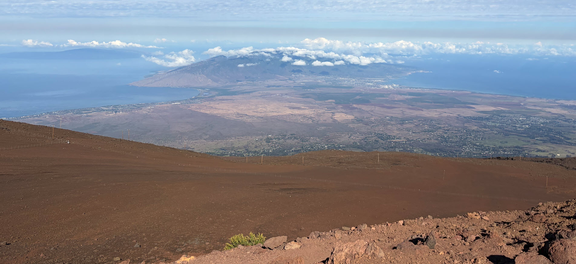
If humanity had arisen to intelligence only 100,000 years later than it did, it would never have known Maui as one island. There would be another, separate island there with a separate name. and there would be water between the two, just like there is now water between Maui and Lana’i and Maui and Moloka’i.
Below is the view from along the blue arrow of the map.

Here we can see the rise of both mountains to the left and right, with the land connecting it really low by the ocean.
It makes me want to come back and time travel to this island 20,000 years from now and see what it looks like.
When I hiked through the Haleakala crater a last week I thought about this. Here I was at 10,000 feet elevation, and I was kicking rocks, thinking that no human being may ever touch those individual rocks again. Furthermore, 10 million years from now, this entire giant mountain will be washed into the sea. Not a single rock will be above water.
Geological times become visible and tangible in Maui. I never tire of marveling about that.