
This morning I did a quick hike of Iron Mountain in San Diego County. The trailhead is on the intersection of Highway 67 and Poway Road, just east of Poway. There a well-built-out parking lot with bathrooms. On weekends, overflow parking occurs along the highway, and you can find a hundred cars there.
Here is the mountain from the trailhead. As always, you can click on my pictures and zoom.

Where we stand, we are at 1,608 feet of elevation, actually quite high already. The mountain peak is at 2,665 feet. The hike there is about 2.9 miles, so the round-trip is about a 6 mile hike with an elevation change of about 1,000 feet. I did the full round-trip in about two and a half hours, plus 15 minutes of hanging out on the peak.
The hike gets very busy on weekends. I am sure I passed several hundred people going up and down, so on a good day this mountain sees a lot of traffic. Dogs are allowed, and many people bring their dogs. But worry not, it’s a long trail, and the crowds separate as you get hiking and there are many stretches when you’re completely alone.
It is a good workout, both up and down. Bring about a quart of water per person. It gets hot and dry. Definitely wear sun protection. It is exposed every step of the way.
When you get to the top, you’re rewarded with 360 degree views of San Diego County in all directions.
Here’s looking north. The ridge on the left with the antennas on it is Woodson Mountain, with the famous potato chip rock on it. See my post on it here. The ridge in the back is Palomar Mountain, home of the famed Palomar Observatory. Palomar is 6,138 feet high.

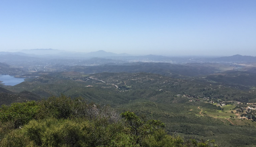
Now facing east, we can see the litte nubby of Cuyamaca Peak, at 6,512 feet one of the highest peaks in San Diego County.

Looking south, due to the haze we cannot see it in this picture, but downtown San Diego would be on the horizon slightly right of the center of this photograph.
And finally, looking west, the haze in the distance is just over the Pacific Ocean. I have been on this mountain around the time of sunset, and depending on the weather, the view is spectacular, and the ocean reflects the sun like a mirror.

Here’s looking down to the trailhead and the parking lot. The arrow points to the parking lot and the white stuff are the cars. That is exactly the point from where I took the first picture, showing the entire mountain. You see a good part of the boring section of the trail from the trailhead toward the right, before it starts ascending sharply out of the picture to the right.

Here is a picture of the peak at the peak. On a weekend, you’ll find a good two or three dozen people there at any time, having a snack, chatting, taking selfies and of course panoramic photographs like I just did.

Iron Mountain is a great hike year round and one of the most popular hikes in San Diego. And – it will get you huffing and puffing.
I’m impressed!
BTW, how was Montreal?
Re Montreal, check my blog entry of 4/6/17. Airport is a nightmare, though. Had to be there at 4:00am for a 6:30am flight out… Terrible traffic. Not very good layout for major airport access. But good visit, though. Some culture shock, surprisingly. Je parle Francais en peu.