
According to the Forest Service, the Fuller Ridge Trail just opened up on June 5 this year, due to significant snow at higher elevations. Our company gave us the Juneteenth (June 19th) off as a holiday, so what better activity for me than to drive high into the mountains and do a high country hike. I drove up Black Mountain Road from Highway 243 west of Idyllwild. The road is 7.5 miles up the mountain one way. You come back the same way.

This is the start of the road on the left. On the right you can see Highway 243. On the map below you can see this point at the red arrow.

The road looks pretty harmless at first, but it quickly turns rough, in some spots very rough.

Here is an example where I left my car there for scale. These ruts are two to three feet deep in some places, and it’s pretty much required to have a high clearance 4-wheel-drive vehicle.
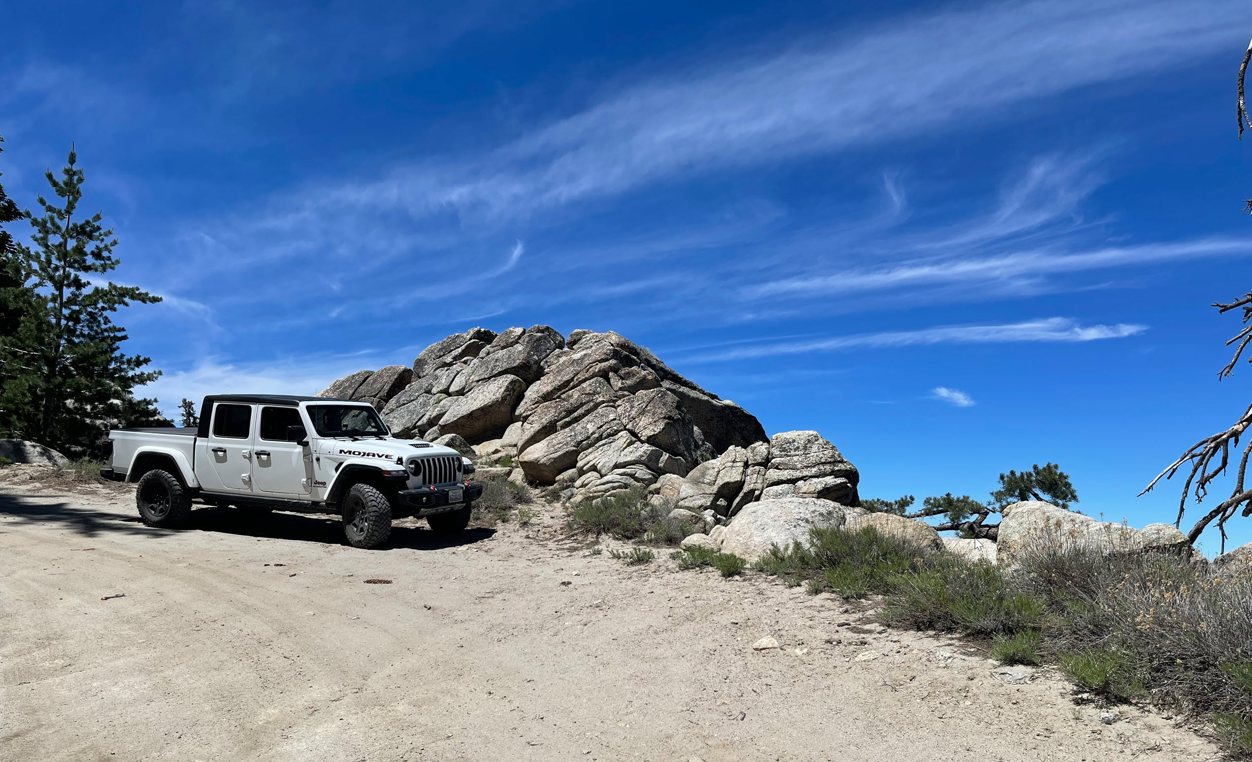
After about six miles up the mountain, we come to some very dramatic lookout points. I call this picture “Jeep in the Sky” for obvious reasons. Looking down from that rock, this is the view:

You can see the San Bernardino Valley about 6,000 feet below us here. The line is Interstate 10. In the distance, you can see the snowcapped peaks of San Gorgonio, the highest mountain range in Southern California at 11,503 feet (3,506 meters) elevation.

About 7.5 miles up, at an elevation of 7,400 feet, I get to the Fuller Ridge Trailhead. This is a large parking and camping area. Usually there are just a few vehicles here. The Pacific Crest Trail (PCT) crosses Fuller Ridge Road here. This is where I parked my car and started my hike up the PCT.

The trail climbs steadily uphill and for the most part is well developed.

There are some good stretches of fairly easy hiking, except, of course, always uphill.

There are many crashed trees that obstruct the trail. This one here is at least four feet thick and I had to take my backpack off and literally crawl under this to get through. In some other spots the trail was fully obstructed by fallen trees, I had to climb up or down around them to move past.

This one was at a lower altitude and thankfully didn’t obstruct the trail. 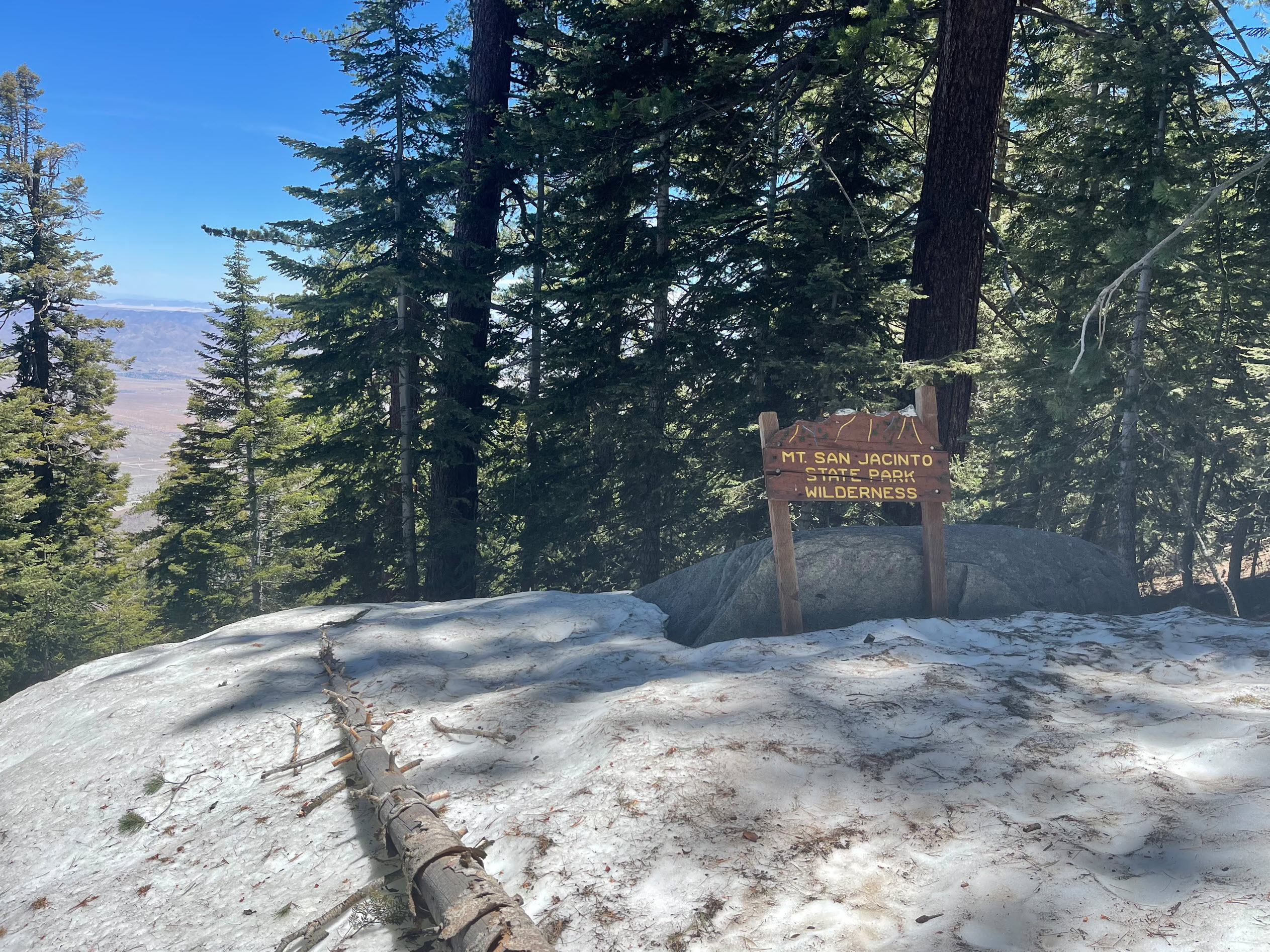
Soon I got to the first snow bank. This was one of the first. The snow was at last six feet deep – on June 19!!

The vistas were amazing in all directions. Especially higher up the granite outcroppings towered over the trail.
 Looking north east, more views of the valley, and the thin strip of light on the horizon to the right of the tip of the tree is the distant Mojave Desert.
Eventually I reached the crest of Fuller Ridge at about 8,000 feet elevation, and the views in all directions were spectacular.

Here is the San Jacinto main summit ridge. The highest point visible from here is actually a false summit. The summit itself, at 10,834 feet, is behind that peak.

Turning my head to the south I can see all of the Southern California “Inland Valley” area, including Temecula, Murietta and Hemet, and countless mountain ranges. I was also able to spot sections of the road where I had just driven up.

Here is another section of the trail at the ridge. The wind was blowing fiercely over this narrow ridge at 8,000 feet.
After reaching the ridge, at about 2 miles up the trail, I wanted to press forward, but the trail was descending down on the other side through a series of switchbacks. Since time was running short, and I had another hour and a half to walk out and then another hour and a half to drive down to the highway, I decided to turn around at about 2.3 miles. To do this enjoyably, I need to come back with a full pack for an overnight stay on the mountain. That’s for another day.
You can see my turnaround point at the green arrow on the map at the top of this post.
Overall, the views are spectacular, the hike is dramatic, and on the trail itself I did not see a single person. I was totally alone on that mountain, and I loved every minute of it.
I was part of the trail crew that built the Fuller Ridge trail the summers of 1965 and 1966.
Wow, thanks for letting us know.