
Stonewall Peak is one of the more dramatic peaks in San Diego County, and I can’t believe that I haven’t hiked it before in all these years. I have been so focused on the other prominent peaks on the west side of Highway 79 at Cuyamaca, like Middle Peak and Cuyamaca Peak, that I have missed it all these years.
We parked the car at the Paso Picacho campground, which is just a couple of miles south of Cuyamaca Lake on California Highway 79. There is a $10 day use fee to park there, but it’s well worth it, not just for supporting the park, but for the bathrooms, waterspouts, ample picnic areas and all-around safety of a patrolled campground.
[click on images to enlarge]

Here is Trisha with the Jeep. I recently bought an offroad monster so we can get to remote areas at the end of dirt roads that would otherwise not be accessible to us. But not to worry about Paso Picacho. It’s right off the highway and a Prius can do it.
Here is the view of the peak from the parking lot.

The campground’s elevation is 4,881 feet. With the peak at 5,730 feet, the climb is about 900 feet or so. Here is a map of the trail.

You can see the trailhead starts directly across the highway from the entrance. It ascends steadily over exactly 2 linear miles. It took up a leisurely hour or so to make it to the top.
Here is a view of the whole mountain from the beginning of the trail, not obscured by trees.

The entire mountain is dotted with massive oak trees that burned many seasons ago and are now all white, making for some stark and dramatic pictures. You can see the trail is mostly well developed and easy to walk.

Well, mostly: Here is a picture of me at the top of a rougher section, of which there are plenty. In the lower left you can see remnants of the last snow, which fell about a week ago, which reportedly covered the Cuyamaca area with 18 inches of powder.

The peak consists mostly of exposed granite. There are some man-made stairs to help hikers across a few more exposed areas at the very top. You can see I am hanging on to the handrails.

And finally we reach the peak. It was 51 degrees outside, and the wind was whipping. I put on all my layers and I needed them.

The views are amazing. I took the picture below pointing the camera almost straight down. The stonewall, after which the peak is obviously named, is almost vertical. I would have loved to try this during my rock climbing years. Down in the distance, in the upper right of the picture, is the campground from where we came, and Highway 79 is clearly visible. Some traces of the trail on which we hiked up are also there in the middle of the picture.

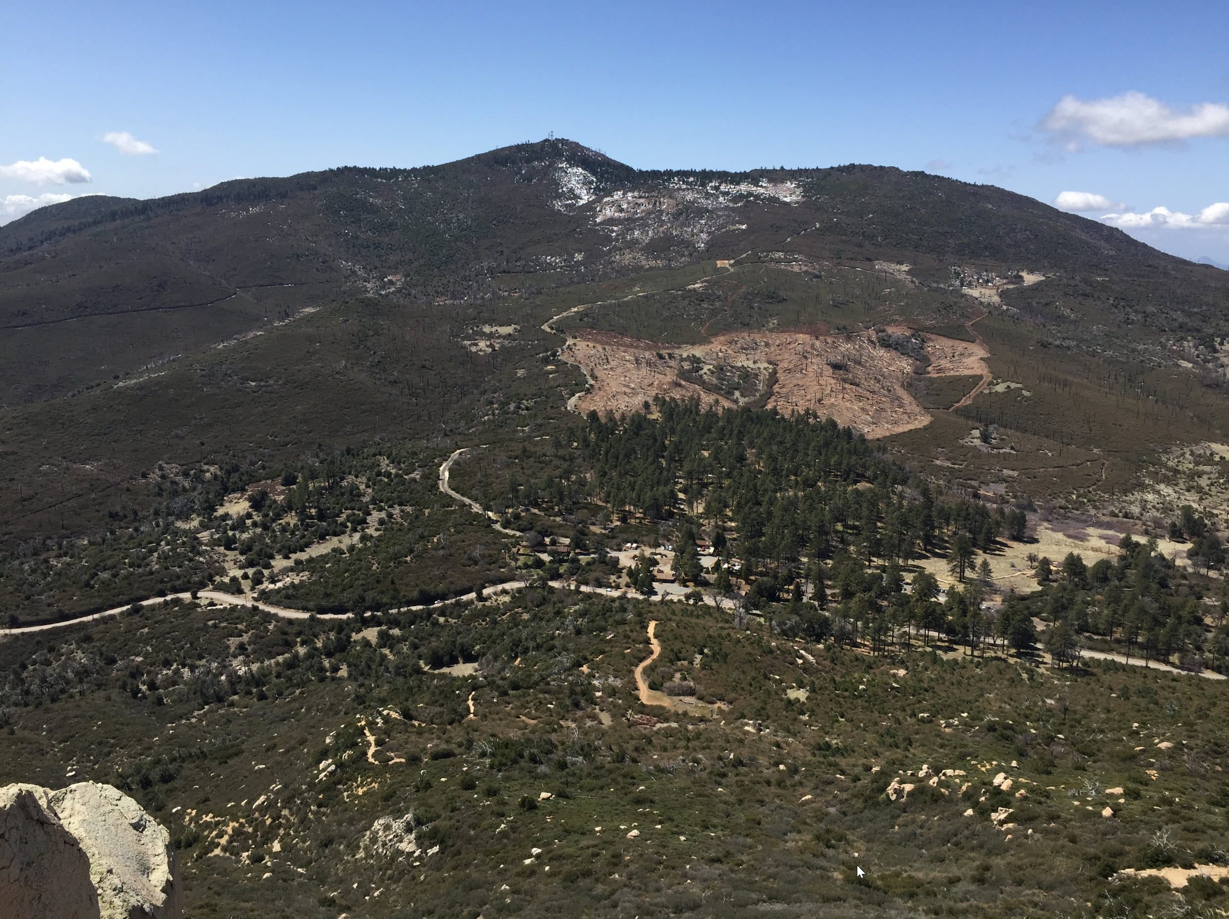
Looking up from the same spot, and pointing the camera level to the west, we can see the broad expanse of Cuyamaca with the peak in the middle.
From the same spot, turning north, we can see parts of the mountains of the Anza Borrego desert on the right side. The ridge in the very back, right below the large cloud in the center, is the massive Mt. San Jacinto, with 10,833 feet (3,300 meters) one of the tallest mountains in Southern California.
And when I saw it there I decided to go back there this summer. It’s been a few years.

Hiking Stonewall peak is something you can easily do, waking up on a Sunday morning in San Diego, having a leisurely breakfast with the morning paper, then driving up to the mountains, doing the round-trip hike, and be back home well before sundown. That’s one thing I love about this area: the mountains are right there!