
This morning I hiked Monserate Mountain.

[Click on any picture to enlarge.]
Here is a view of the mountain in the distance, right after I exited at the Hwy 76 exit off I-15 North and turned onto Old Hwy 395 North. The arrow shows where I am going.

As you drive north on Old Hwy 395, turn right onto Stewart Canyon Road, go under I-15 and the trailhead is right there at the T of Stewart Canyon Road and Pankey Road.
I started hiking at 9:00am, and it was already getting hot.

This is the view from the trailhead up the trail. To be safe, I brought two quarts of water, but I only needed about half of one.
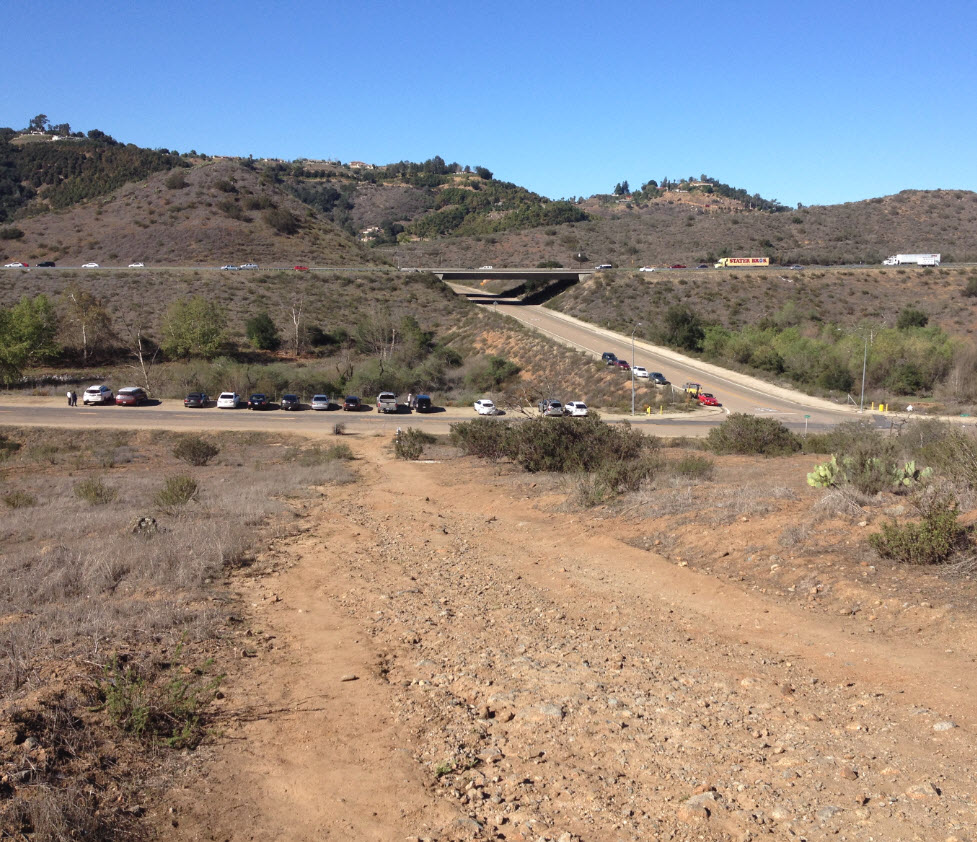
Here is the view back to the parking area about 20 seconds past the trailhead.

The profile of the trail shows it is fairly steep and steady. The parking lot starts at an elevation of about 400 feet. The peak is at about 1542 feet, so it’s an elevation change of 950 feet over 1.6 miles of trail. I got into a good pace and arrived at the peak 44 minutes after leaving the car.

Here is the peak. There is a little registration box.

It was a spectacularly clear day, and I was able to see further than I would normally from here. The view to the north shows two of my favorite mountains. On the left is San Gorgonio, with 11,503 feet the highest peak in Southern California. It is covered with snow after the rains we had a couple of weeks ago. To the right is San Jacinto with an elevation of 10,834 feet. Of course, I have climbed both many times. You can search this blog for trip summaries.
San Gorgonio is about 70 miles away as the crow flies from where I am standing. San Jacinto about 60 miles.

Looking west we overlook Fallbrook and Bonsall. In the distance is the blue band of the Pacific Ocean. In the middle of the view, marked by the green arrow, is the famous “Sleeping Indian,” a range of hills that resembles a man lying down on his back, sleeping. The arrow points to his head. The body stretches to the left (or south). People living in Fallbrook are known to give the location to their house as: “Our house is on the neck of the Sleeping Indian” or some other body part.
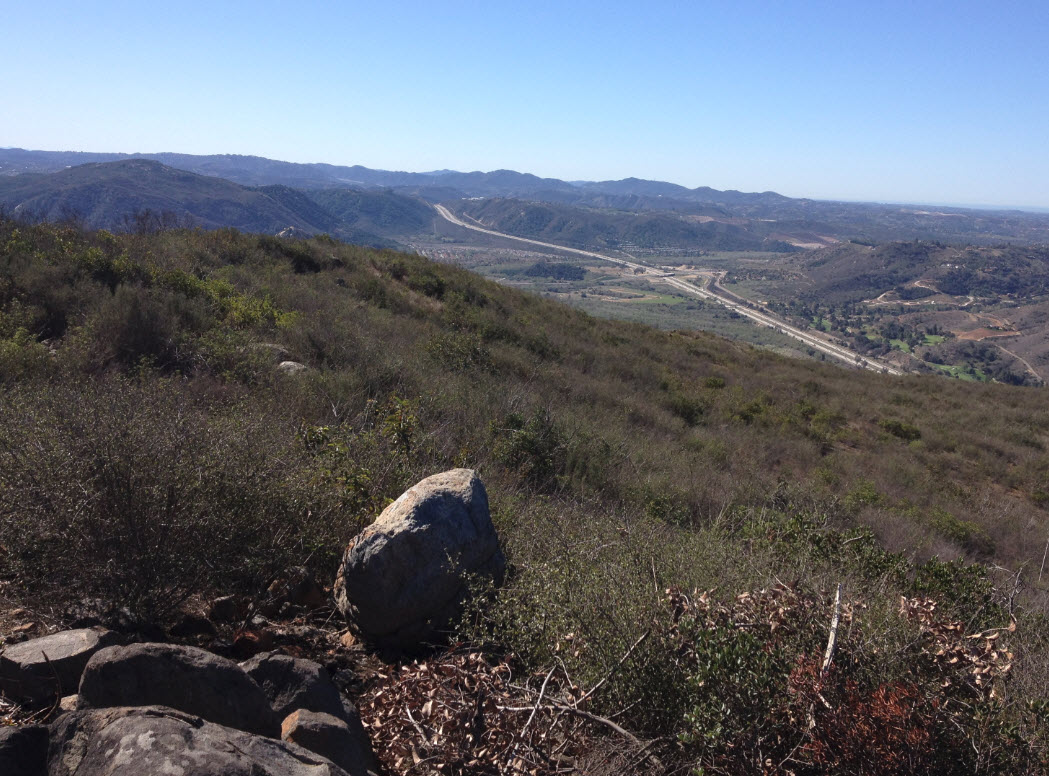
Finally, looking south, I see I-15 from where I came, snaking over the hill at Lilac Road.
After taking these pictures and drinking some water, I went back the same way I came, carefully stepping on the steep parts of the trail so I didn’t slip. I got back to the car about 90 minutes after I left, and that included a five-minute break on the top.
It was very hot on the way down. I would recommend making this hike early in the morning, since the sun beats down on the trail which is always on the southern exposure. I turned the A/C on in the car when I got back at only 10:30. It was hot.
This is a good trail to get quick cardiovascular exercise, since it is quite steep. The round trip is 3.2 miles long. The trail is rough, quite eroded, with sharp, loose rocks everywhere. Most people I saw wore running shoes, but I was glad I had my full hiking boots. My ankles are not as sturdy as they used to be anymore.